MyTopo
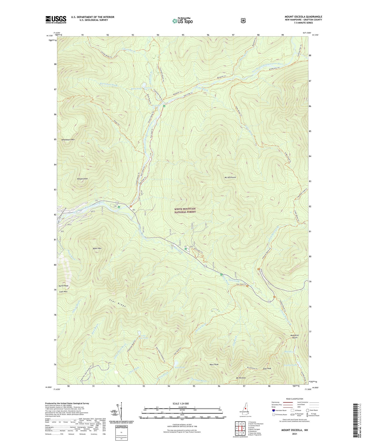
Mount Osceola New Hampshire US Topo Map
Couldn't load pickup availability
Also explore the Mount Osceola Forest Service Topo of this same quad for updated USFS data
2024 topographic map quadrangle Mount Osceola in the state of New Hampshire. Scale: 1:24000. Based on the newly updated USGS 7.5' US Topo map series, this map is in the following counties: Grafton. The map contains contour data, water features, and other items you are used to seeing on USGS maps, but also has updated roads and other features. This is the next generation of topographic maps. Printed on high-quality waterproof paper with UV fade-resistant inks.
Quads adjacent to this one:
West: Lincoln
Northwest: Franconia
North: South Twin Mountain
Northeast: Crawford Notch
East: Mount Carrigain
Southeast: Mount Tripyramid
South: Waterville Valley
Southwest: Woodstock
This map covers the same area as the classic USGS quad with code o44071a5.
Contains the following named places: Big Rock Campground, Birch Island Brook, Black Brook, Black Mountain, Black Pond, Camp 16 Shelter, Camp 9 Shelter, Camp Nine Shelter, Cedar Brook, Ceder Brook Trail, Cheney Brook, Clear Brook, East Peak, East Pond, East Pond Loop, East Pond Trail, Franconia Branch, Franconia Brook Campsite, Franconia Falls, Franconia Shelter, Greeley Ponds, Greeley Ponds Scenic Area, Greeley Ponds Trail, Hancock Branch, Hancock Campground, Hancock Loop Trail, Hancock Overlook, Ice Pond, Lincoln Brook, Little East Pond, Little East Pond Trail, Mad River Notch, Mount Hitchcock, Mount Osceola, Mount Osceola Trail, North Fork East Branch Pemigewasset River, North Fork Hancock Branch, North Peak, Osseo Trail, Otter Rocks Rest Area, Pine Brook, Potash Knob, Scar Ridge, South Fork Hancock Branch, Town of Lincoln, West Peak, Whaleback Mountain, Wilderness Trail