MyTopo
Green Bank New Jersey US Topo Map
Couldn't load pickup availability
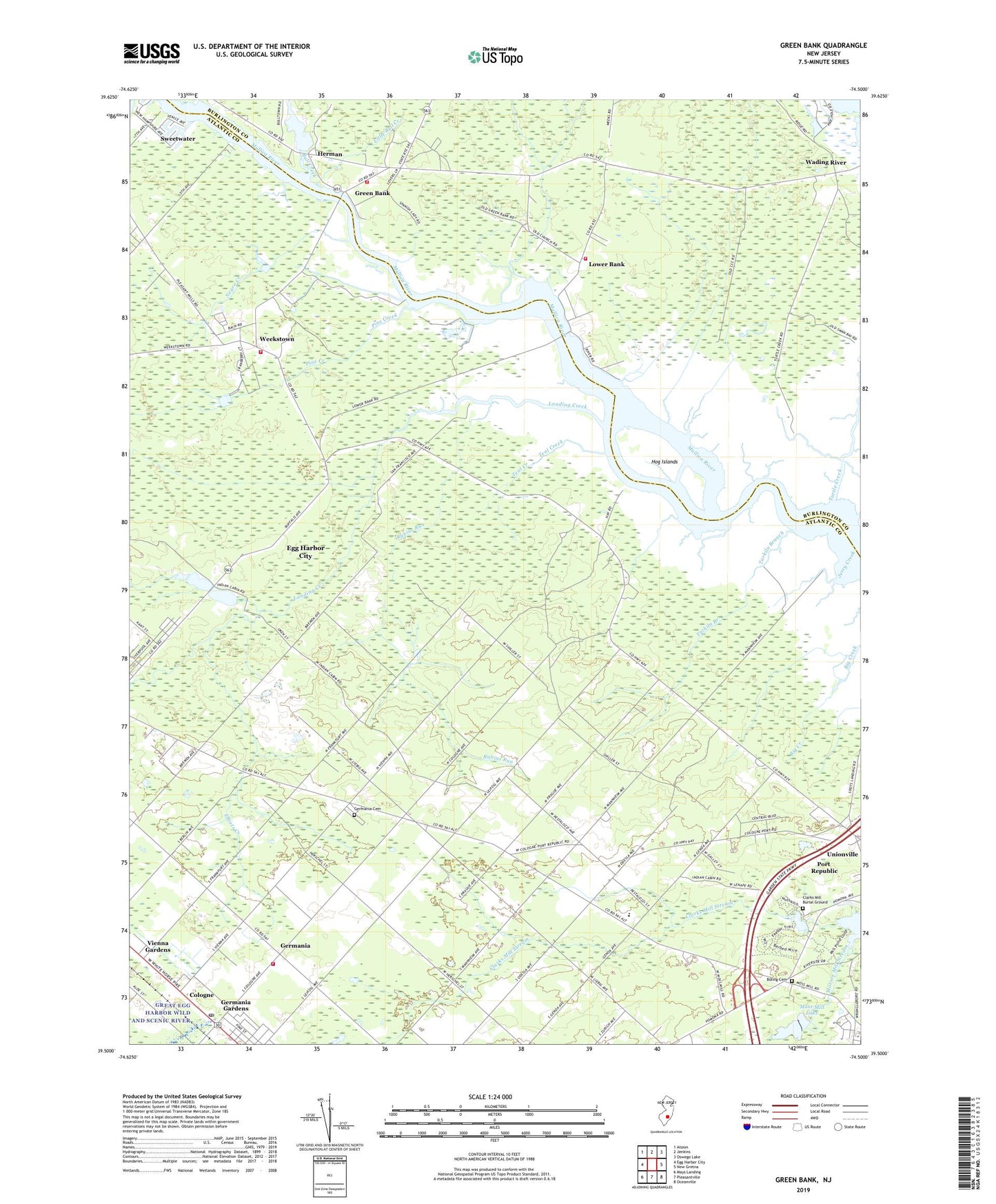
2023 topographic map quadrangle Green Bank in the state of New Jersey. Scale: 1:24000. Based on the newly updated USGS 7.5' US Topo map series, this map is in the following counties: Atlantic, Burlington. The map contains contour data, water features, and other items you are used to seeing on USGS maps, but also has updated roads and other features. This is the next generation of topographic maps. Printed on high-quality waterproof paper with UV fade-resistant inks.
Quads adjacent to this one:
West: Egg Harbor City
Northwest: Atsion
North: Jenkins
Northeast: Oswego Lake
East: New Gretna
Southeast: Oceanville
South: Pleasantville
Southwest: Mays Landing
This map covers the same area as the classic USGS quad with code o39074e5.
Contains the following named places: Boling Cemetery, Bull Creek, City of Egg Harbor City, Clarks Landing, Clarks Mill, Clarks Mill Burial Ground, Clarks Mill Stream, Cologne, Cologne Post Office, Egg Harbor City Lake, Elliots Creek, Fence Creek, Galloway Township Fire Department Germania Volunteer Fire Company, Germania, Germania Cemetery, Germania Census Designated Place, Germania Gardens, Glouster Landing, Green Bank, Green Bank Elementary School, Green Bank State Forest, Green Bank Volunteer Ambulance Company, Green Bank Volunteer Fire Company, Herman, Hog Islands, Indian Cabin Creek, Jerry Creek, Landing Creek, Little Bull Creek, Lower Bank, Lower Bank Church, Lower Bank Volunteer Fire Company, Mill Pond, Morses Mill Stream, Moss Mill Lake, Moss Mill Lake Dam, Negro Creek, Otter Pond, Pacemaker Heliport, Pine Creek, Richard Stockton State College, Rubins Run, Snyder Church, Swan Bay Wildlife Management Area, Tarkiln Branch, Teal Creek, The Pilgrim Academy School, Turtle Creek, Union Creek, Unionville, Vienna Gardens, Wading River, Weekstown, Weekstown Volunteer Fire Company, Winchelsea Airport, ZIP Code: 08215