MyTopo
Alamito New Mexico US Topo Map
Couldn't load pickup availability
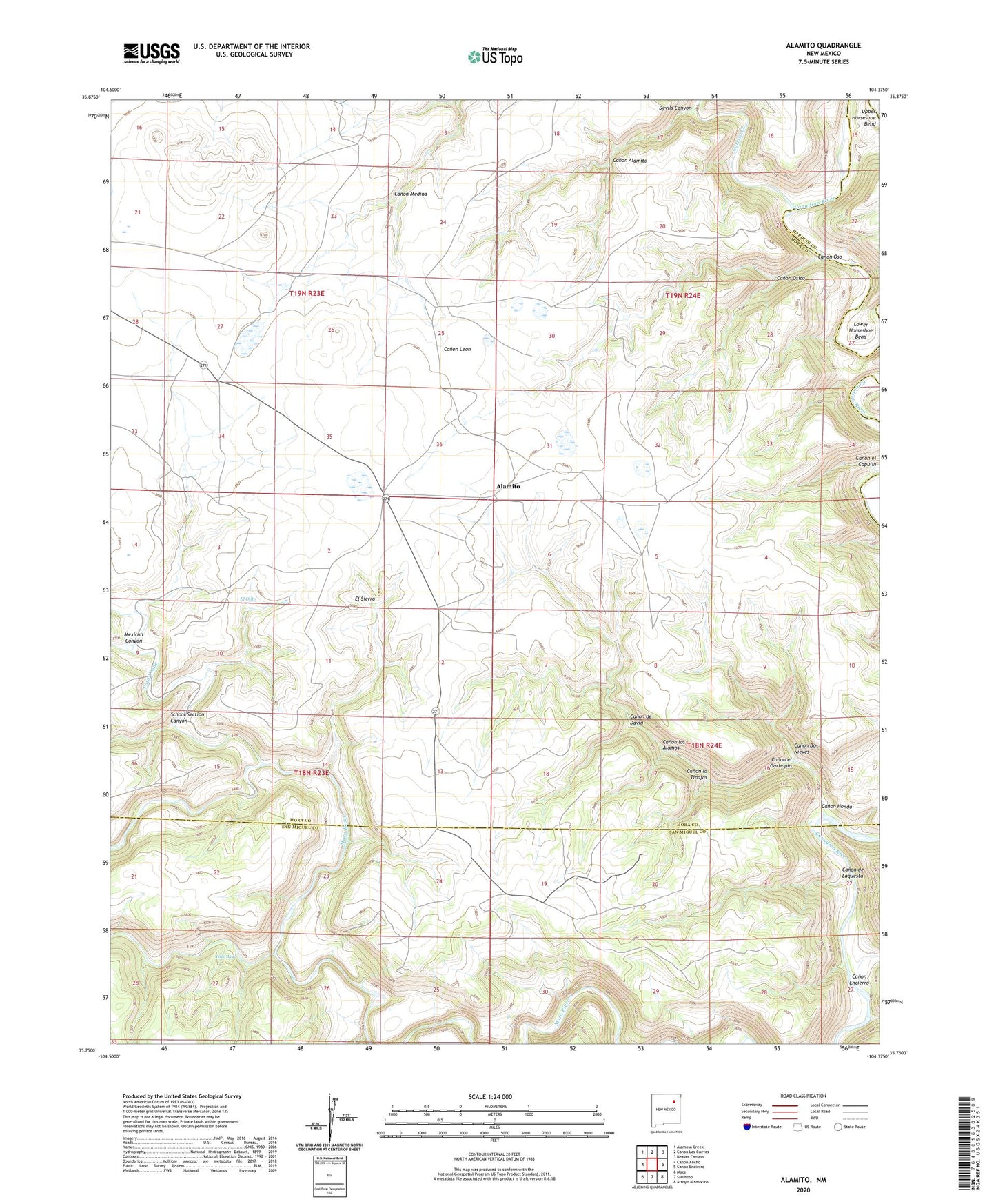
2023 topographic map quadrangle Alamito in the state of New Mexico. Scale: 1:24000. Based on the newly updated USGS 7.5' US Topo map series, this map is in the following counties: Mora, San Miguel, Harding. The map contains contour data, water features, and other items you are used to seeing on USGS maps, but also has updated roads and other features. This is the next generation of topographic maps. Printed on high-quality waterproof paper with UV fade-resistant inks.
Quads adjacent to this one:
West: Canon Ancho
Northwest: Alamosa Creek
North: Canon Las Cuevas
Northeast: Beaver Canyon
East: Canon Encierro
Southeast: Arroyo Alamocito
South: Sabinoso
Southwest: Maes
This map covers the same area as the classic USGS quad with code o35104g4.
Contains the following named places: Alamito, Banco Redondo, Canon Alamito, Canon de David, Canon de Laquesta, Canon Dos Nieves, Canon el Capulin, Canon el Gachupin, Canon Encierro, Canon Hondo, Canon la Tinajas, Canon los Alamos, Canon Medina, Canon Osito, Canon Oso, Carrizo Creek, Devils Canyon, El Ojito, El Sierro, Las Placitas, Las Ventanas, Laubhan, Lower Horseshoe Bend, McDaniels, Mensor Windmill, Mexican Canyon, Pozo Azul, School Section Canyon, Tata Vique, West Windmill