MyTopo
Canon Encierro New Mexico US Topo Map
Couldn't load pickup availability
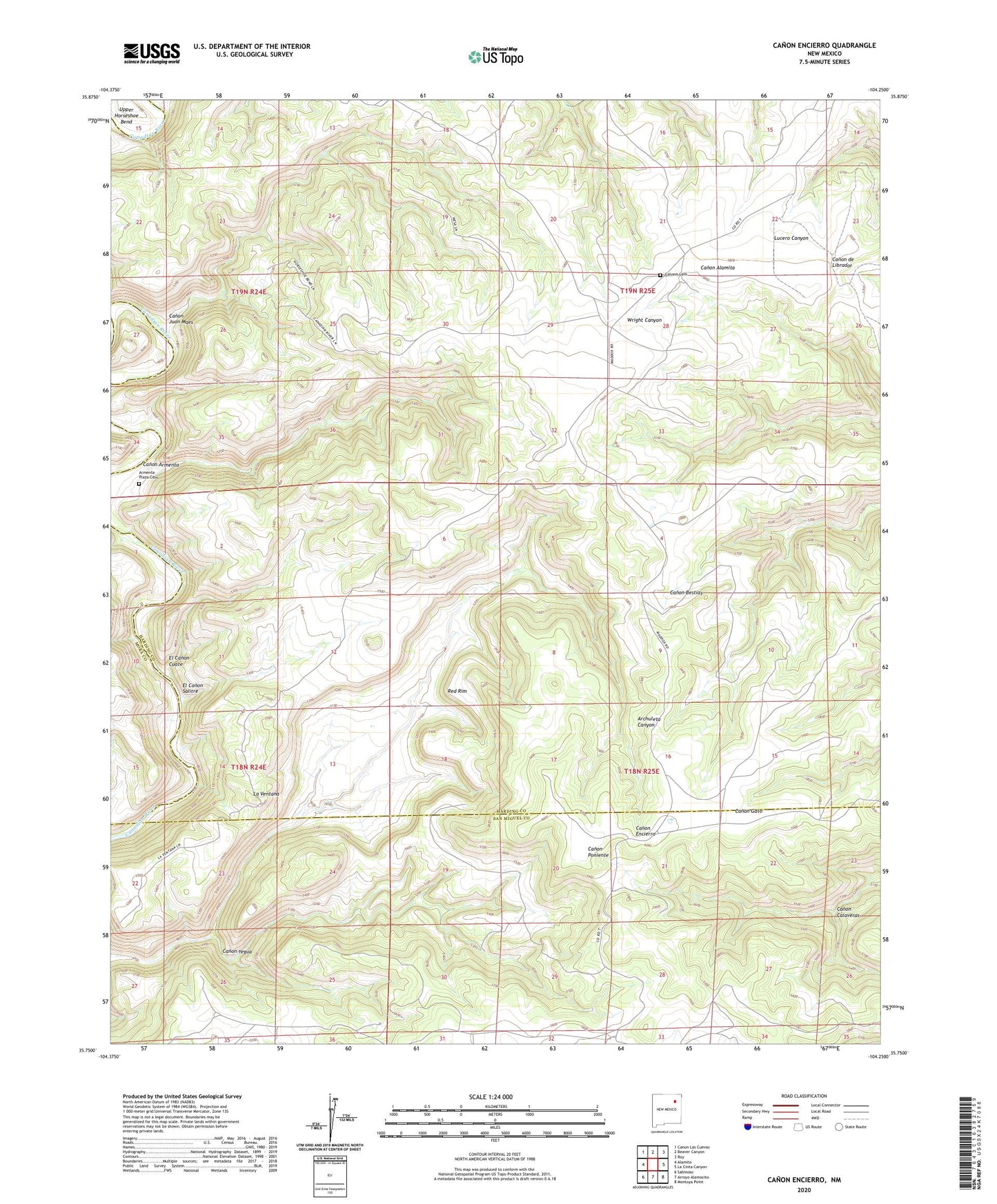
2023 topographic map quadrangle Canon Encierro in the state of New Mexico. Scale: 1:24000. Based on the newly updated USGS 7.5' US Topo map series, this map is in the following counties: Harding, San Miguel, Mora. The map contains contour data, water features, and other items you are used to seeing on USGS maps, but also has updated roads and other features. This is the next generation of topographic maps. Printed on high-quality waterproof paper with UV fade-resistant inks.
Quads adjacent to this one:
West: Alamito
Northwest: Canon Las Cuevas
North: Beaver Canyon
Northeast: Roy
East: La Cinta Canyon
Southeast: Montoya Point
South: Arroyo Alamocito
Southwest: Sabinoso
This map covers the same area as the classic USGS quad with code o35104g3.
Contains the following named places: Armenta Plaza, Armenta Plaza Cemetery, Calvert Cemetery, Canon Armenta, Canon Calaveras, Canon Juan Maes, Canon Yegua, El Canon Cuate, El Canon Salitre, Hartleg, La Ventana, Los Mogotes, Red Rim, Upper Horseshoe Bend, Valle Romero, W-3 Cattle Company