MyTopo
Canon Ancho New Mexico US Topo Map
Couldn't load pickup availability
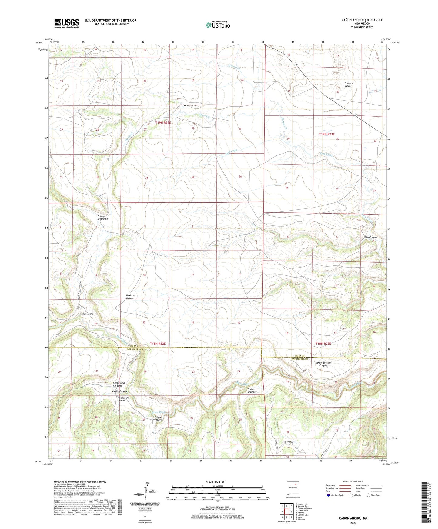
2023 topographic map quadrangle Canon Ancho in the state of New Mexico. Scale: 1:24000. Based on the newly updated USGS 7.5' US Topo map series, this map is in the following counties: Mora, San Miguel. The map contains contour data, water features, and other items you are used to seeing on USGS maps, but also has updated roads and other features. This is the next generation of topographic maps. Printed on high-quality waterproof paper with UV fade-resistant inks.
Quads adjacent to this one:
West: Frutosa Lake
Northwest: Mogote Hills
North: Alamosa Creek
Northeast: Canon Las Cuevas
East: Alamito
Southeast: Sabinoso
South: Maes
Southwest: Llonidas Lake
This map covers the same area as the classic USGS quad with code o35104g5.
Contains the following named places: Canon Agua Chiquito, Canon Ancho, Canon del Grilla, Canon Encinoso, Canon Escondido, Canon Vegocito, Chavez Creek, Eureka Ranch Airport, Middle Canyon, Paltenghe Ranch, Romero, Sixtysix Creek, The Canyon, Vega Sixtysix, Wilcox Draw