MyTopo
Alivio New Mexico US Topo Map
Couldn't load pickup availability
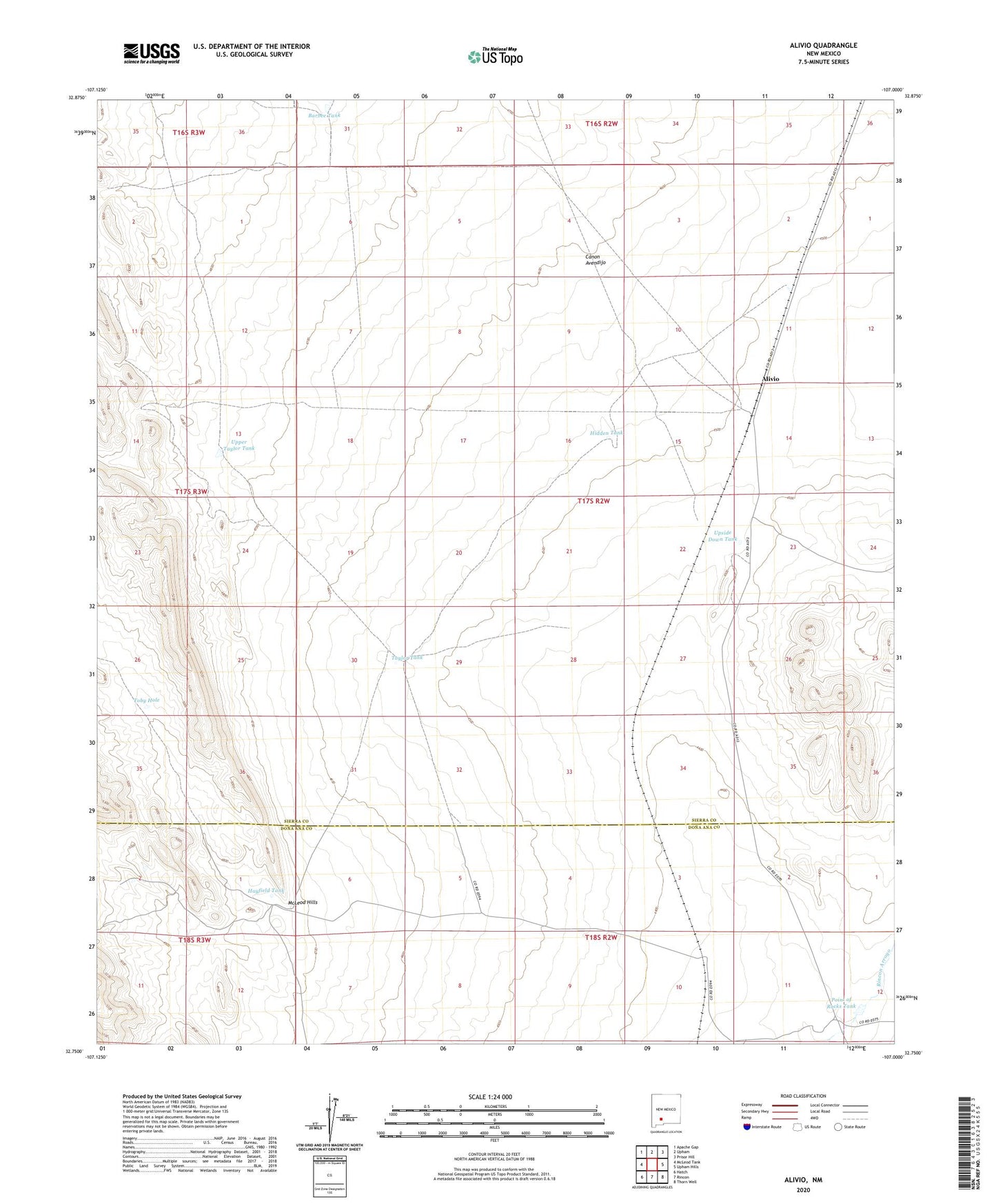
2023 topographic map quadrangle Alivio in the state of New Mexico. Scale: 1:24000. Based on the newly updated USGS 7.5' US Topo map series, this map is in the following counties: Sierra, Doña Ana. The map contains contour data, water features, and other items you are used to seeing on USGS maps, but also has updated roads and other features. This is the next generation of topographic maps. Printed on high-quality waterproof paper with UV fade-resistant inks.
Quads adjacent to this one:
West: McLeod Tank
Northwest: Apache Gap
North: Upham
Northeast: Prisor Hill
East: Upham Hills
Southeast: Thorn Well
South: Rincon
Southwest: Hatch
This map covers the same area as the classic USGS quad with code o32107g1.
Contains the following named places: Alivio, Barbee Tank, Canon Avendijo, Hayfield Tank, Hidden Tank, Horseshoe Deposit, Point of Rocks Tank, Point of Rocks Windmill, Railroad Windmill, Rincon Dikes, Taylor Tank, Taylor Well, Toby Hole, Upper Taylor Tank, Upside Down Tank