MyTopo
Prisor Hill New Mexico US Topo Map
Couldn't load pickup availability
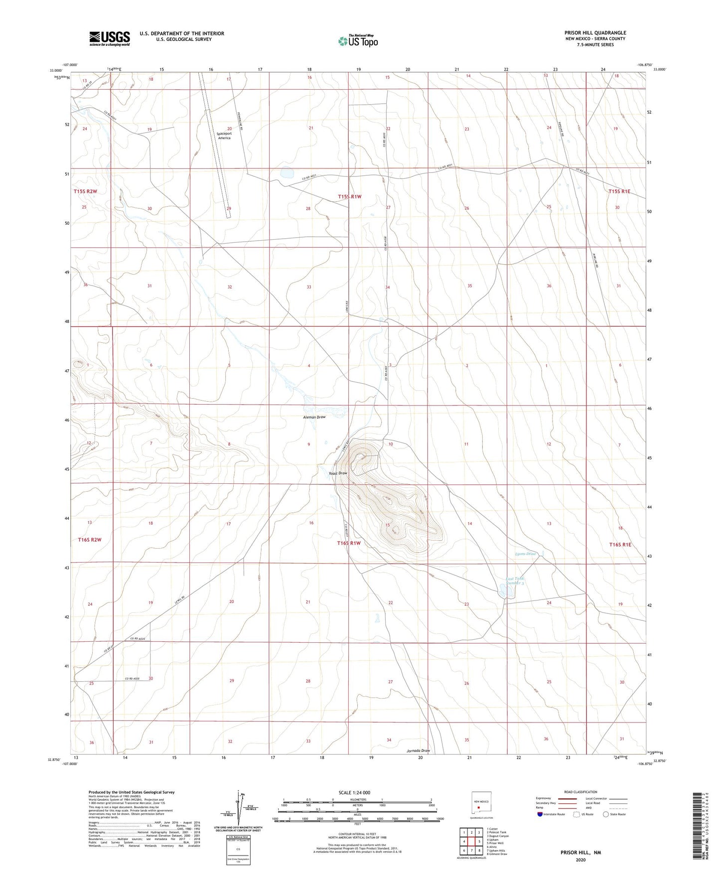
2023 topographic map quadrangle Prisor Hill in the state of New Mexico. Scale: 1:24000. Based on the newly updated USGS 7.5' US Topo map series, this map is in the following counties: Sierra. The map contains contour data, water features, and other items you are used to seeing on USGS maps, but also has updated roads and other features. This is the next generation of topographic maps. Printed on high-quality waterproof paper with UV fade-resistant inks.
Quads adjacent to this one:
West: Upham
Northwest: Cutter
North: Polecat Tank
Northeast: Dugout Canyon
East: Prisor Well
Southeast: Gilmore Draw
South: Upham Hills
Southwest: Alivio
This map covers the same area as the classic USGS quad with code o32106h8.
Contains the following named places: Aleman Draw, Aleman Ranch Headquarters, Cox Tank, East Tank Number 3, Mose Tank, Spaceport America, Yoast Draw