MyTopo
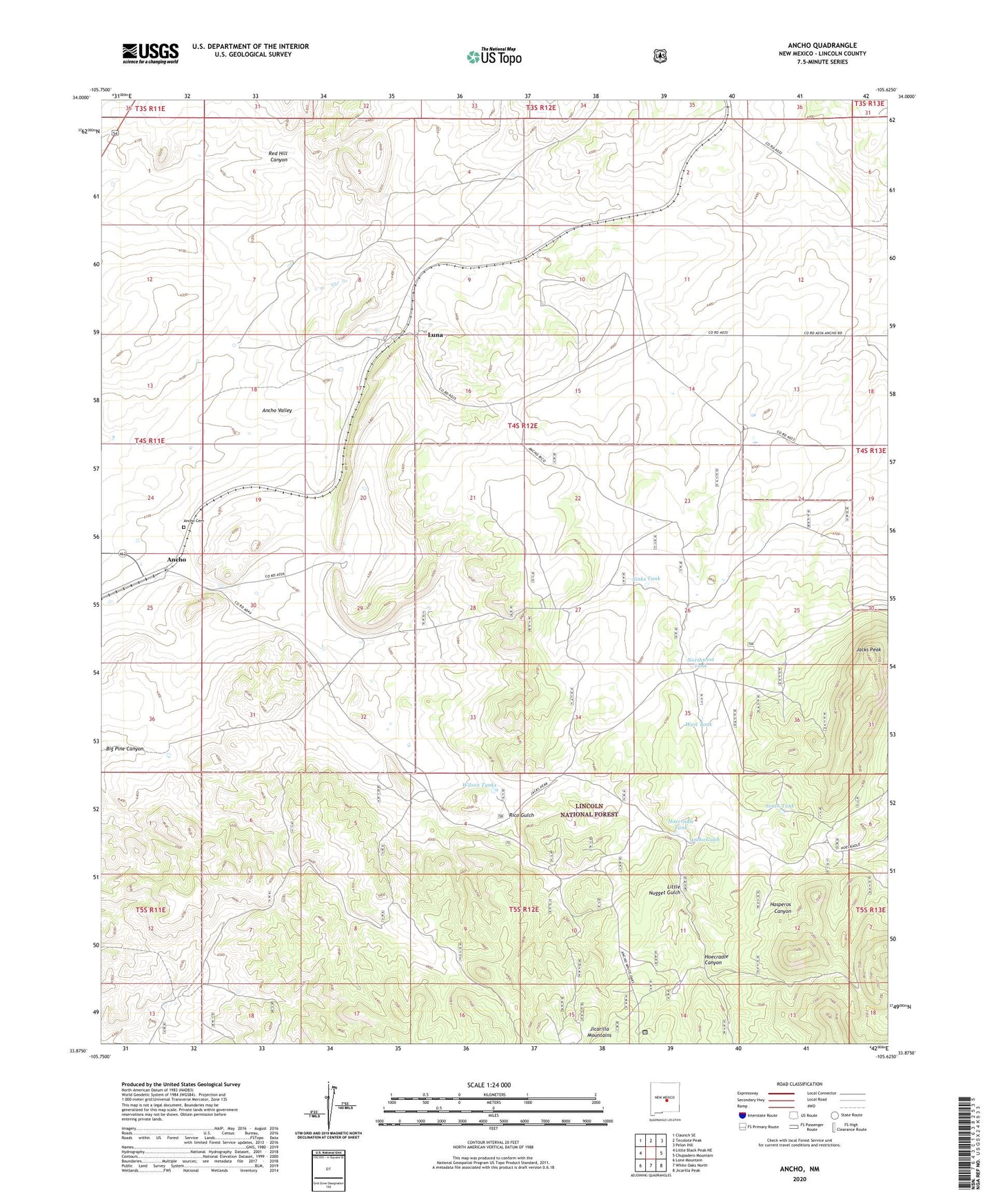
Ancho New Mexico US Topo Map
Couldn't load pickup availability
Also explore the Ancho Forest Service Topo of this same quad for updated USFS data
2023 topographic map quadrangle Ancho in the state of New Mexico. Scale: 1:24000. Based on the newly updated USGS 7.5' US Topo map series, this map is in the following counties: Lincoln. The map contains contour data, water features, and other items you are used to seeing on USGS maps, but also has updated roads and other features. This is the next generation of topographic maps. Printed on high-quality waterproof paper with UV fade-resistant inks.
Quads adjacent to this one:
West: Little Black Peak NE
Northwest: Claunch SE
North: Tecolote Peak
Northeast: Pelon Hill
East: Chupadero Mountain
Southeast: Jicarilla Peak
South: White Oaks North
Southwest: Lone Mountain
This map covers the same area as the classic USGS quad with code o33105h6.
Contains the following named places: Alpha Mill Mine, Alpha Mine, Ancho, Ancho Cemetery, Ancho Clay, Ancho Crusher Plant, Ancho Gulch, Ancho Gypsum, Ancho Post Office, Ancho Railroad Depot Historic Site, Ancho Weather Station, Black Hat Group, Hightower Ranch, Hoecradle Canyon, Hoecradle Tank, Jack Mine, Jacks Peak, Jicarilla Mine, Little Nugget Gulch, Lobner, Luna, Miller Ranch, Mountain Ministry Parish, Norma Grande, Northwest Tank, Pittsburg Number One, Rico Gulch, Sierra Blanca Mill and Processing, Sinks Tank, South Tank, West Tank, Wilson Ranch, Wilson Tanks