MyTopo
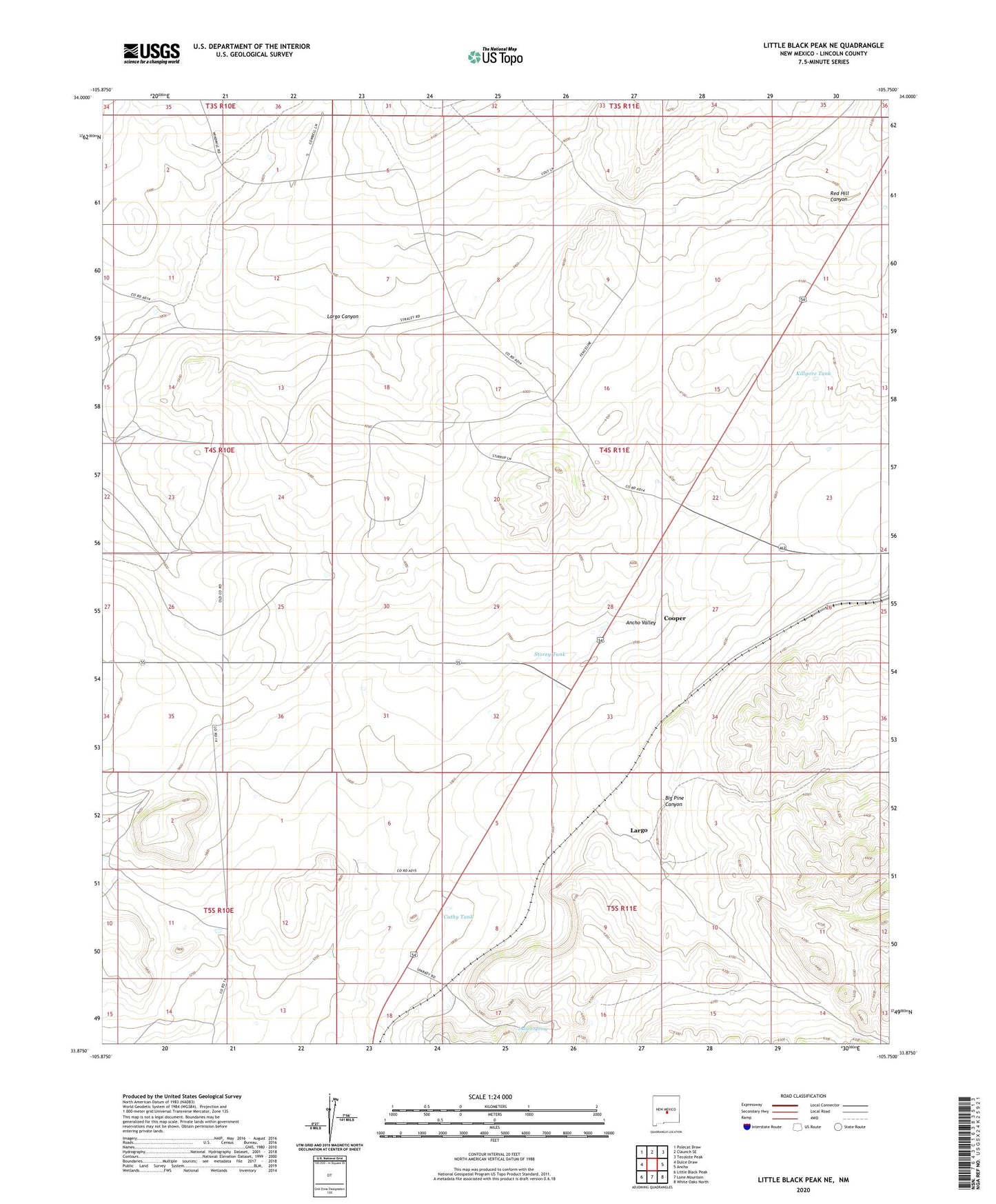
Little Black Peak NE New Mexico US Topo Map
Couldn't load pickup availability
Also explore the Little Black Peak NE Forest Service Topo of this same quad for updated USFS data
2023 topographic map quadrangle Little Black Peak NE in the state of New Mexico. Scale: 1:24000. Based on the newly updated USGS 7.5' US Topo map series, this map is in the following counties: Lincoln. The map contains contour data, water features, and other items you are used to seeing on USGS maps, but also has updated roads and other features. This is the next generation of topographic maps. Printed on high-quality waterproof paper with UV fade-resistant inks.
Quads adjacent to this one:
West: Dulce Draw
Northwest: Polecat Draw
North: Claunch SE
Northeast: Tecolote Peak
East: Ancho
Southeast: White Oaks North
South: Lone Mountain
Southwest: Little Black Peak
This map covers the same area as the classic USGS quad with code o33105h7.
Contains the following named places: Ancho Valley, Ashbey Tank, Big Bear, Big Pine Canyon, Cathy Tank, Cooper, Cooper Tank, Hamm Tank, Highway Tank, Hobbs Tank, Indian Spring, Iron Jack Number 1 and Number 2 Mine, Killgore Tank, Knight Pit, Largo, Lizzard Windmill, Railroad Tank, Red Hill Canyon, Spade Windmill, Storey Tank