
MyTopo
Anthony New Mexico US Topo Map
Couldn't load pickup availability
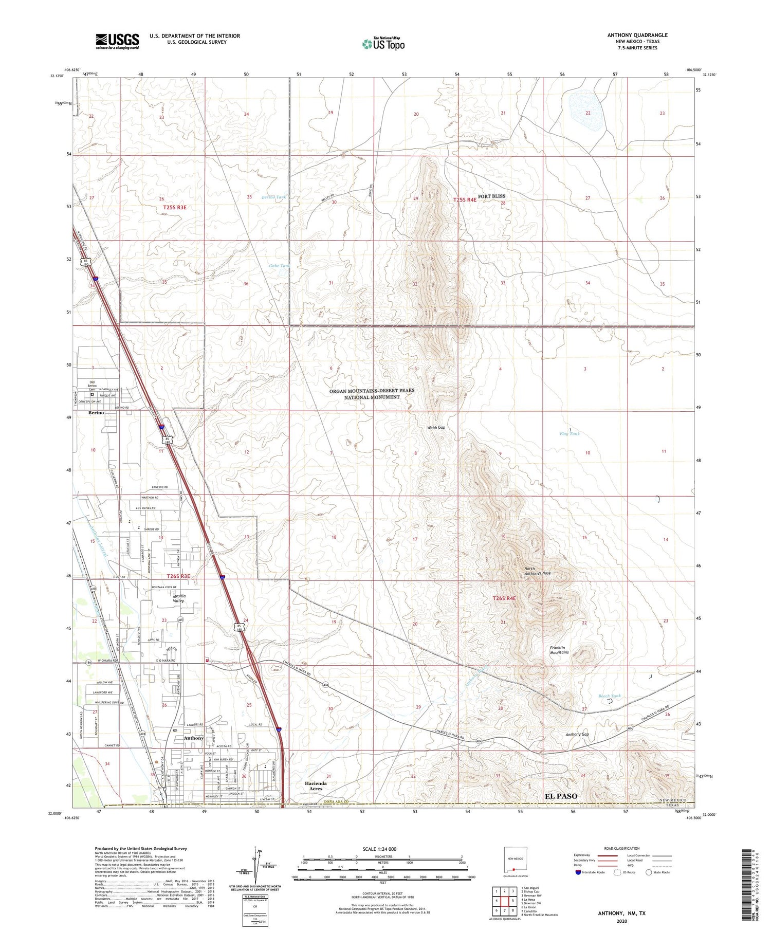
2020 topographic map quadrangle Anthony in the state of New Mexico. Scale: 1:24000. Based on the newly updated USGS 7.5' US Topo map series, this map is in the following counties: Doña Ana, El Paso. The map contains contour data, water features, and other items you are used to seeing on USGS maps, but also has updated roads and other features. This is the next generation of topographic maps. Printed on high-quality waterproof paper with UV fade-resistant inks.
Quads adjacent to this one:
West: La Mesa
Northwest: San Miguel
North: Bishop Cap
Northeast: Newman NW
East: Newman SW
Southeast: North Franklin Mountain
South: Canutillo
Southwest: La Union
Contains the following named places: 10116 Water Well, A-1 Water Well, Anthony, Anthony Arroyo Watershed Site One Dam, Anthony Catholic Cemetery, Anthony Census Designated Place, Anthony Community Cemetery, Anthony Division, Anthony Elementary School, Anthony Gap, Anthony Lateral, Anthony Post Office, Anthony Volunteer Fire Department, Anthony Wash, Beech Tank, Berino, Berino Cemetery, Berino Census Designated Place, Berino Elementary School, Berino Post Office, Berino Tank, Berino Well, City of Anthony, Copiapo Mine, East Drain, First Baptist Church, First United Methodist Church, Flay Tank, Gabe Tank, Hacienda Acres, K 10 Water Well, K 20 Water Well, K 4 Water Well, K 8 Water Well, Kingdom Hall of Jehovah Witness, La Purisema Church, North Anthonys Nose, Number 2 Water Well, Old Berino Cemetery, River Valley Dairy, Saint Anthony's Catholic Cemetery, Story Cemetery, Upper Valley Baptist Church, Webb Gap


