MyTopo
Applegate Mountain New Mexico US Topo Map
Couldn't load pickup availability
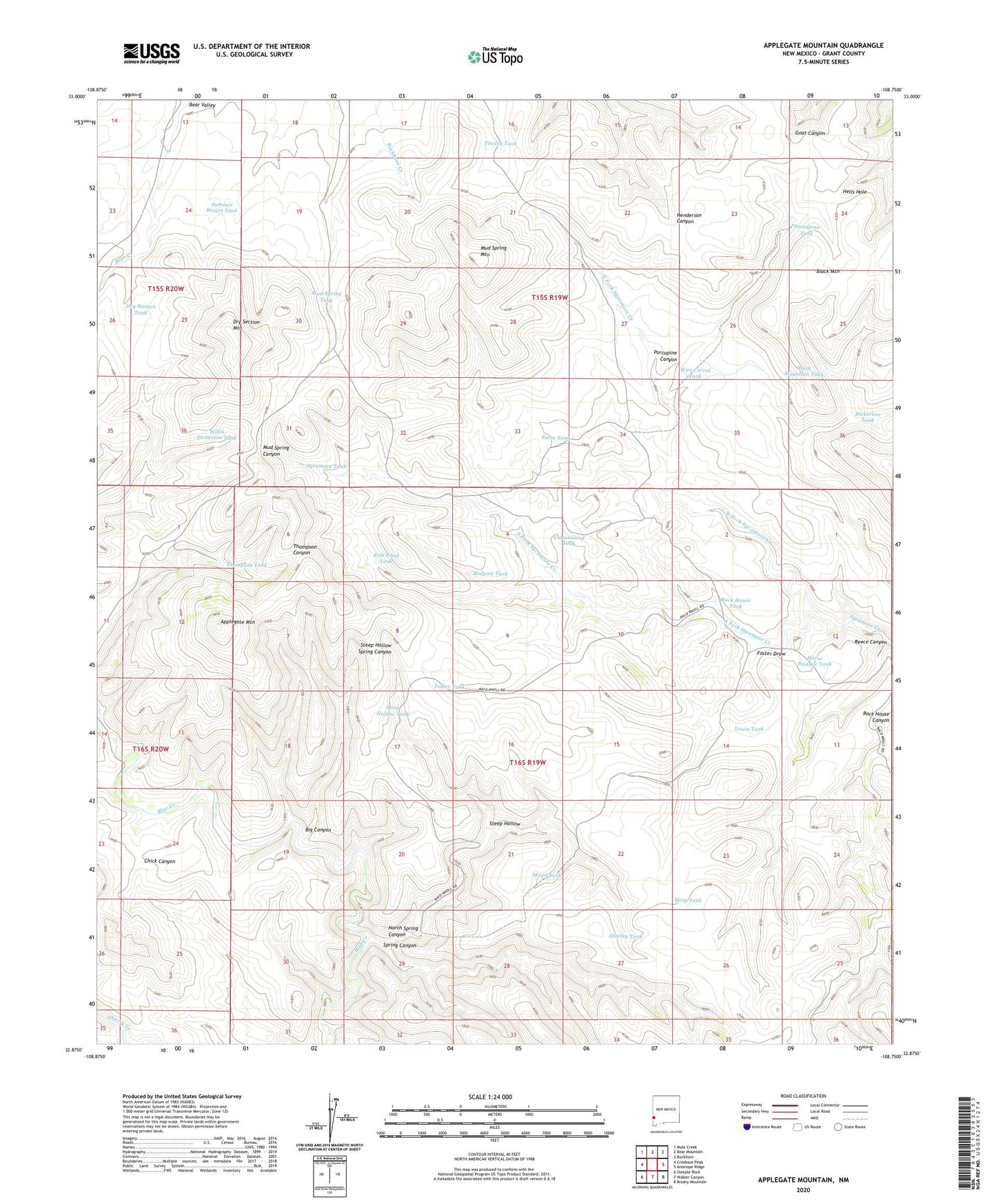
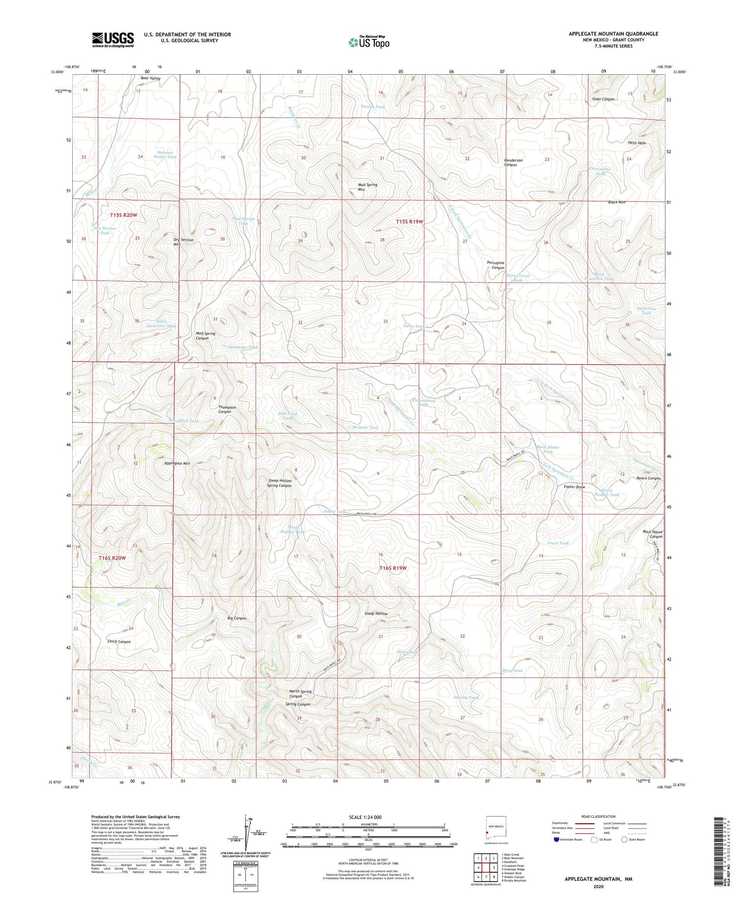
2020 topographic map quadrangle Applegate Mountain in the state of New Mexico. Scale: 1:24000. Based on the newly updated USGS 7.5' US Topo map series, this map is in the following counties: Grant. The map contains contour data, water features, and other items you are used to seeing on USGS maps, but also has updated roads and other features. This is the next generation of topographic maps. Printed on high-quality waterproof paper with UV fade-resistant inks.
Quads adjacent to this one:
West: Crookson Peak
Northwest: Mule Creek
North: Bear Mountain
Northeast: Buckhorn
East: Antelope Ridge
Southeast: Brushy Mountain
South: Walker Canyon
Southwest: Steeple Rock
Contains the following named places: Applegate Mountain, Big Canyon, Black Mountain Tank, Cottonwood Tank, Dickerson Tank, Dry Section Mountain, Dry Section Tank, Farm Tank, Fish Pond Tank, Foster Draw, Foster Tank, Horse Pasture Tank, Lewis Tank, Malpais Tank, Mayo Tank, Mesa Tank, Mud Spring Mountain, Mud Spring Tank, Mud Spring Windmill, North Fork Sycamore Creek, North Spring Canyon, Porcupine Canyon, Porcupine Tank, Reece Canyon, Rock House Tank, Sheeley Tank, South Fork Sycamore Creek, Spring Canyon, Steep Hollow, Steep Hollow Spring Canyon, Steep Hollow Tank, Summer Resort Tank, Sycamore Camp, Sycamore Tank, Thompson Tank, Tinsley Tank, Willis Dickerson Tank, Wire Corral Tank