MyTopo
Antelope Ridge New Mexico US Topo Map
Couldn't load pickup availability
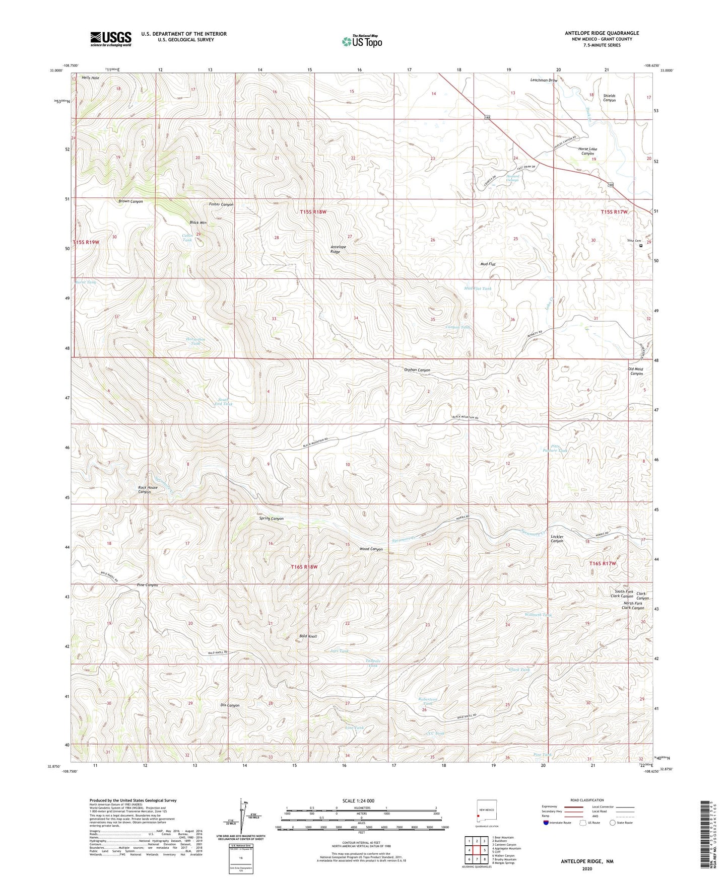
2023 topographic map quadrangle Antelope Ridge in the state of New Mexico. Scale: 1:24000. Based on the newly updated USGS 7.5' US Topo map series, this map is in the following counties: Grant. The map contains contour data, water features, and other items you are used to seeing on USGS maps, but also has updated roads and other features. This is the next generation of topographic maps. Printed on high-quality waterproof paper with UV fade-resistant inks.
Quads adjacent to this one:
West: Applegate Mountain
Northwest: Bear Mountain
North: Buckhorn
Northeast: Canteen Canyon
East: Cliff
Southeast: Mangas Springs
South: Brushy Mountain
Southwest: Walker Canyon
This map covers the same area as the classic USGS quad with code o32108h6.
Contains the following named places: Antelope Ridge, Bald Knoll, Bennett, Big Dix Windmill, Black Mountain, Bradberry Ranch, Burnt Tank, Cabin Tank, Canyon Tank, CCC Tank, Clark Tank, Clark Windmill, Cow Camp, Horse Lake Canyon, Horseshoe Tank, Howard Cienega, Hunter Windmill, Joes Tank, Leachman Draw, Line Tank, Little Dix Windmill, Lockler Canyon, Mud Flat, Mud Flat Tank, Norris Ranch, North Fork Clark Canyon, Old Maid Canyon, Orphan Canyon, Pine Canyon, Pine Tank, Pitts Pasture Tank, Robertson Tank, Rock House Canyon, Shields Canyon, South End Tank, South Fork Clark Canyon, Spring Canyon, Stout Cemetery, Tadpole Tank, Wallace Ranch, Wallace Ranch Perlite Deposit, Willmeth Tank, Willmeth Windmill, Wood Canyon, ZIP Code: 88028