MyTopo
Los Pilares New Mexico US Topo Map
Couldn't load pickup availability
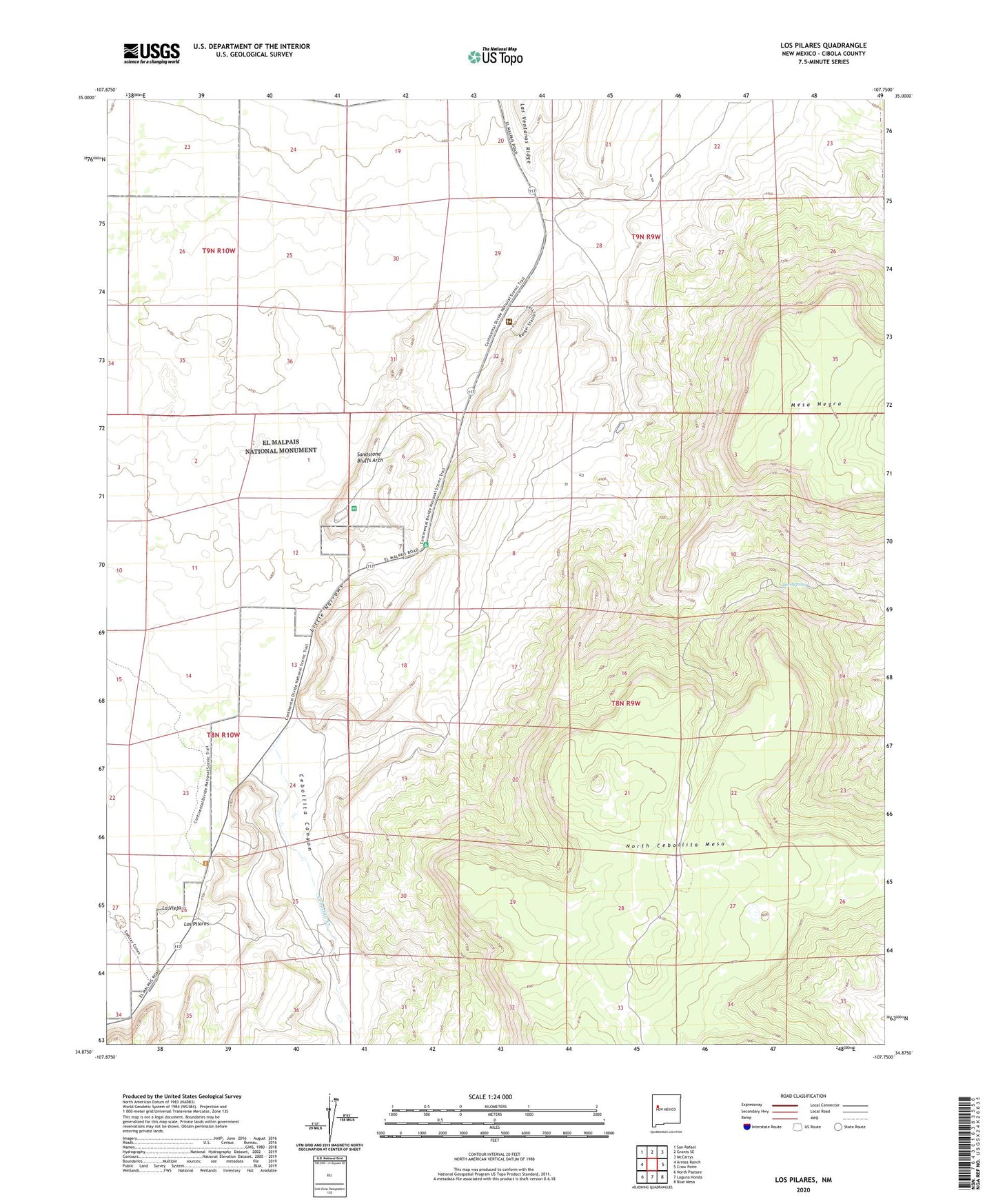
2023 topographic map quadrangle Los Pilares in the state of New Mexico. Scale: 1:24000. Based on the newly updated USGS 7.5' US Topo map series, this map is in the following counties: Cibola. The map contains contour data, water features, and other items you are used to seeing on USGS maps, but also has updated roads and other features. This is the next generation of topographic maps. Printed on high-quality waterproof paper with UV fade-resistant inks.
Quads adjacent to this one:
West: Arrosa Ranch
Northwest: San Rafael
North: Grants SE
Northeast: McCartys
East: Crow Point
Southeast: Blue Mesa
South: Laguna Honda
Southwest: North Pasture
This map covers the same area as the classic USGS quad with code o34107h7.
Contains the following named places: Acoma Water Well, Baca Ranch, Berryhill Water Well, Bibo Ranch, Cebollita Canyon, Cebollita Creek, Deer Spring, Kowina Water Well, La Vieja, Las Ventanas Windmill, Little Narrows, Los Medanitos, Los Pilares, Los Water Well, North Cebollita Mesa, Pilares Water Well, Pilares Windmill, Sandstone Bluffs Arch, SB Water Well