MyTopo
Grants SE New Mexico US Topo Map
Couldn't load pickup availability
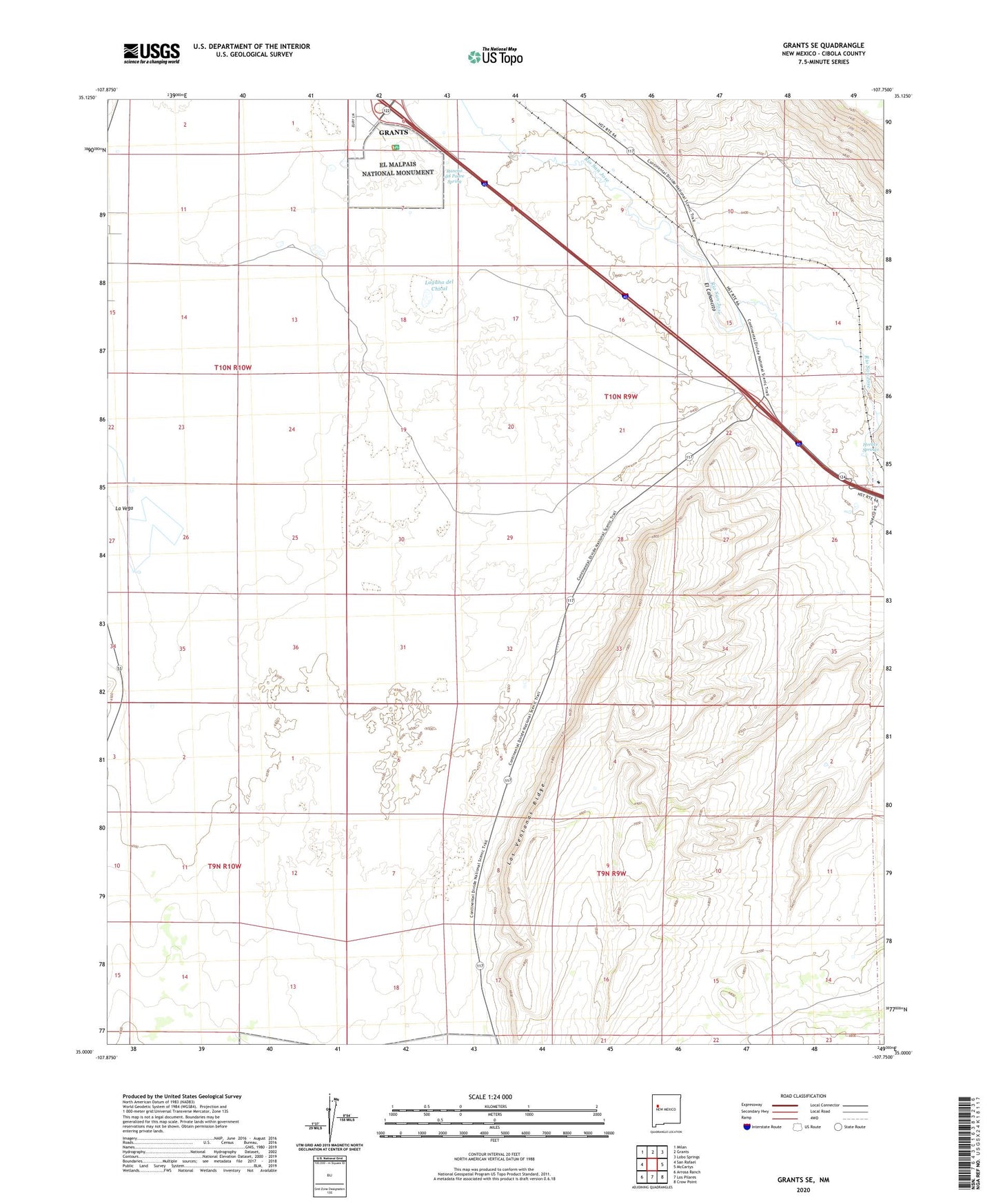
2023 topographic map quadrangle Grants SE in the state of New Mexico. Scale: 1:24000. Based on the newly updated USGS 7.5' US Topo map series, this map is in the following counties: Cibola. The map contains contour data, water features, and other items you are used to seeing on USGS maps, but also has updated roads and other features. This is the next generation of topographic maps. Printed on high-quality waterproof paper with UV fade-resistant inks.
Quads adjacent to this one:
West: San Rafael
Northwest: Milan
North: Grants
Northeast: Lobo Springs
East: McCartys
Southeast: Crow Point
South: Los Pilares
Southwest: Arrosa Ranch
This map covers the same area as the classic USGS quad with code o35107a7.
Contains the following named places: 10029 Water Well, 10030 Water Well, 10034 Water Well, 10035 Water Well, 10040 Water Well, 10041 Water Well, 10042 Water Well, 87051, Bajar Quemazon, El Canoncito, El Medano, Horace Springs, KOFK-AM (Milan), La Vega, Laguna del Chical, Las Ventanas Ridge, Mount Taylor Census Designated Place, Rancho del Padre Spring