MyTopo
Guadalupe New Mexico US Topo Map
Couldn't load pickup availability
Also explore the Guadalupe Forest Service Topo of this same quad for updated USFS data
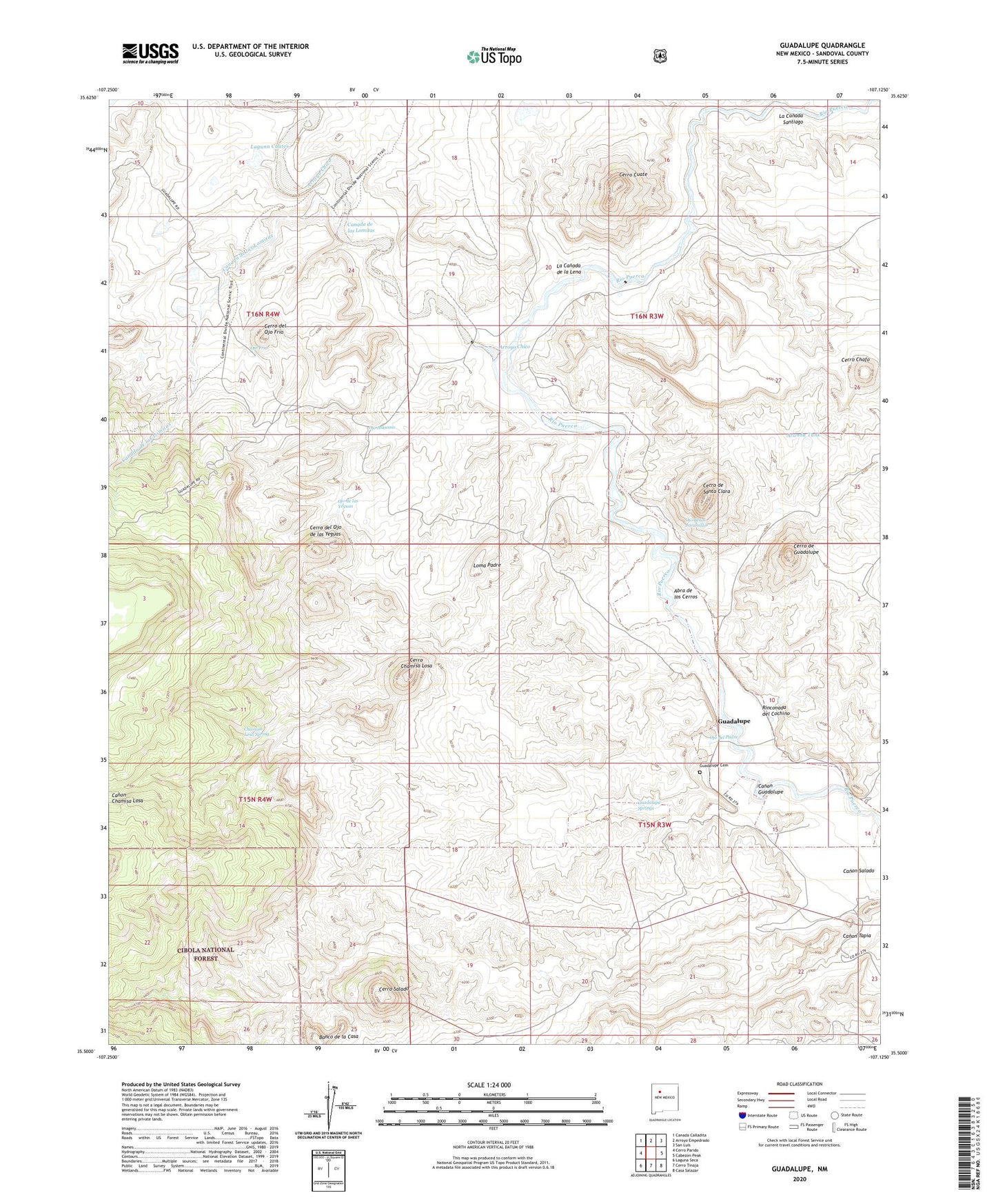
2023 topographic map quadrangle Guadalupe in the state of New Mexico. Scale: 1:24000. Based on the newly updated USGS 7.5' US Topo map series, this map is in the following counties: Sandoval. The map contains contour data, water features, and other items you are used to seeing on USGS maps, but also has updated roads and other features. This is the next generation of topographic maps. Printed on high-quality waterproof paper with UV fade-resistant inks.
Quads adjacent to this one:
West: Cerro Parido
Northwest: Canada Calladita
North: Arroyo Empedrado
Northeast: San Luis
East: Cabezon Peak
Southeast: Casa Salazar
South: Cerro Tinaja
Southwest: Laguna Seca
This map covers the same area as the classic USGS quad with code o35107e2.
Contains the following named places: Abra de los Cerros, Aranda Tank, Arroyo Chico, Canada de las Lomitas, Canon Chamisa Losa, Canon Guadalupe, Cerro Chafo, Cerro Chamisa Losa, Cerro Cuate, Cerro de Guadalupe, Cerro de Santa Clara, Cerro del Ojo de las Yeguas, Cerro del Ojo Frio, Cerro Salado, Chamisa Losa Spring, Chamisa Wilderness Study Area, Cirillio Garcia Detention Dam, Guadalupe, Guadalupe Cemetery, Guadalupe Historic District, Guadalupe Springs, Ignacio Chavez Wilderness Study Area, La Canada de la Lena, La Canada Santiago, Laguna Cuates, Loddy, Loma Padre, Ojo Atascoso, Ojo de las Yeguas, Ojo de los Jaramillos, Ojo del Padre, Ojo Frio, Rinconada del Cochino