MyTopo
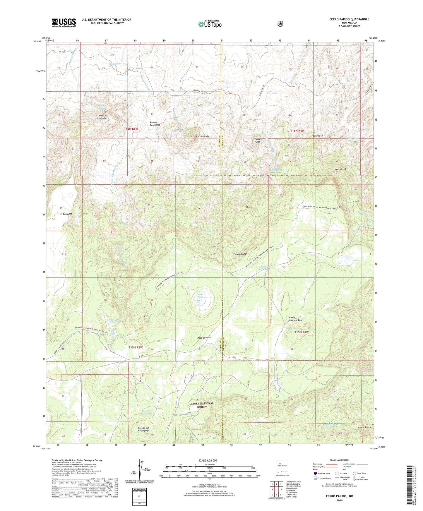
Cerro Parido New Mexico US Topo Map
Couldn't load pickup availability
Also explore the Cerro Parido Forest Service Topo of this same quad for updated USFS data
2023 topographic map quadrangle Cerro Parido in the state of New Mexico. Scale: 1:24000. Based on the newly updated USGS 7.5' US Topo map series, this map is in the following counties: McKinley, Sandoval. The map contains contour data, water features, and other items you are used to seeing on USGS maps, but also has updated roads and other features. This is the next generation of topographic maps. Printed on high-quality waterproof paper with UV fade-resistant inks.
Quads adjacent to this one:
West: Mesa Cortada
Northwest: Mesita Del Gavilan
North: Canada Calladita
Northeast: Arroyo Empedrado
East: Guadalupe
Southeast: Cerro Tinaja
South: Laguna Seca
Southwest: El Dado Mesa
This map covers the same area as the classic USGS quad with code o35107e3.
Contains the following named places: 10017 Water Well, Barrel Spring, Bear Mouth, Cerrito del Relampago, Cerro Parido, Cerro Pelon, Coal Spring, El Banquito, Ernest Montoya Ranch, Heifer Tank, Ignacio Chavez Grant, Joe Montoya Ranch, Laguna Blanca, Laguna Cuarenta, Mesa la Azabache, Ned Tank, Ojo Azabache, Ojo de Alamo, R-13 Water Well, Rincon Entranosa, Salado Spring, Sandoval Ranch, Seco Tank, Toro Tank, Toruno Spring