MyTopo
Arroyo Seco New Mexico US Topo Map
Couldn't load pickup availability
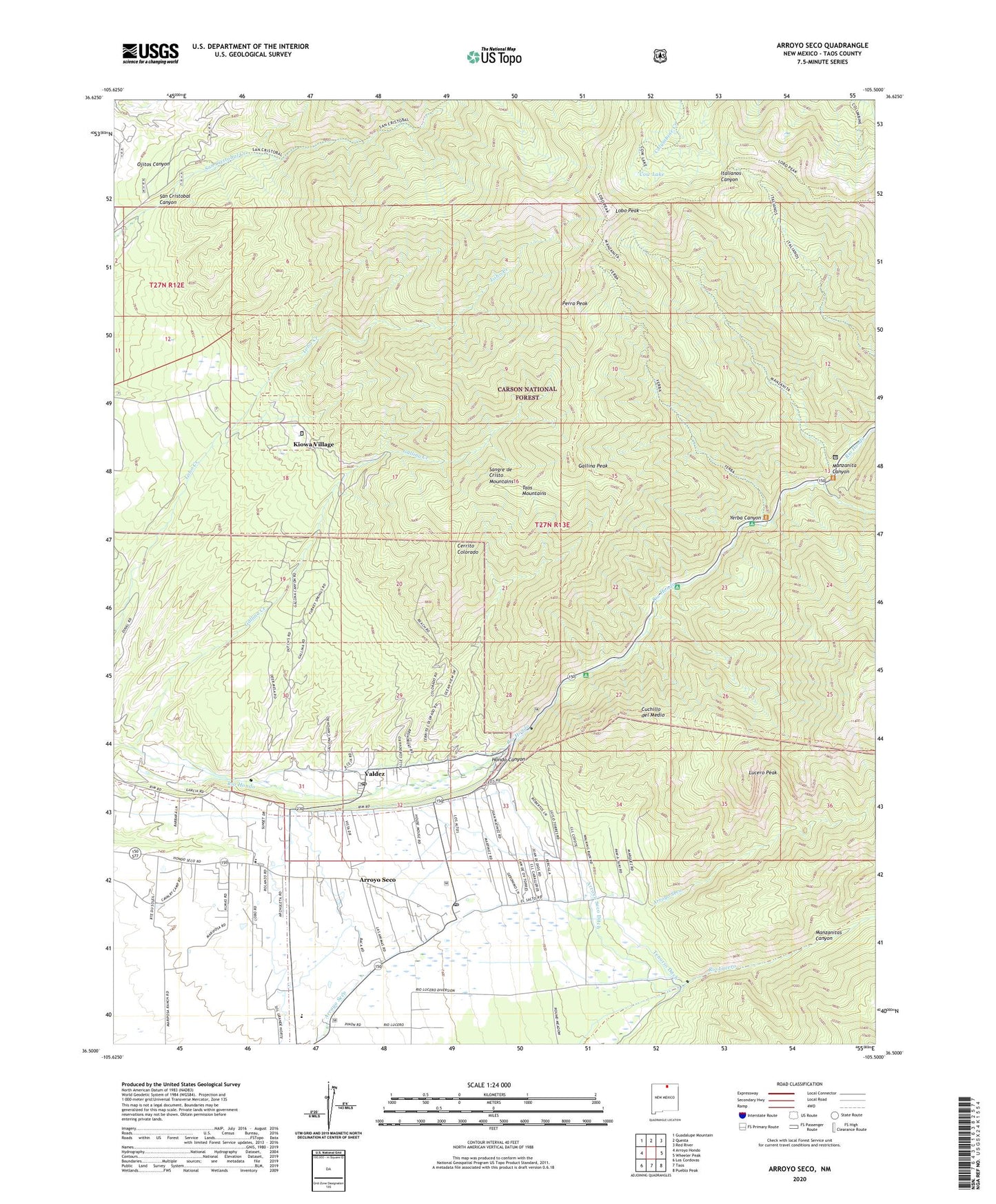
2020 topographic map quadrangle Arroyo Seco in the state of New Mexico. Scale: 1:24000. Based on the newly updated USGS 7.5' US Topo map series, this map is in the following counties: Taos. The map contains contour data, water features, and other items you are used to seeing on USGS maps, but also has updated roads and other features. This is the next generation of topographic maps. Printed on high-quality waterproof paper with UV fade-resistant inks.
Quads adjacent to this one:
West: Arroyo Hondo
Northwest: Guadalupe Mountain
North: Questa
Northeast: Red River
East: Wheeler Peak
Southeast: Pueblo Peak
South: Taos
Southwest: Los Cordovas
Contains the following named places: Antoine Leroux, Arroyo Hondo Division, Arroyo Hondo Grant, Arroyo Seco, Arroyo Seco Census Designated Place, Arroyo Seco Ditch, Arroyo Seco Elementary School, Arroyo Seco Post Office, Canoncito, Cerrito Colorado, Columbine Hondo Wilderness Study Area, Cow Lake, Cuchillo De Medio Campground, Cuchillo del Medio, D H Lawrence Ranch University of New Mexico Historical Marker, Del Monte Ranch, Gallina Creek, Gallina Peak, Hondo Cabin, Hondo Canyon, Hondo Forest Service Facility, Iowa Group, Kiowa Village, Lawrence Ranch, Lobo, Lobo Hall, Lobo Peak, Lobo Post Office, Lower Hondo Campground, Lucero Peak, Manzanita Canyon, Manzanitas Canyon, Perra Peak, Portico Prospect, San Cristobal Canyon, South Fork Mine, South Fork Rio Hondo, Tenorio Ditch, University of New Mexico, Valdez, Valdez Post Office, Valley Bible Baptist Church, Vuicich, Watson School, Yerba Canyon, ZIP Codes: 87514, 87580