MyTopo
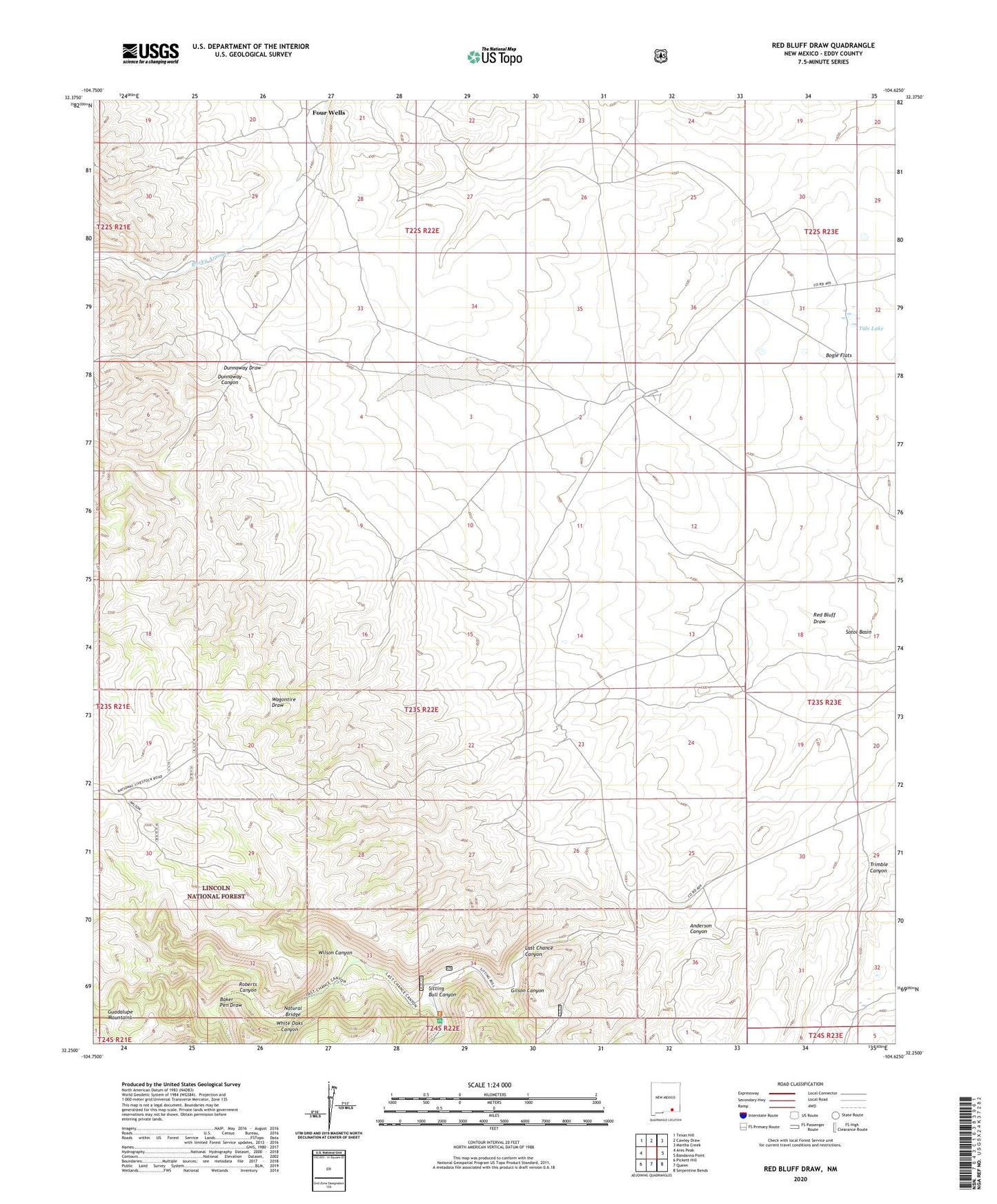
Red Bluff Draw New Mexico US Topo Map
Couldn't load pickup availability
Also explore the Red Bluff Draw Forest Service Topo of this same quad for updated USFS data
2023 topographic map quadrangle Red Bluff Draw in the state of New Mexico. Scale: 1:24000. Based on the newly updated USGS 7.5' US Topo map series, this map is in the following counties: Eddy. The map contains contour data, water features, and other items you are used to seeing on USGS maps, but also has updated roads and other features. This is the next generation of topographic maps. Printed on high-quality waterproof paper with UV fade-resistant inks.
Quads adjacent to this one:
West: Ares Peak
Northwest: Texas Hill
North: Cawley Draw
Northeast: Martha Creek
East: Bandanna Point
Southeast: Serpentine Bends
South: Queen
Southwest: Pickett Hill
This map covers the same area as the classic USGS quad with code o32104c6.
Contains the following named places: 06685 Water Well, 07037 Water Well, 20096 Water Well, 20097 Water Well, 20141 Water Well, Anderson Canyon, Baker Pen Draw, Bogle Flats, Burleson Well, Dunnaway Canyon, Four Wells, Gilson Canyon, H Bar Y Ranch, J D Well, Line Water Storage Tank, Natural Bridge, Red Bluff Draw, Roberts Canyon, Sitting Bull Canyon, Sitting Bull Communication Facility, Tin Henry Well, Trimble Canyon, Tule Lake, Tule Well, White Oaks Canyon, Wilson Canyon