MyTopo
Bear Peak New Mexico US Topo Map
Couldn't load pickup availability
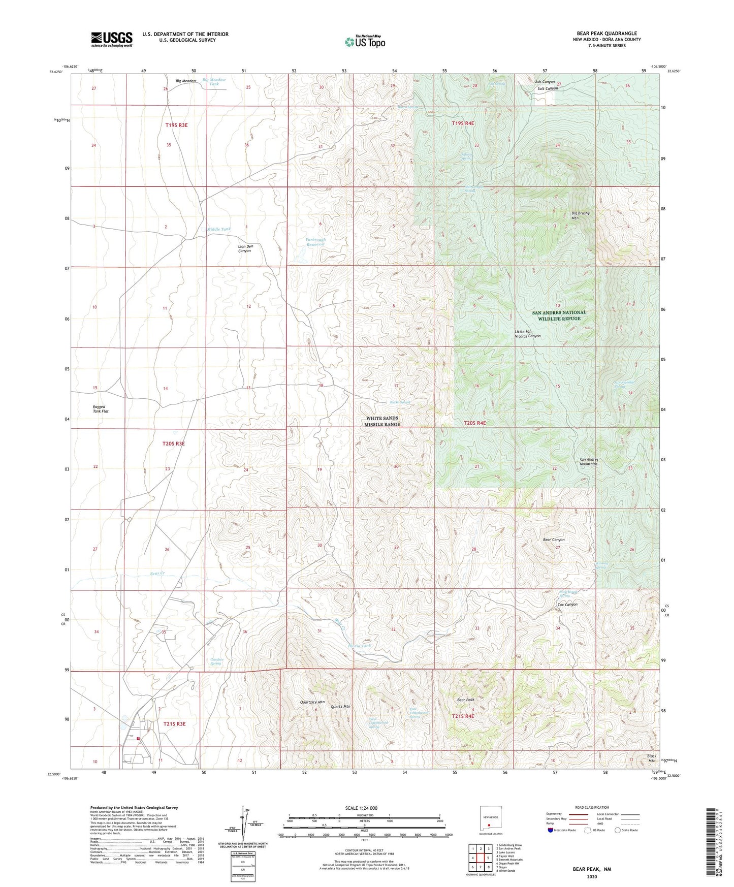
2023 topographic map quadrangle Bear Peak in the state of New Mexico. Scale: 1:24000. Based on the newly updated USGS 7.5' US Topo map series, this map is in the following counties: Doña Ana. The map contains contour data, water features, and other items you are used to seeing on USGS maps, but also has updated roads and other features. This is the next generation of topographic maps. Printed on high-quality waterproof paper with UV fade-resistant inks.
Quads adjacent to this one:
West: Taylor Well
Northwest: Goldenburg Draw
North: San Andres Peak
Northeast: Lake Lucero
East: Bennett Mountain
Southeast: White Sands
South: Organ
Southwest: Organ Peak NW
This map covers the same area as the classic USGS quad with code o32106e5.
Contains the following named places: Ash Spring, Bear Peak, Big Brushy Mountain, Big Meadow, Big Meadow Tank, Burke Spring, Burro Spring, Cox Canyon, Davis Tank, Davis Well, Divide Tanks, East Cottonwood Spring, Gardner Spring, Gravelly Ridges Artificial Revegetation Plot, Horse Tank, Johnson Space Center White Sands Test Facility Fire Department, Lion Den Canyon, Little Wells, Love Ranch Headquarters, Middle Tank, Mountain Tank, New Well, Peoria Tank, Quartz Mountain, Ragged Tank Flat, Rock House Spring, Salinas Spring, Salt Canyon, Salt Canyon Spring, San Nicholas Spring, Stinking Spring, Upper Well, West Cottonwood Spring, West Cottonwood Well, White Sands Division, White Sands Missile Range, White Sands Test Facility, Yarbrough Reservoir