MyTopo
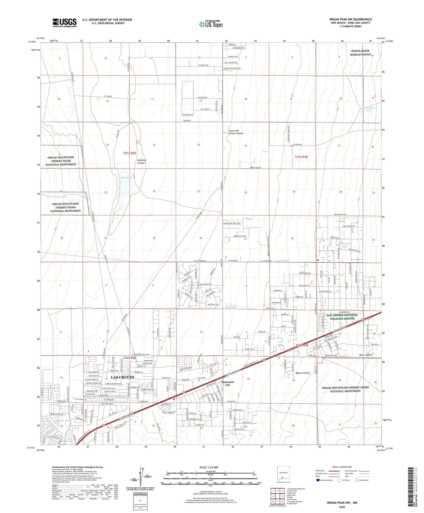
Organ Peak NW New Mexico US Topo Map
Couldn't load pickup availability
2023 topographic map quadrangle Organ Peak NW in the state of New Mexico. Scale: 1:24000. Based on the newly updated USGS 7.5' US Topo map series, this map is in the following counties: Doña Ana. The map contains contour data, water features, and other items you are used to seeing on USGS maps, but also has updated roads and other features. This is the next generation of topographic maps. Printed on high-quality waterproof paper with UV fade-resistant inks.
Quads adjacent to this one:
West: Dona Ana
Northwest: Summerford Mountain
North: Taylor Well
Northeast: Bear Peak
East: Organ
Southeast: Organ Peak
South: Tortugas Mountain
Southwest: Las Cruces
This map covers the same area as the classic USGS quad with code o32106d6.
Contains the following named places: Baylor Canyon, Blair Canyon, Butterfield Park Census Designated Place, Chandler Tank, Clark and Brown Canyon, Douglas School, Greasewood Tank, Hawkeye Canyon, Hiblar Tank, Isaack Lake, Lake Tank, Las Cruces Fire Department Station 5, Laswell Tank, Little Tank, Organ Volunteer Fire Department Station 2, Parker Tank Number 1, Parker Tank Number 2, Petts Tank, Sand Hill Arroyo Dam, Shoestring Ranch Airport, Spaceport City, Washington Tank, Will F Isaacks Ranch