MyTopo
Taylor Well New Mexico US Topo Map
Couldn't load pickup availability
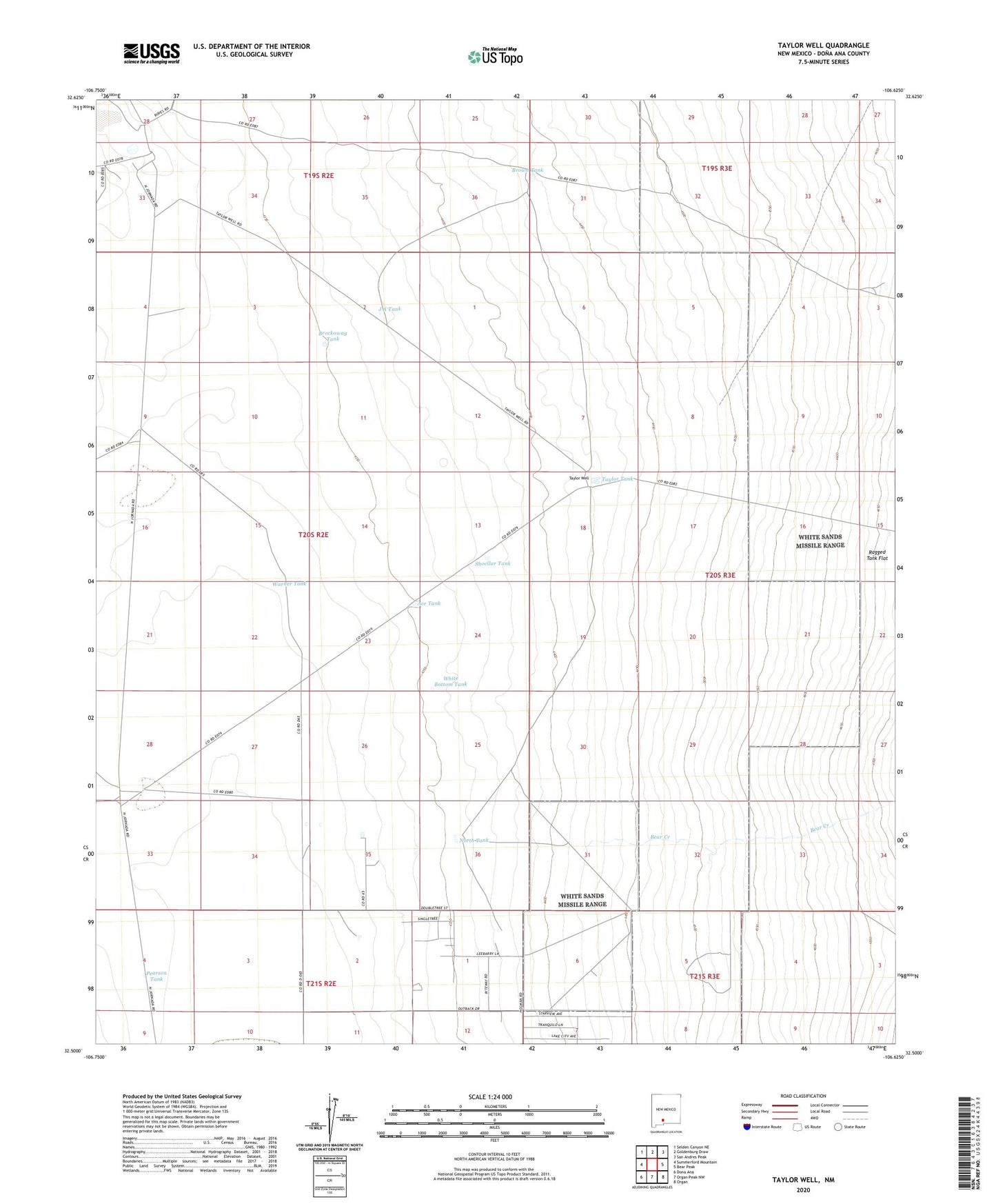
2023 topographic map quadrangle Taylor Well in the state of New Mexico. Scale: 1:24000. Based on the newly updated USGS 7.5' US Topo map series, this map is in the following counties: Doña Ana. The map contains contour data, water features, and other items you are used to seeing on USGS maps, but also has updated roads and other features. This is the next generation of topographic maps. Printed on high-quality waterproof paper with UV fade-resistant inks.
Quads adjacent to this one:
West: Summerford Mountain
Northwest: Selden Canyon NE
North: Goldenburg Draw
Northeast: San Andres Peak
East: Bear Peak
Southeast: Organ
South: Organ Peak NW
Southwest: Dona Ana
This map covers the same area as the classic USGS quad with code o32106e6.
Contains the following named places: Ace Tank, Bear Creek, Brockoway Tank, Brown Tank, Corners Tanks, Cross Tank, Frog Tank, J A Tank, Jornada Experimental Range Headquarters, North Tank, Pearson Tank, Ragged Tank, Shoellar Tank, South Well, Taylor Tank, Taylor Well, Waids Airpark, Warner Tank, White Bottom Tank