MyTopo
Bear Springs Peak New Mexico US Topo Map
Couldn't load pickup availability
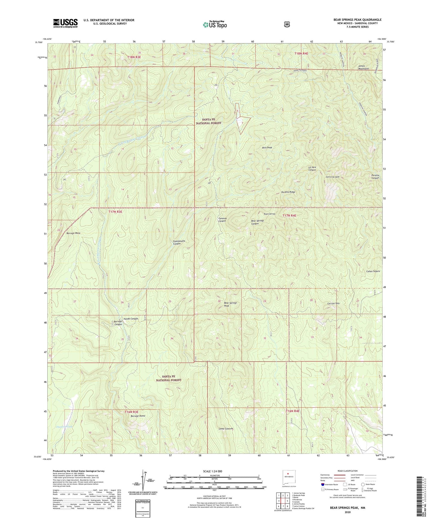
2020 topographic map quadrangle Bear Springs Peak in the state of New Mexico. Scale: 1:24000. Based on the newly updated USGS 7.5' US Topo map series, this map is in the following counties: Sandoval. The map contains contour data, water features, and other items you are used to seeing on USGS maps, but also has updated roads and other features. This is the next generation of topographic maps. Printed on high-quality waterproof paper with UV fade-resistant inks.
Quads adjacent to this one:
West: Ponderosa
Northwest: Jemez Springs
North: Redondo Peak
Northeast: Bland
East: Canada
Southeast: Santo Domingo Pueblo SW
South: Loma Creston
Southwest: Jemez Pueblo
Contains the following named places: Bear Springs Guard Station, Bear Springs Peak, Bland Bear Springs Trail, Borrego Dome, Borrego Mesa, Canovas Number 13 Group, Cerrito Yelo, Cerro la Jara, Chamisal Tank, Elza Seligman Camp, Guacamalla Canyon, Hondo Canyon, Loma Canovas, Mont de Lion Group, Peralta Lion Group, Ponderosa Camp, Ruiz Peak, Strip Mine, Tres Cerros, West Fork Borrego Canyon