MyTopo
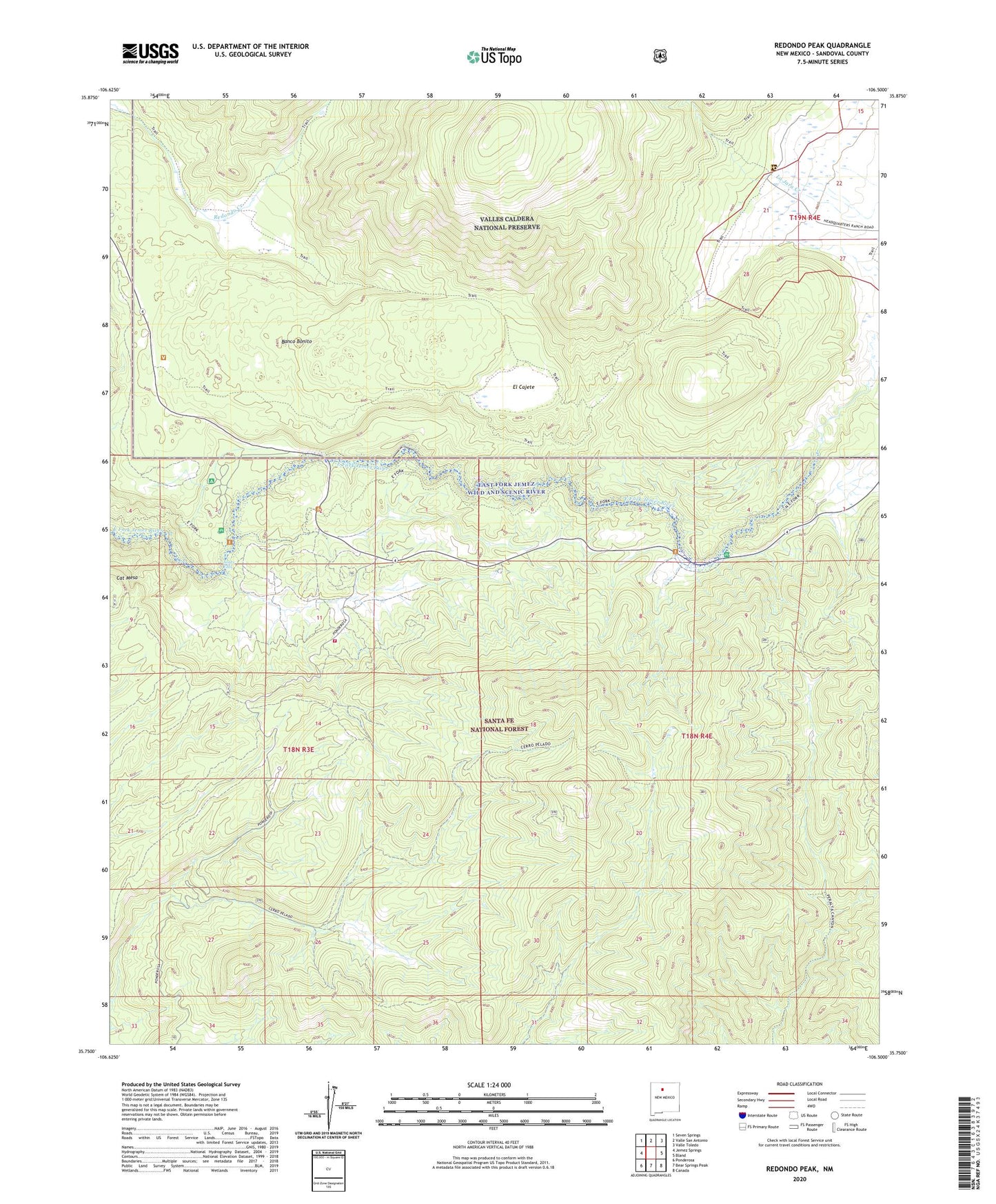
Redondo Peak New Mexico US Topo Map
Couldn't load pickup availability
Also explore the Redondo Peak Forest Service Topo of this same quad for updated USFS data
2023 topographic map quadrangle Redondo Peak in the state of New Mexico. Scale: 1:24000. Based on the newly updated USGS 7.5' US Topo map series, this map is in the following counties: Sandoval. The map contains contour data, water features, and other items you are used to seeing on USGS maps, but also has updated roads and other features. This is the next generation of topographic maps. Printed on high-quality waterproof paper with UV fade-resistant inks.
Quads adjacent to this one:
West: Jemez Springs
Northwest: Seven Springs
North: Valle San Antonio
Northeast: Valle Toledo
East: Bland
Southeast: Canada
South: Bear Springs Peak
Southwest: Ponderosa
This map covers the same area as the classic USGS quad with code o35106g5.
Contains the following named places: Banco Bonito, Cerro del Pino, Cerro Pelado, East Fork Jemez Wild and Scenic River, East Fork Recreation Site, El Cajete, El Cajete Canyon, Headquarters Ranch, Jemez Falls, Jemez Falls Campground, Jemez Falls Campgrounds, KBOM-FM (Los Alamos), KCHF-TV (Santa Fe), KIVA-FM (Santa Fe), KKSS-FM (Santa Fe), KKTO-TV (Santa Fe), KLSK-FM (Santa Fe), KOLT-FM (Santa Fe), La Cueva Fire District Sierra Los Penos, Las Conchas, Las Conchas Campground, Laura S, Lavaland Heights Mine, Lee Ault Pumice Mine, Lone Star Mine, Los Griegos, Peralta Ridge, Princis Number One Mine, Redondo Peak, Redondo Well, Rinehart Mines, Sierra de los Pinos, Tip Top Mine, Triple H Ranch, Valle Grande, Vallecitos de los Indios, Washington Mine