MyTopo
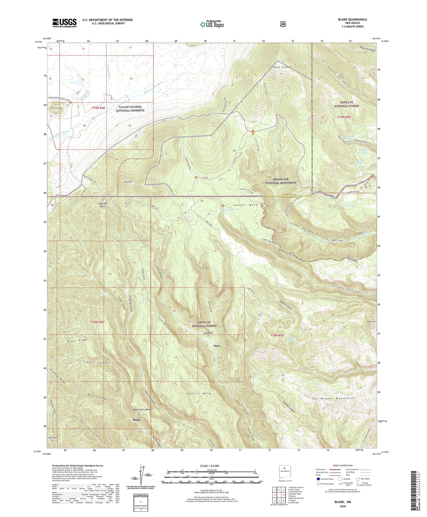
Bland New Mexico US Topo Map
Couldn't load pickup availability
Also explore the Bland Forest Service Topo of this same quad for updated USFS data
2023 topographic map quadrangle Bland in the state of New Mexico. Scale: 1:24000. Based on the newly updated USGS 7.5' US Topo map series, this map is in the following counties: Sandoval, Los Alamos. The map contains contour data, water features, and other items you are used to seeing on USGS maps, but also has updated roads and other features. This is the next generation of topographic maps. Printed on high-quality waterproof paper with UV fade-resistant inks.
Quads adjacent to this one:
West: Redondo Peak
Northwest: Valle San Antonio
North: Valle Toledo
Northeast: Guaje Mountain
East: Frijoles
Southeast: Cochiti Dam
South: Canada
Southwest: Bear Springs Peak
This map covers the same area as the classic USGS quad with code o35106g4.
Contains the following named places: Alamo Spring, Allerton Mine, American Spring, Armstead Spring, Aspen Peak, Avondale, Bearhead Ridge, Black Girl, Bland, Bland Post Office, Blue Bell Mine, Bruce Place, Bruce Ridge, Bull of the Woods, Canon del Norte, Capulin Trail, Cerro Grande, Cerro la Jara, Cochiti Chief Claim, Cochiti Mesa, Cochiti Mining District, Crager Ridge, Crown Point Mine, Daisy Mine, Denver Girl Group Mine, Emerald Claim, Empire Lode, Evans-Griffin Place, Exchange Hotel Complex Historic Site, Frazier Canyon, Giant Claim, Good Hope, Hopewell, Jaramillo Creek, King Tut, La Cueva Fire District Cochiti Mesa, La Jara Creek, Last Chance Lode, Last Chance Number Two, Laura S. Claim, Little Casino, Lonestar Group, Los Utes Spring, Mesa del Rito, Missing Link Claim, Mogul Group, Monte Cristo Group, Monument Lode, North Star Lode, Obsidian Ridge, Pajarito Canyon Trail, Pajarito Spring, Paso del Norte, Pines, Pines Canyon, Pines Post Office, Ponto Lode, Posey Mine, Rabbit Hill, Rabbit Mountain, Reid Canyon, Sambo, San Miguel Mountains, Sawyer Mesa, Sawyer Spring, Sheridan Lode, Spruce Canyon, Tent Rock, Tent Rock Ranch, Tip Top Lode, Uncle Joe Number Two, Upper Horn Mesa, Valle Grande Pumice Mine, Valle Trail, Washington Group, Washington Mine, Woodard Ridge