MyTopo
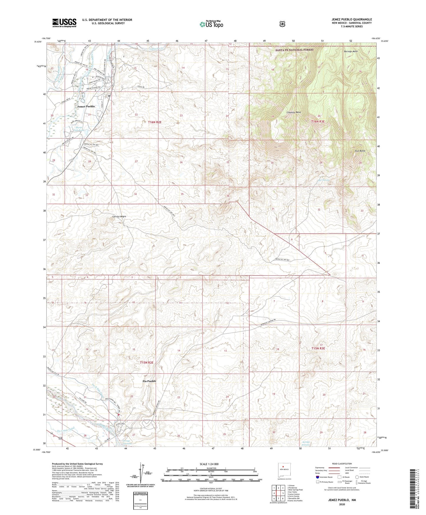
Jemez Pueblo New Mexico US Topo Map
Couldn't load pickup availability
Also explore the Jemez Pueblo Forest Service Topo of this same quad for updated USFS data
2023 topographic map quadrangle Jemez Pueblo in the state of New Mexico. Scale: 1:24000. Based on the newly updated USGS 7.5' US Topo map series, this map is in the following counties: Sandoval. The map contains contour data, water features, and other items you are used to seeing on USGS maps, but also has updated roads and other features. This is the next generation of topographic maps. Printed on high-quality waterproof paper with UV fade-resistant inks.
Quads adjacent to this one:
West: San Ysidro
Northwest: Gilman
North: Ponderosa
Northeast: Bear Springs Peak
East: Loma Creston
Southeast: Santa Ana Pueblo
South: Bernalillo NW
Southwest: Cerro Conejo
This map covers the same area as the classic USGS quad with code o35106e6.
Contains the following named places: 12345 'Proposed' Water Well, 4 IRR Water Well, Anthony Pecos Ditch, Arroyo Chamisa, Cerrito Negro, Chamisa Mesa, Community Presbyterian Church, East Side Canal, Indian Springs, Jemez Day School, Jemez Mountains Historical Marker, Jemez Pueblo, Jemez Pueblo Census Designated Place, Jemez Pueblo Community Library, Jemez Pueblo Emergency Medical Services, Jemez Pueblo Grant, Jemez Pueblo Post Office, Jemez Valley Elementary School, Jemez Valley Middle School, Ko-ah'-sai-ya Ruin, Ojo Chamisa, Pico Butte, Pueblo of Jemez Historical Marker, RWP-7 Water Well, RWP-9 Water Well, San Diego Elem/Mid Mission School, San Ysidro Pit, Sheep Fish Pond, Vallecito Creek, West Side Canal, West Side Lateral, Zia 16 Water Well, ZIA 9A Water Well, Zia Day School, Zia North Side Canal, ZIA PS 2 Water Well, Zia Pueblo, Zia Pueblo Census Designated Place, Zia Pueblo Grant, Zia Pueblo Volunteer Fire Department, Zia South Side Canal, ZIA-13 Water Well