MyTopo
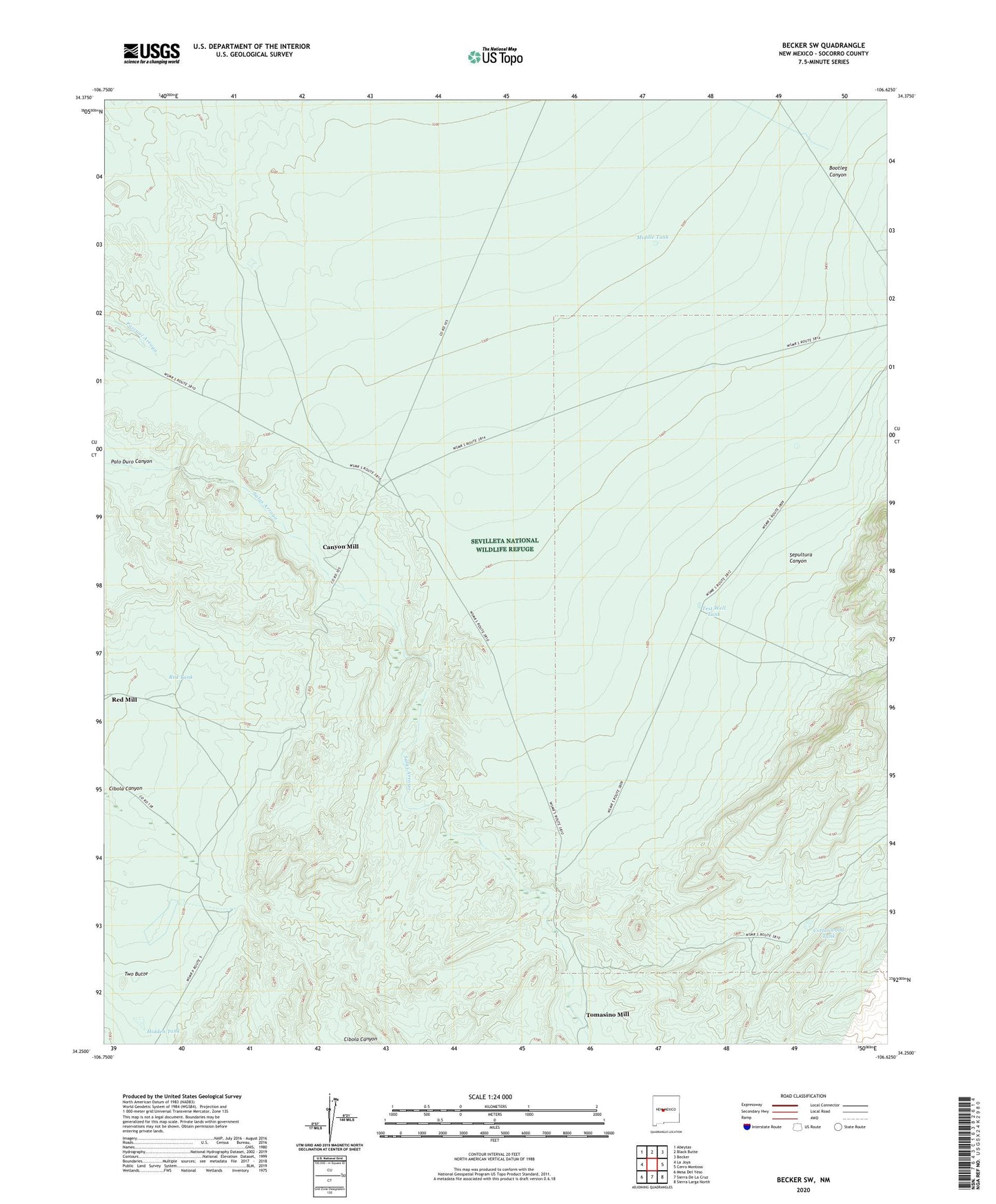
Becker SW New Mexico US Topo Map
Couldn't load pickup availability
2023 topographic map quadrangle Becker SW in the state of New Mexico. Scale: 1:24000. Based on the newly updated USGS 7.5' US Topo map series, this map is in the following counties: Socorro. The map contains contour data, water features, and other items you are used to seeing on USGS maps, but also has updated roads and other features. This is the next generation of topographic maps. Printed on high-quality waterproof paper with UV fade-resistant inks.
Quads adjacent to this one:
West: La Joya
Northwest: Abeytas
North: Black Butte
Northeast: Becker
East: Cerro Montoso
Southeast: Sierra Larga North
South: Sierra De La Cruz
Southwest: Mesa Del Yeso
This map covers the same area as the classic USGS quad with code o34106c6.
Contains the following named places: Bootleg Canyon, Canyon Mill, Cottonwood Tank, Deep Well, Freds Water Well, Gibbs Place, Hidden Tank, Middle Tank, Mine Shaft Mill, Red Tank, Sepultura Canyon, Test Well Tank, Tomasino Mill, Two Butte