MyTopo
Cerro Montoso New Mexico US Topo Map
Couldn't load pickup availability
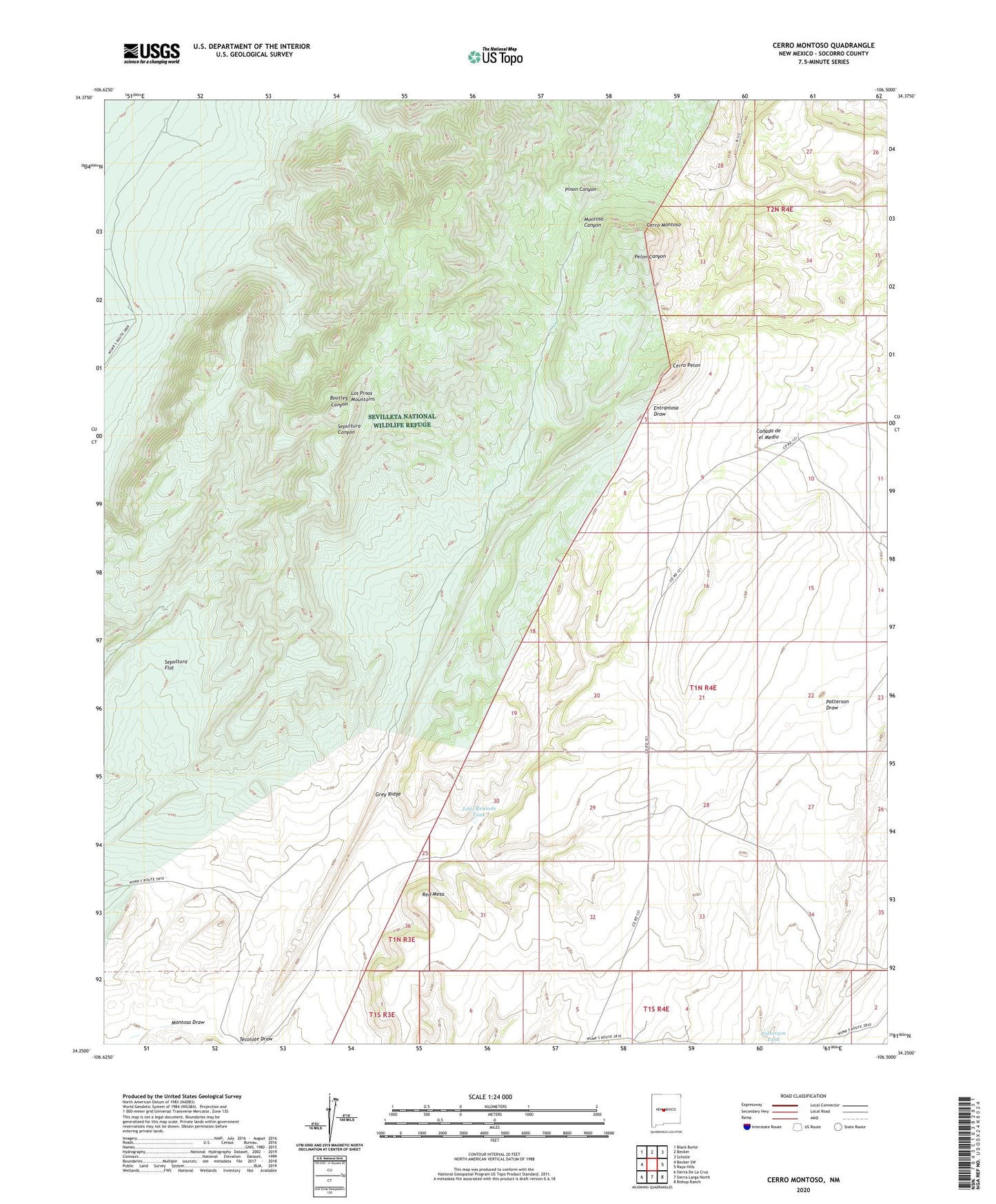
2023 topographic map quadrangle Cerro Montoso in the state of New Mexico. Scale: 1:24000. Based on the newly updated USGS 7.5' US Topo map series, this map is in the following counties: Socorro. The map contains contour data, water features, and other items you are used to seeing on USGS maps, but also has updated roads and other features. This is the next generation of topographic maps. Printed on high-quality waterproof paper with UV fade-resistant inks.
Quads adjacent to this one:
West: Becker SW
Northwest: Black Butte
North: Becker
Northeast: Scholle
East: Rayo Hills
Southeast: Bishop Ranch
South: Sierra Larga North
Southwest: Sierra De La Cruz
This map covers the same area as the classic USGS quad with code o34106c5.
Contains the following named places: Agua de los Torres Mill, Burris and Nunn Ranch, Burris HQ Water Well, Cerro Montoso, Cerro Pelon, Conqueror Mine, Grey Ridge, John Renlods Tank, Los Pinos Mountains, Lower Montosa Well, Montosa Draw, Parker Ranch, Parker Water Well, Patterson Tank, Red Mesa, Sepultura Flat, Tecolote Draw, Test Water Well 2, Tom Wright Mill, Upper Montosa Well