MyTopo
Albert New Mexico US Topo Map
Couldn't load pickup availability
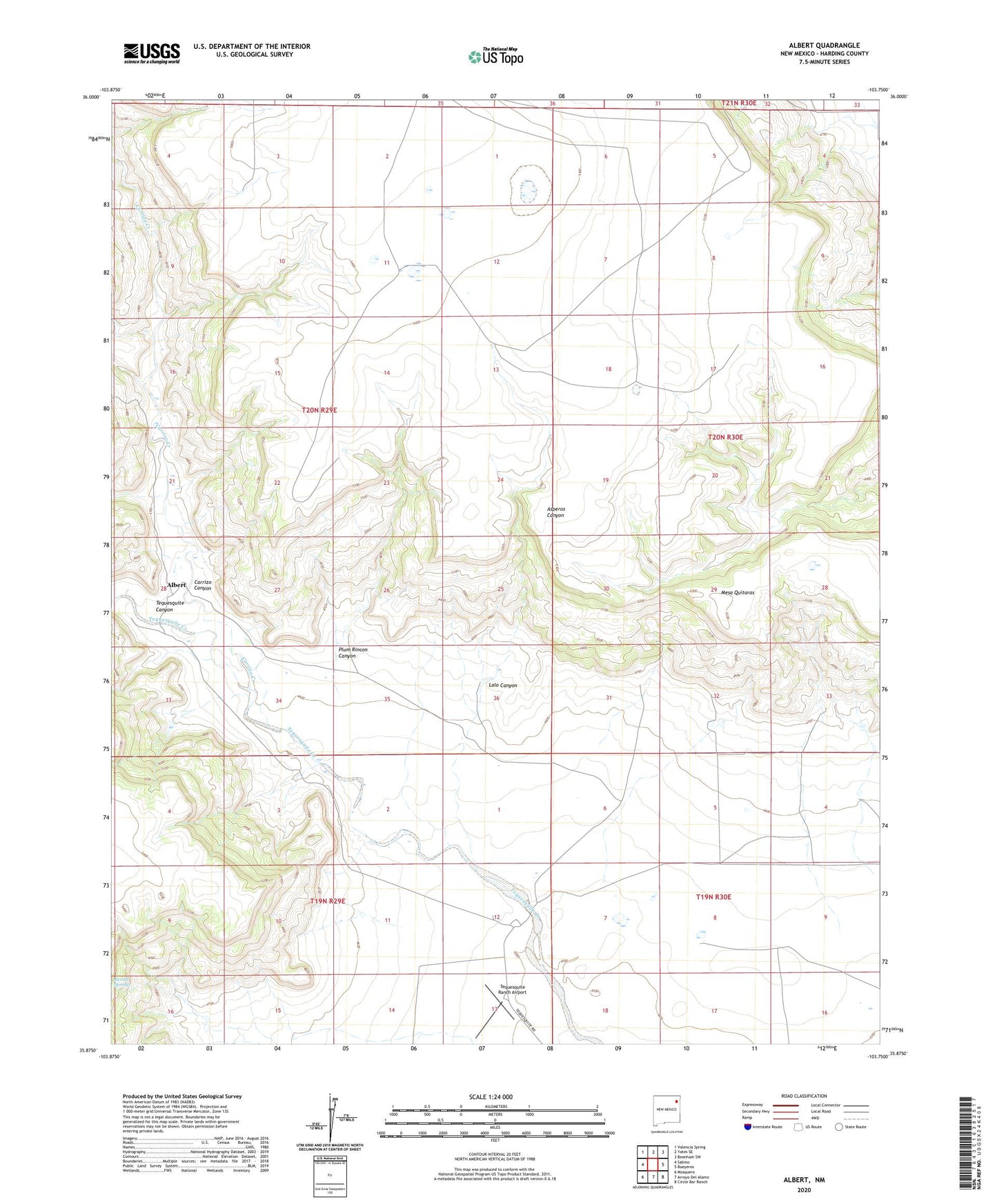
2023 topographic map quadrangle Albert in the state of New Mexico. Scale: 1:24000. Based on the newly updated USGS 7.5' US Topo map series, this map is in the following counties: Harding. The map contains contour data, water features, and other items you are used to seeing on USGS maps, but also has updated roads and other features. This is the next generation of topographic maps. Printed on high-quality waterproof paper with UV fade-resistant inks.
Quads adjacent to this one:
West: Sabino
Northwest: Valencia Spring
North: Yates SE
Northeast: Beenham SW
East: Bueyeros
Southeast: Circle Bar Ranch
South: Arroyo Del Alamo
Southwest: Mosquero
This map covers the same area as the classic USGS quad with code o35103h7.
Contains the following named places: Albert, Albert Academy, Albert P O, Albert Post Office, Amerigas Number Six Mitchell, Amoco Number One State F C, Carrizo Canyon, Carrizo Creek, Clay Number One State, Lalo Canyon, Mesa Quitaras, Plum Rincon Canyon, Tequesquite Canyon, Tequesquite Ranch Airport