MyTopo
Bell Peak New Mexico US Topo Map
Couldn't load pickup availability
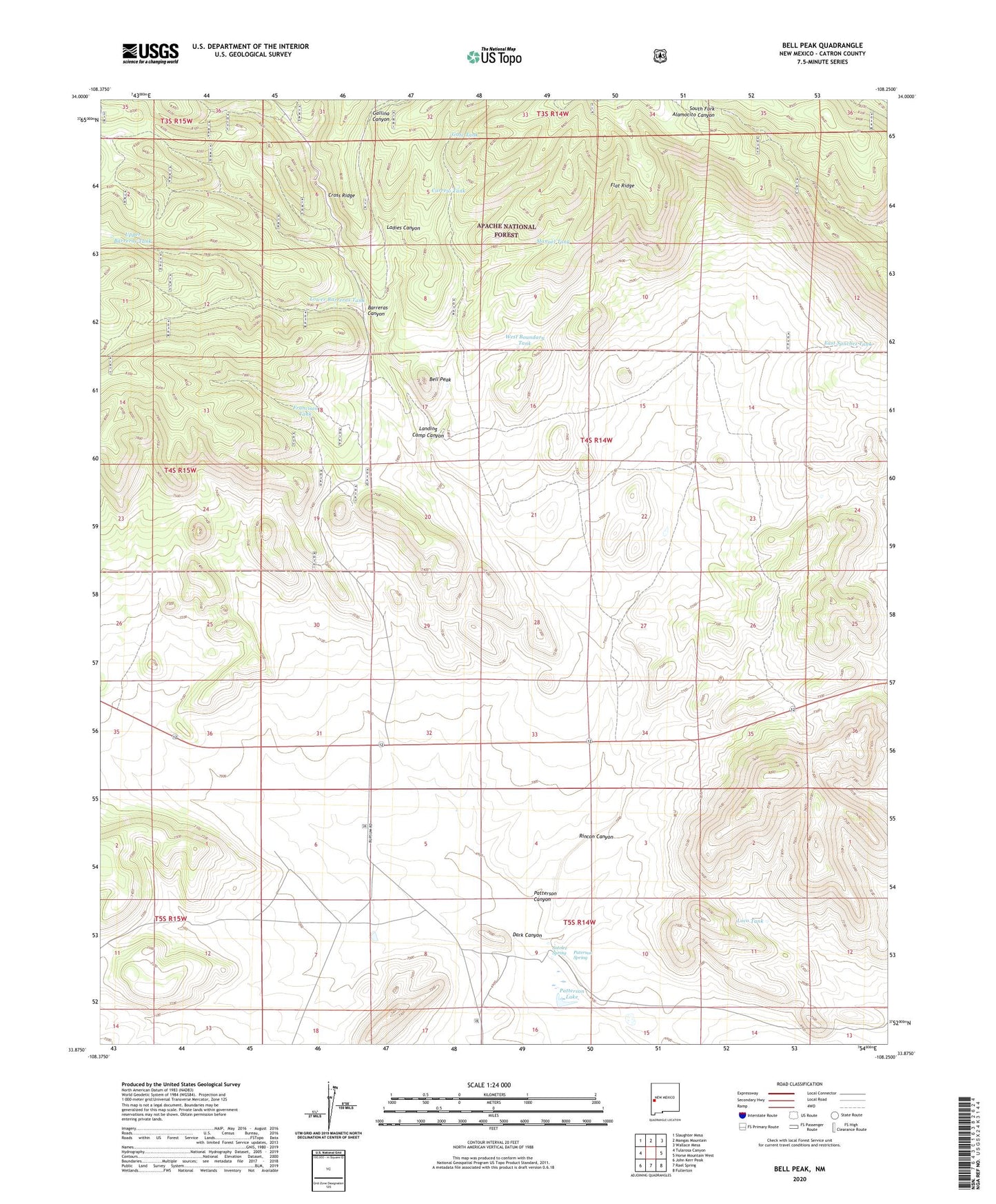
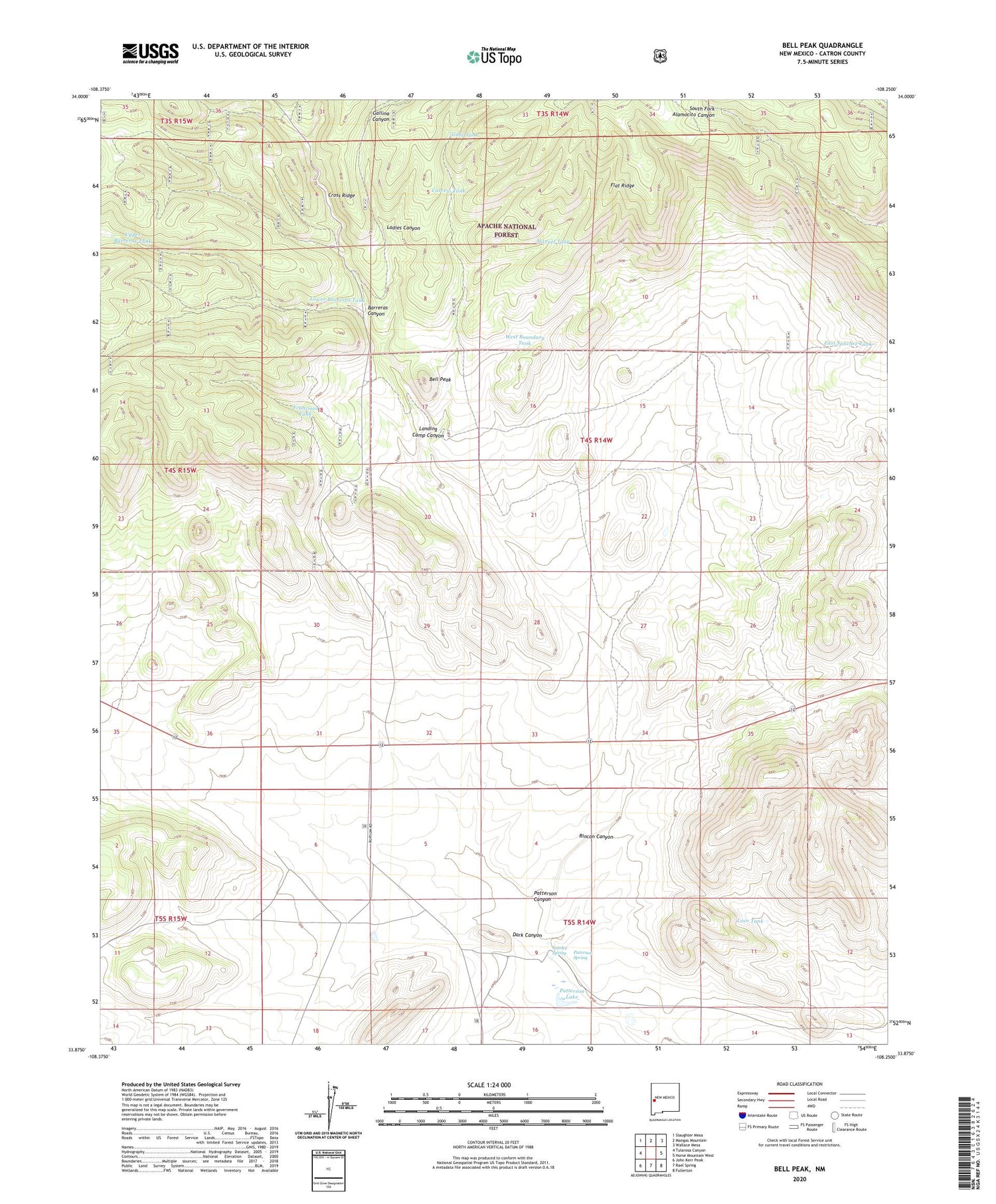
2020 topographic map quadrangle Bell Peak in the state of New Mexico. Scale: 1:24000. Based on the newly updated USGS 7.5' US Topo map series, this map is in the following counties: Catron. The map contains contour data, water features, and other items you are used to seeing on USGS maps, but also has updated roads and other features. This is the next generation of topographic maps. Printed on high-quality waterproof paper with UV fade-resistant inks.
Quads adjacent to this one:
West: Tularosa Canyon
Northwest: Slaughter Mesa
North: Mangas Mountain
Northeast: Wallace Mesa
East: Horse Mountain West
Southeast: Fullerton
South: Rael Spring
Southwest: John Kerr Peak
Contains the following named places: Barreras Canyon, Bell Peak, Carrejo Tank, Celeo Well, Cross Ridge, Dark Canyon, East Sanchez Tank, Flat Ridge, Francisco Tank, Gallina Canyon, Gate Tank, Horse Springs Bible Cemetery, Jaramillo Ranch, Ladies Canyon, Lady Tank, Landing Camp Canyon, Loco Tank, Lower Barreras Tank, Manuel Tank, Paterson Spring, Patterson Canyon, Patterson Lake, Plains of San Agustin, Plains of San Augustin Historical Marker, Rincon Canyon, Sotolee Spring, Todd Water Well, Upper Barreras Tank, Well A-1 Water Well, West Boundary Tank