MyTopo
Fullerton New Mexico US Topo Map
Couldn't load pickup availability
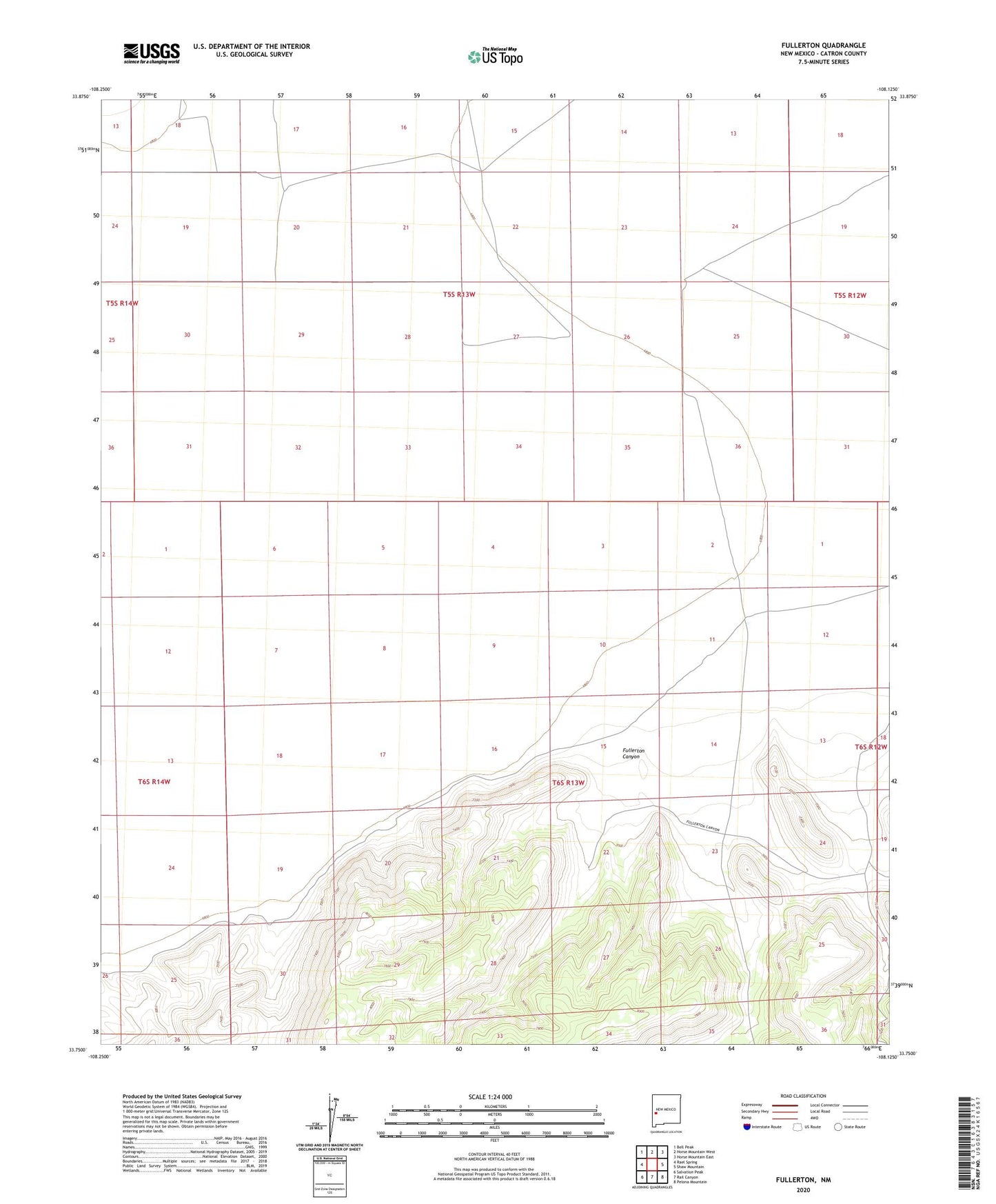
2023 topographic map quadrangle Fullerton in the state of New Mexico. Scale: 1:24000. Based on the newly updated USGS 7.5' US Topo map series, this map is in the following counties: Catron. The map contains contour data, water features, and other items you are used to seeing on USGS maps, but also has updated roads and other features. This is the next generation of topographic maps. Printed on high-quality waterproof paper with UV fade-resistant inks.
Quads adjacent to this one:
West: Rael Spring
Northwest: Bell Peak
North: Horse Mountain West
Northeast: Horse Mountain East
East: Shaw Mountain
Southeast: Pelona Mountain
South: Rail Canyon
Southwest: Salvation Peak
This map covers the same area as the classic USGS quad with code o33108g2.
Contains the following named places: Bat Cave Water Well, Birmingham Well, Carrejo Well, Crooked Tower Well, Diego Water Well, Fullerton, Fullerton Canyon, Fullerton E Water Well, Fullerton Post Office, Fullerton W Water Well, Sanchez Water Well, Windmill B Water Well