MyTopo
Horse Mountain West New Mexico US Topo Map
Couldn't load pickup availability
Also explore the Horse Mountain West Forest Service Topo of this same quad for updated USFS data
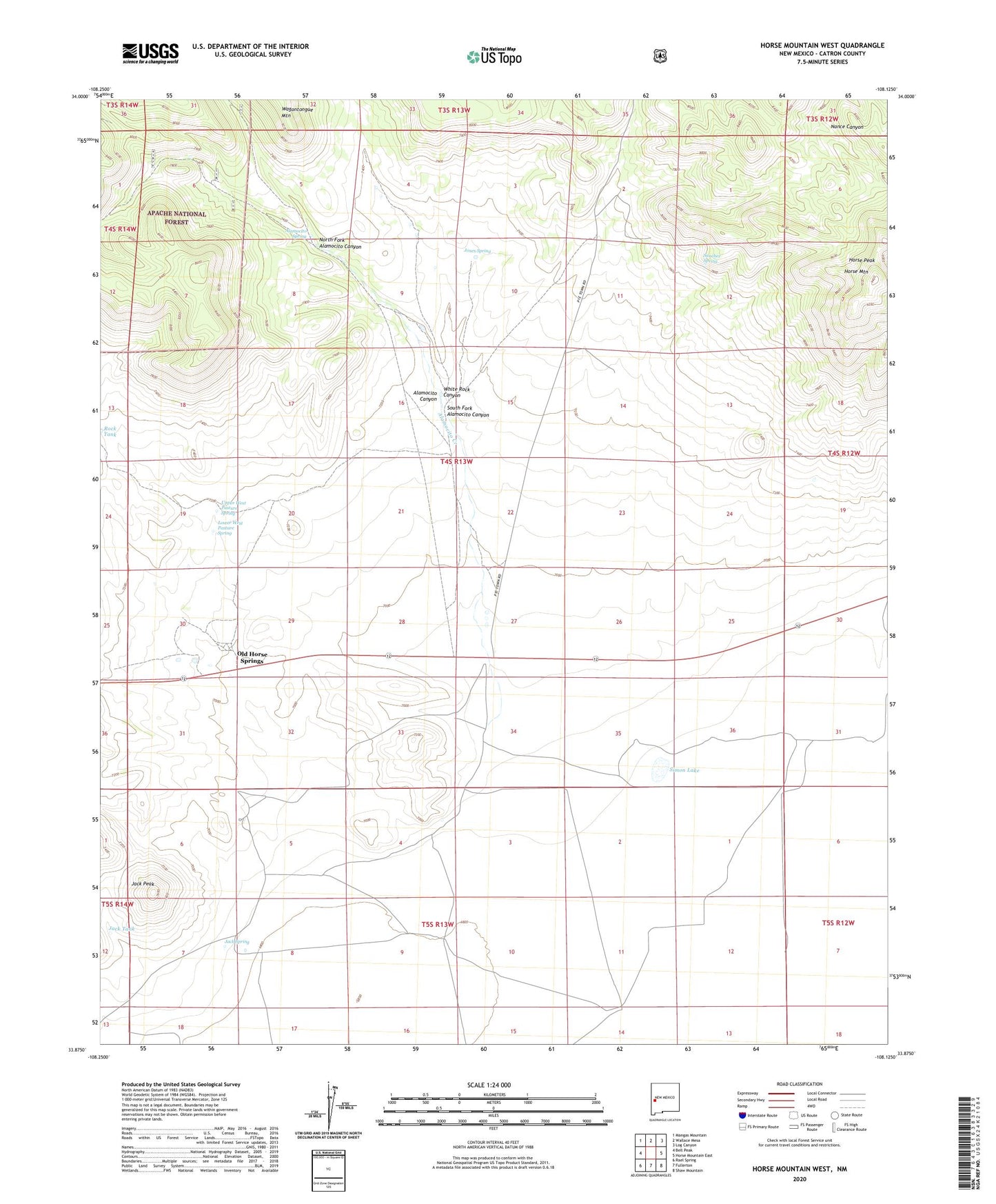
2023 topographic map quadrangle Horse Mountain West in the state of New Mexico. Scale: 1:24000. Based on the newly updated USGS 7.5' US Topo map series, this map is in the following counties: Catron. The map contains contour data, water features, and other items you are used to seeing on USGS maps, but also has updated roads and other features. This is the next generation of topographic maps. Printed on high-quality waterproof paper with UV fade-resistant inks.
Quads adjacent to this one:
West: Bell Peak
Northwest: Mangas Mountain
North: Wallace Mesa
Northeast: Log Canyon
East: Horse Mountain East
Southeast: Shaw Mountain
South: Fullerton
Southwest: Rael Spring
This map covers the same area as the classic USGS quad with code o33108h2.
Contains the following named places: 10014 Water Well, Alamocito Canyon, Alamocito Creek, Alamocito Spring, Armijo 1 Water Well, Armijo 2 Water Well, Armijo 3 Water Well, Armijo 4 Water Well, Armijo Water Well, Davis Water Well, Deep Well, East Water Well, Heifer Water Well, Horse Mountain, Horse Mountain Wilderness Study Area, Horse Peak, Horse Springs Cemetery, Horse Springs Store, Jack Peak, Jack Spring, Jack Tank, Jones Spring, Lebya Well, Lower West Pasture Spring, Madino Water Well, Madino Well, New Horse Springs, North Fork Alamocito Canyon, Old Horse Springs, Old Horse Water Well, Rock Tank, Sanchez Spring, Simon Lake, South Fork Alamocito Canyon, Upper West Pasture Spring, West Water Well, White Rock Canyon, Windmill D Water Well