MyTopo
Tularosa Canyon New Mexico US Topo Map
Couldn't load pickup availability
Also explore the Tularosa Canyon Forest Service Topo of this same quad for updated USFS data
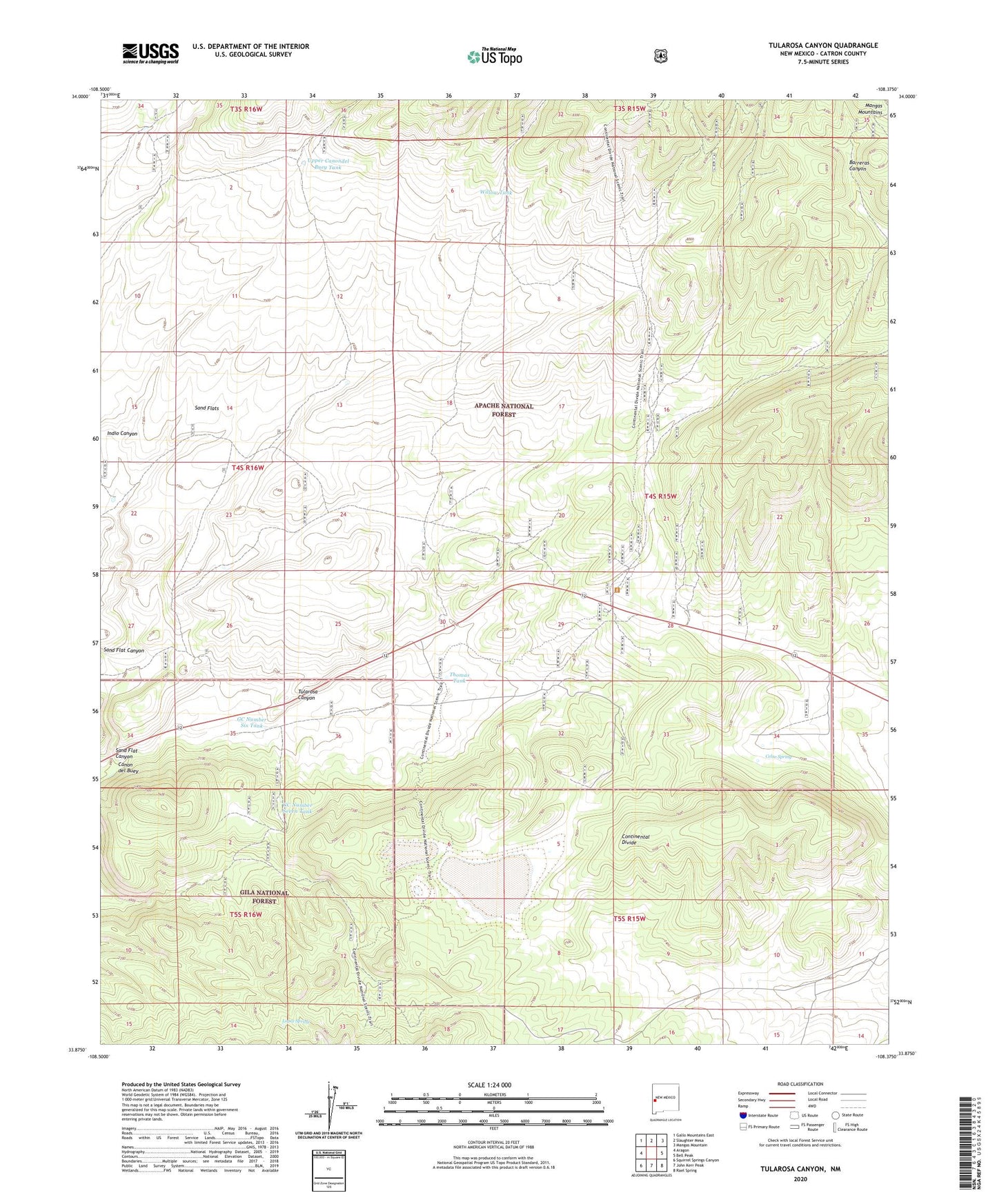
2023 topographic map quadrangle Tularosa Canyon in the state of New Mexico. Scale: 1:24000. Based on the newly updated USGS 7.5' US Topo map series, this map is in the following counties: Catron. The map contains contour data, water features, and other items you are used to seeing on USGS maps, but also has updated roads and other features. This is the next generation of topographic maps. Printed on high-quality waterproof paper with UV fade-resistant inks.
Quads adjacent to this one:
West: Aragon
Northwest: Gallo Mountains East
North: Slaughter Mesa
Northeast: Mangas Mountain
East: Bell Peak
Southeast: Rael Spring
South: John Kerr Peak
Southwest: Squirrel Springs Canyon
Contains the following named places: 10007 Water Well, Attavesudo Tank, Canon del Buey, Catron County, Celso Spring, Dog Tank, Fence Tank, GC Number Seven Tank, GC Number Six Tank, Indio Canyon, Jackson Well, Lambing Camp Tank, Lopez Spring, Patterson Pond, Poacher Tank, Road Forks Tank, Rock Tank, Sand Flat Canyon, Sand Flats, South Tank, Thomas Tank, Tularosa Canyon, Tularosa Shipping Corrals, Upper Canondel Buey Tank, West Well, Willow Tank