MyTopo
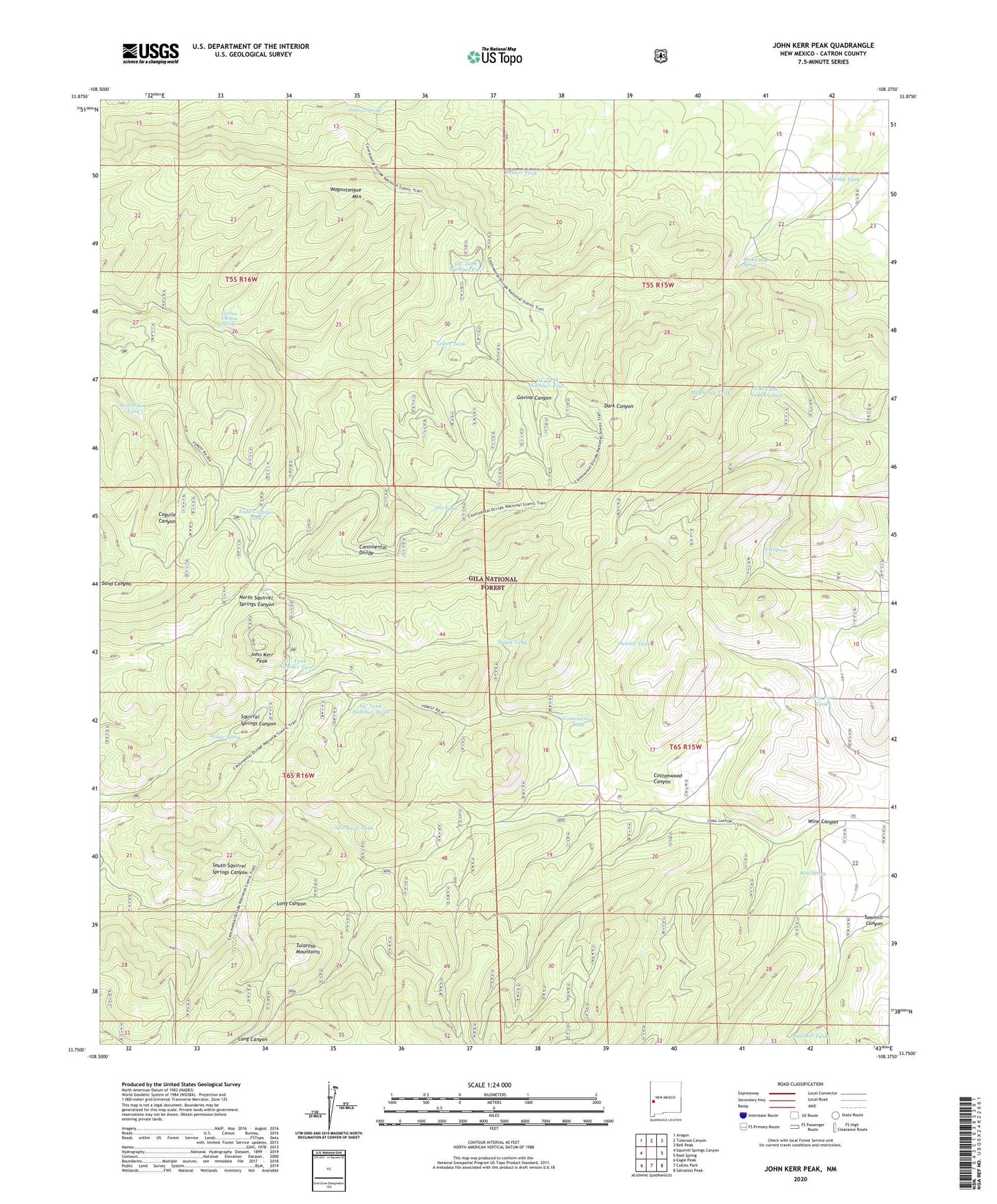
John Kerr Peak New Mexico US Topo Map
Couldn't load pickup availability
Also explore the John Kerr Peak Forest Service Topo of this same quad for updated USFS data
2023 topographic map quadrangle John Kerr Peak in the state of New Mexico. Scale: 1:24000. Based on the newly updated USGS 7.5' US Topo map series, this map is in the following counties: Catron. The map contains contour data, water features, and other items you are used to seeing on USGS maps, but also has updated roads and other features. This is the next generation of topographic maps. Printed on high-quality waterproof paper with UV fade-resistant inks.
Quads adjacent to this one:
West: Squirrel Springs Canyon
Northwest: Aragon
North: Tularosa Canyon
Northeast: Bell Peak
East: Rael Spring
Southeast: Salvation Peak
South: Collins Park
Southwest: Eagle Peak
This map covers the same area as the classic USGS quad with code o33108g4.
Contains the following named places: Banker Tank, Cottonwood Canyon, Cottonwood Tank, Damian Spring, Danley Tank, Dark Canyon, Dark Canyon Spring, GC Tank Number Five, GC Tank Number Four, GC Tank Number Three, GC Tank Number Two, Govina Canyon Spring, Horseshoe Tank, John Kerr Peak, Long Canyon Windmill, Long Fork Tank, Lopez Tank, Mayberry Tank, Pit Tank, Sawmill Tank, South Tank, Spring Tank, Spurgeon Tank, T H Spring, T H Tank Number Two, Three Forks Tank, Todd Cienega Tank, Wagontongue Mountain, Willow Spring, Wine Canyon, Wine Spring