MyTopo
Slaughter Mesa New Mexico US Topo Map
Couldn't load pickup availability
Also explore the Slaughter Mesa Forest Service Topo of this same quad for updated USFS data
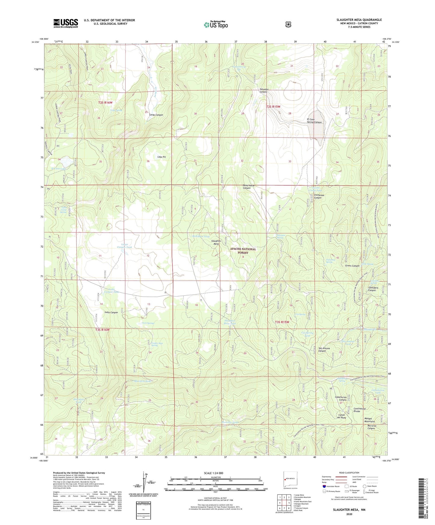
2023 topographic map quadrangle Slaughter Mesa in the state of New Mexico. Scale: 1:24000. Based on the newly updated USGS 7.5' US Topo map series, this map is in the following counties: Catron. The map contains contour data, water features, and other items you are used to seeing on USGS maps, but also has updated roads and other features. This is the next generation of topographic maps. Printed on high-quality waterproof paper with UV fade-resistant inks.
Quads adjacent to this one:
West: Gallo Mountains East
Northwest: Largo Mesa
North: Escondido Mountain
Northeast: Mangas
East: Mangas Mountain
Southeast: Bell Peak
South: Tularosa Canyon
Southwest: Aragon
This map covers the same area as the classic USGS quad with code o34108a4.
Contains the following named places: Antelope Tank, Bluestem Tank, Bull Tank, Caballeriza Spring, Caballeriza Tank, Cassidera Spring, Cat Spring, Cat Spring Tank, Chimenea Canyon, Chimenea Spring, Continental Tank, Cooper Seep Spring, Dead Horse Canyon, Divide Tank, Dry Lake Well, East Tank, El Caso Lake, El Caso Lookout, Elk Tank, Fire Tank, Gooseberry Pit, Green Tank, Hell Hole Tank, Indio Canyon Tank, Jacobs Camp Tank, Lake Pit, Largo Canyon, Largo Canyon Tank, Leslie Spring, Leslie Spring Trail, Lobo Tank, Lost Cabin Well, Lyles Camp Spring, Mangas Mountains, McKibben Tank, Mestenio Tank, North Tank, Salvador Canyon, Salvador Spring, San Antone Tank, Slaughter Mesa, Slaughter Mesa Tank, Twin Springs, Verde Spring