MyTopo
Big Costilla Peak New Mexico US Topo Map
Couldn't load pickup availability
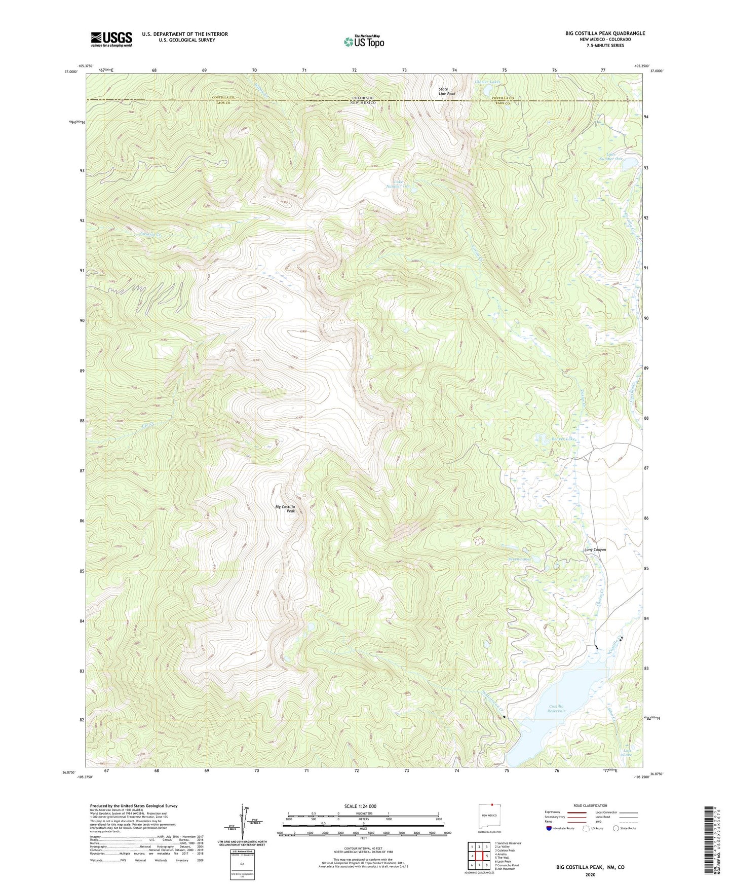
2023 topographic map quadrangle Big Costilla Peak in the states of New Mexico, Colorado. Scale: 1:24000. Based on the newly updated USGS 7.5' US Topo map series, this map is in the following counties: Taos, Costilla. The map contains contour data, water features, and other items you are used to seeing on USGS maps, but also has updated roads and other features. This is the next generation of topographic maps. Printed on high-quality waterproof paper with UV fade-resistant inks.
Quads adjacent to this one:
West: Amalia
Northwest: Sanchez Reservoir
North: La Valley
Northeast: Culebra Peak
East: The Wall
Southeast: Ash Mountain
South: Comanche Point
Southwest: Latir Peak
This map covers the same area as the classic USGS quad with code o36105h3.
Contains the following named places: Allen Creek, Beaver Lake, Big Costilla Peak, Casias Creek, Costilla Lodge, Costilla Reservoir, Costilla Reservoir Dam, East Fork Costilla Creek, Glacier Lakes, Lake Number One, Lake Number Two, Long Canyon, Lost Lake, Santistevan Creek, Seven Lakes, State Line Peak, West Fork Costilla Creek, ZIP Code: 87512