MyTopo
Amalia New Mexico US Topo Map
Couldn't load pickup availability
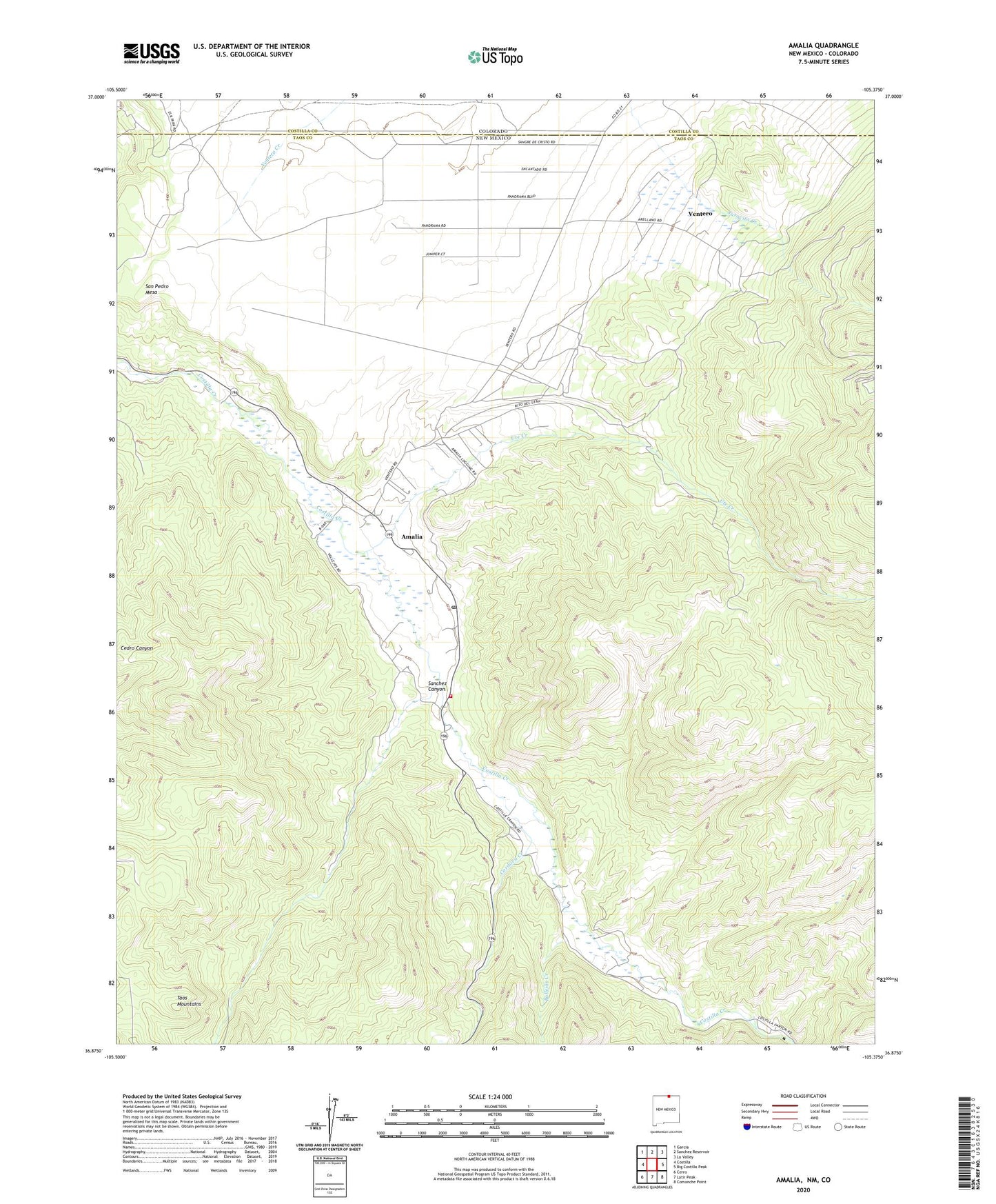
2023 topographic map quadrangle Amalia in the state of New Mexico. Scale: 1:24000. Based on the newly updated USGS 7.5' US Topo map series, this map is in the following counties: Taos, Costilla. The map contains contour data, water features, and other items you are used to seeing on USGS maps, but also has updated roads and other features. This is the next generation of topographic maps. Printed on high-quality waterproof paper with UV fade-resistant inks.
Quads adjacent to this one:
West: Costilla
Northwest: Garcia
North: Sanchez Reservoir
Northeast: La Valley
East: Big Costilla Peak
Southeast: Comanche Point
South: Latir Peak
Southwest: Cerro
This map covers the same area as the classic USGS quad with code o36105h4.
Contains the following named places: Amalia, Amalia / Ventero Volunteer Fire Department, Amalia Cemetery, Amalia Post Office, Amalia School, Ballejas Creek, Cordova Creek, San Pedro Mesa, Sanchez Canyon, Sangre de Cristo Grant, Santo Nino church, Ski Rio, Ute Creek, Ventero