MyTopo
Big Rock Hill New Mexico US Topo Map
Couldn't load pickup availability
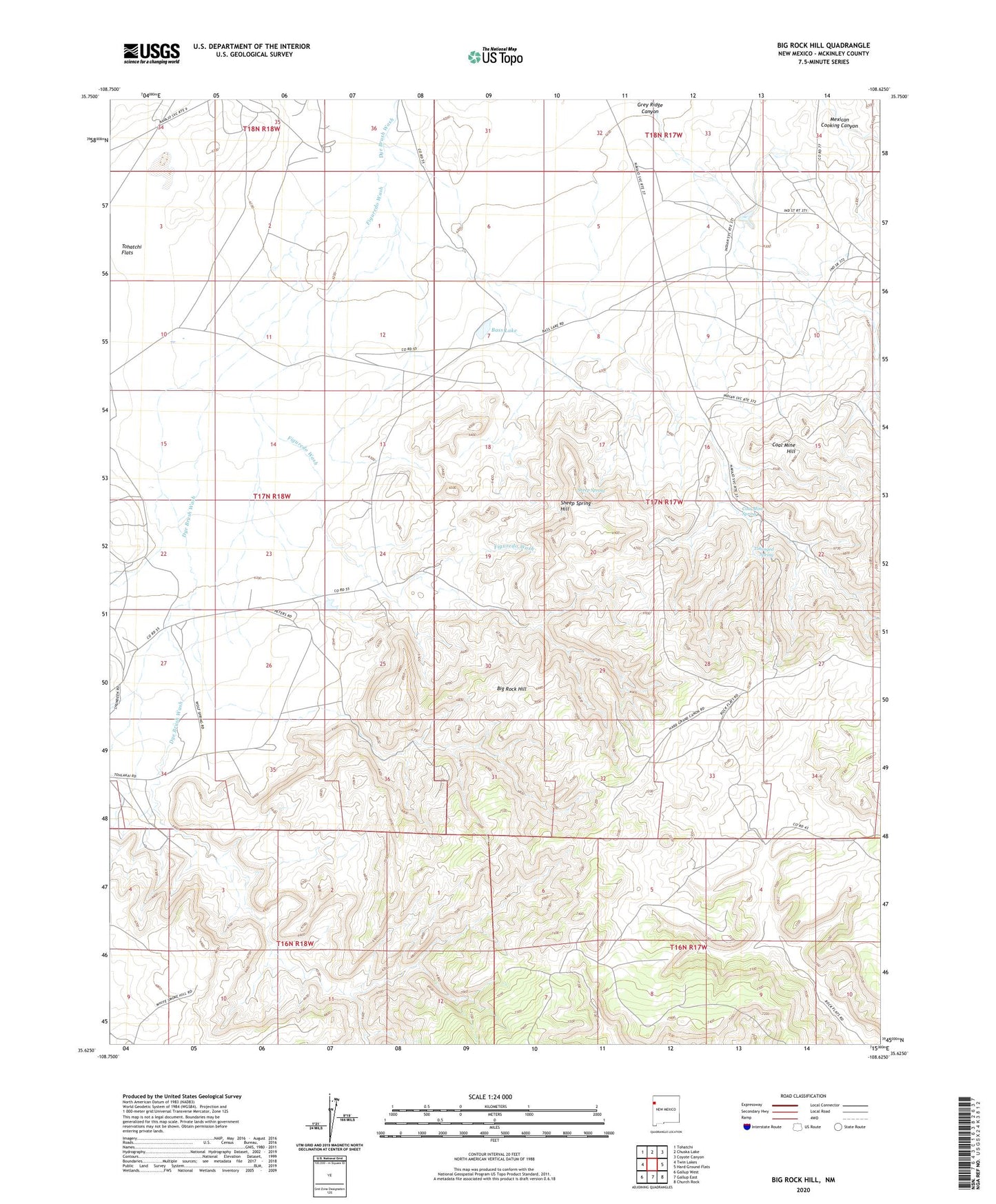
2020 topographic map quadrangle Big Rock Hill in the state of New Mexico. Scale: 1:24000. Based on the newly updated USGS 7.5' US Topo map series, this map is in the following counties: McKinley. The map contains contour data, water features, and other items you are used to seeing on USGS maps, but also has updated roads and other features. This is the next generation of topographic maps. Printed on high-quality waterproof paper with UV fade-resistant inks.
Quads adjacent to this one:
West: Twin Lakes
Northwest: Tohatchi
North: Chuska Lake
Northeast: Coyote Canyon
East: Hard Ground Flats
Southeast: Church Rock
South: Gallup East
Southwest: Gallup West
Contains the following named places: 14K-318 Water Well, 14T-306 Water Well, 14T-321 Water Well, Bass Lake, Bethlehem Church, Big Rock Hill, Coal Mine Hill, Coal Mine Spring, ERC 17-1 Water Well, Figuredo Wash, Jack Johnson, Jack Johnson Mine, Mexican Cooking Canyon, Sheep Spring, Sheep Spring Hill, State Pit 63-4-5, Tohasged Spring, Tohatchie Mine, Tom Ranch, Woolly Tommy Mine