MyTopo
Twin Lakes New Mexico US Topo Map
Couldn't load pickup availability
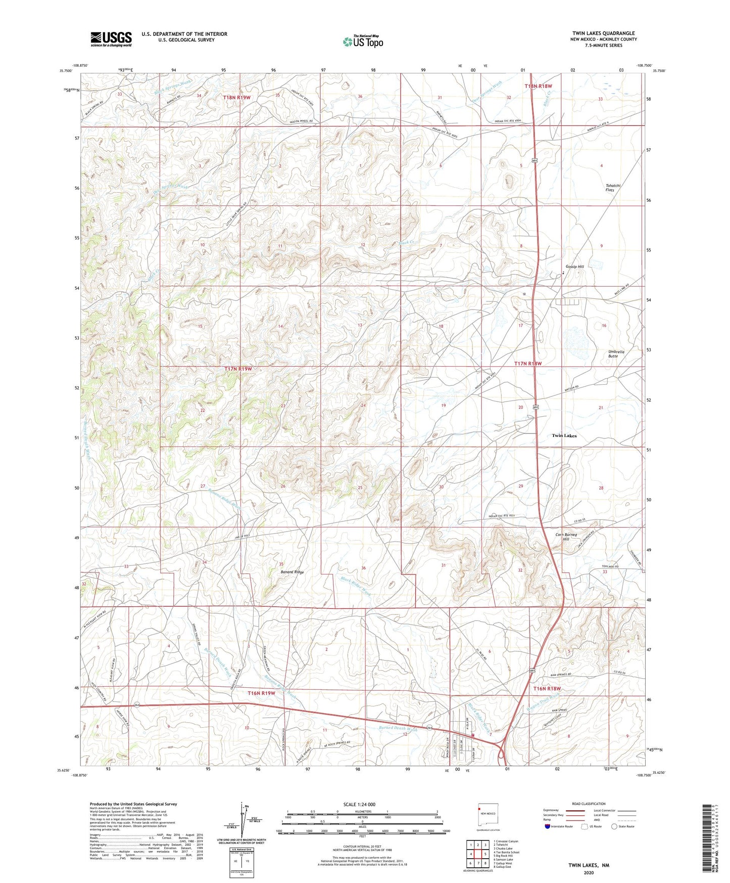
2023 topographic map quadrangle Twin Lakes in the state of New Mexico. Scale: 1:24000. Based on the newly updated USGS 7.5' US Topo map series, this map is in the following counties: McKinley. The map contains contour data, water features, and other items you are used to seeing on USGS maps, but also has updated roads and other features. This is the next generation of topographic maps. Printed on high-quality waterproof paper with UV fade-resistant inks.
Quads adjacent to this one:
West: Tse Bonita School
Northwest: Crevasse Canyon
North: Tohatchi
Northeast: Chuska Lake
East: Big Rock Hill
Southeast: Gallup East
South: Gallup West
Southwest: Samson Lake
This map covers the same area as the classic USGS quad with code o35108f7.
Contains the following named places: 10019 Water Well, 14K-314 Water Well, 14T-323 Water Well, 14T-501 Water Well, 14T-532 Water Well, 14T-533 Water Well, 14Y-9A Water Well, 16T-524 Water Well, 16T-526 Water Well, 16T-608 Water Well, 87375, Banana Ridge, Banana Ridge Wash, Corn Burned Hill, Fort Defiance Historical Marker, Gossip Hill, Navajo Estates Volunteer Fire Department Station 1 Headquarters, Navajo School Mine, PWSI000269 Water Well, Tohatchi Flats, Tohlakai Trading Post, Twin Lakes, Twin Lakes Census Designated Place, Twin Lakes Chapter, Umbrella Butte, Wagon Trail Wash, Yah-ta-hey, Yah-ta-hey Census Designated Place