
MyTopo
Gage New Mexico US Topo Map
Couldn't load pickup availability
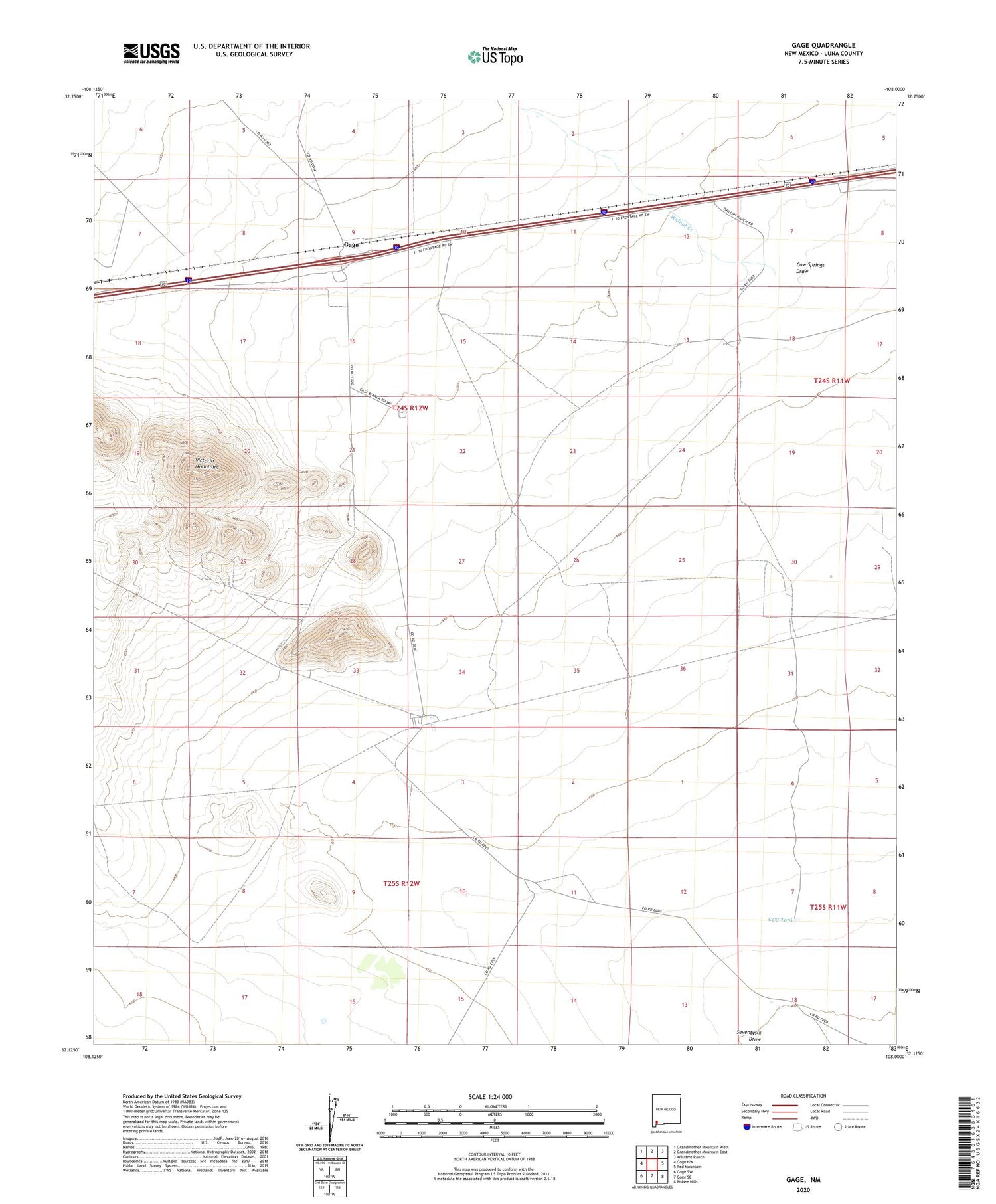
2023 topographic map quadrangle Gage in the state of New Mexico. Scale: 1:24000. Based on the newly updated USGS 7.5' US Topo map series, this map is in the following counties: Luna. The map contains contour data, water features, and other items you are used to seeing on USGS maps, but also has updated roads and other features. This is the next generation of topographic maps. Printed on high-quality waterproof paper with UV fade-resistant inks.
Quads adjacent to this one:
West: Gage NW
Northwest: Grandmother Mountain West
North: Grandmother Mountain East
Northeast: Williams Ranch
East: Red Mountain
Southeast: Bisbee Hills
South: Gage SE
Southwest: Gage SW
This map covers the same area as the classic USGS quad with code o32108b1.
Contains the following named places: 00626 Water Well, 00627 Water Well, 00628 Water Well, 00629 Water Well, 00631 Water Well, 01390 Water Well, 01391 Water Well, 01392 Water Well, 01393 Water Well, 01394 Water Well, 01395 Water Well, 01396 Water Well, 01421 Water Well, 01422 Water Well, 01423 Water Well, 01424 Water Well, 10228 Water Well, 10229 Water Well, 10248 Water Well, 1389 Water Well, 1569 Water Well, 1574 Water Well, Airington Windmill, Antelope Wells, Berts Well, Burke Mine, CCC Tank, Chance and Jessie Mines, Cow Springs Draw, Earp Ranch, Excess Mine, Gage, Gage Post Office, Gage Weather Station, Helen, Irish Rose, Jessie Mine, M-2279 Water Well, Mines Windmill, Mongola Windmill, Parole Mine, Rambler Mine, Rover Group, Separ Windmill, Tedford Prospect, Tidwich Windmill, Victorio Group, Victorio Mountains, Walnut Creek


