MyTopo
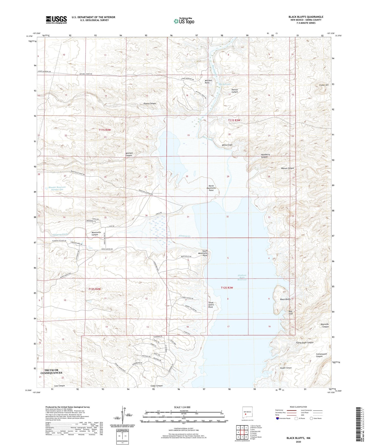
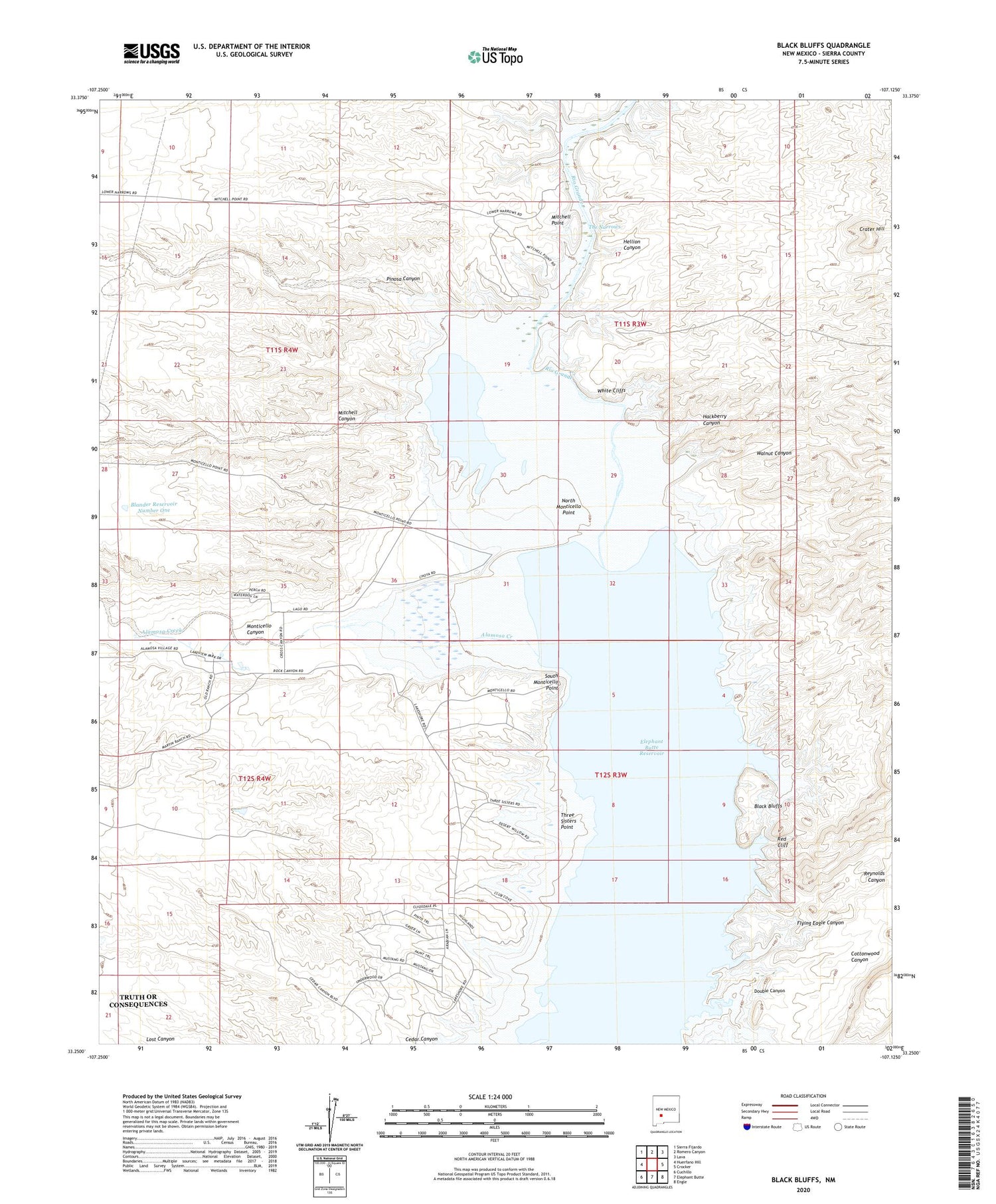
Black Bluffs New Mexico US Topo Map
Couldn't load pickup availability
2023 topographic map quadrangle Black Bluffs in the state of New Mexico. Scale: 1:24000. Based on the newly updated USGS 7.5' US Topo map series, this map is in the following counties: Sierra. The map contains contour data, water features, and other items you are used to seeing on USGS maps, but also has updated roads and other features. This is the next generation of topographic maps. Printed on high-quality waterproof paper with UV fade-resistant inks.
Quads adjacent to this one:
West: Huerfano Hill
Northwest: Sierra Fijardo
North: Romero Canyon
Northeast: Lava
East: Crocker
Southeast: Engle
South: Elephant Butte
Southwest: Cuchillo
This map covers the same area as the classic USGS quad with code o33107c2.
Contains the following named places: Alamosa Creek, Alamosa Ranch House and Blacksmith Shop Historic Site, Black Bluffs, Blander Reservoir Number One, Bolander, Chavez Windmill, Cottonwood Canyon, Crater Hill, Double Canyon, Elkins Ranch, Engle Point, Flying Eagle Canyon, Hackberry Canyon, Hellion Canyon, Mitchell Canyon, Mitchell Point, Monticello Canyon, Narrows Water Well, North Monticello Point, Pinosa Canyon, Red Cliff, Reynolds Canyon, RG 4091 Water Well, RG 6977 Water Well, South Monticello Point, Three Sisters Point, Walnut Canyon, White Cliffs, ZIP Code: 87935