MyTopo
Engle New Mexico US Topo Map
Couldn't load pickup availability
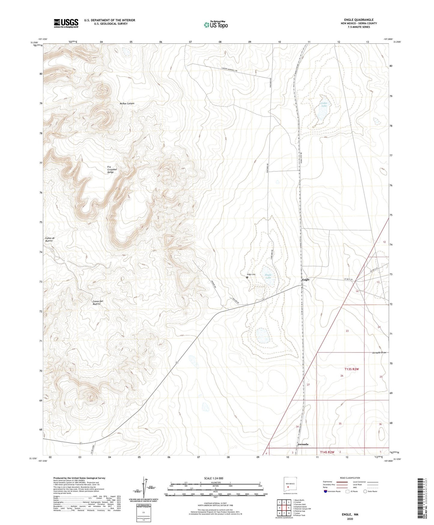
2023 topographic map quadrangle Engle in the state of New Mexico. Scale: 1:24000. Based on the newly updated USGS 7.5' US Topo map series, this map is in the following counties: Sierra. The map contains contour data, water features, and other items you are used to seeing on USGS maps, but also has updated roads and other features. This is the next generation of topographic maps. Printed on high-quality waterproof paper with UV fade-resistant inks.
Quads adjacent to this one:
West: Elephant Butte
Northwest: Black Bluffs
North: Crocker
Northeast: Fairview Well
East: Shannon Canyon NW
Southeast: Polecat Tank
South: Cutter
Southwest: Palomas Gap
This map covers the same area as the classic USGS quad with code o33107b1.
Contains the following named places: Canon del Muerto, Cedar Lake, Eagle Community Church, Engle, Engle Cemetery, Engle Lake, Engle Post Office, Larson Windmill, Reservoir Windmill, Seven T X Camp, ZIP Code: 87901