MyTopo
Huerfano Hill New Mexico US Topo Map
Couldn't load pickup availability
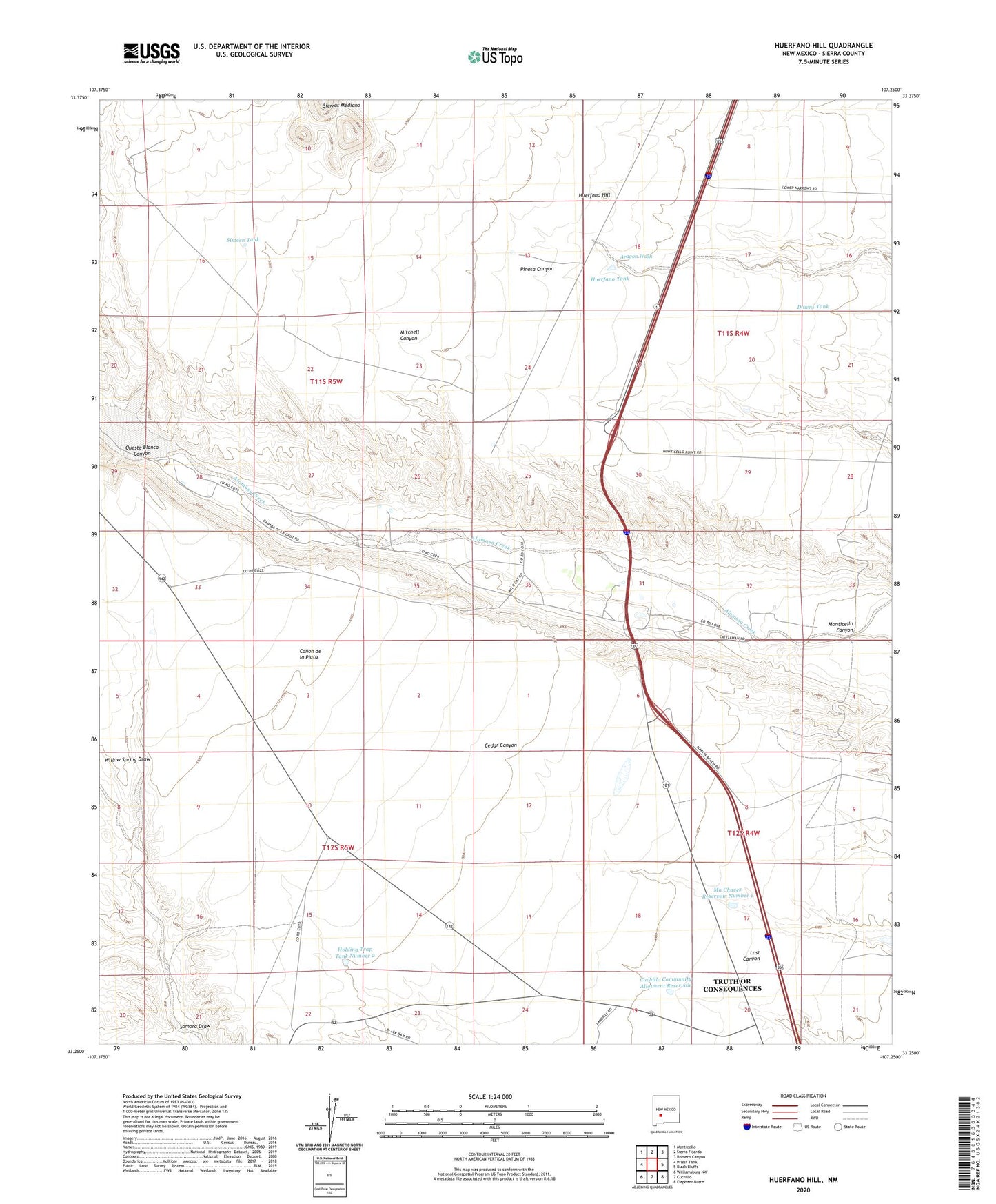
2023 topographic map quadrangle Huerfano Hill in the state of New Mexico. Scale: 1:24000. Based on the newly updated USGS 7.5' US Topo map series, this map is in the following counties: Sierra. The map contains contour data, water features, and other items you are used to seeing on USGS maps, but also has updated roads and other features. This is the next generation of topographic maps. Printed on high-quality waterproof paper with UV fade-resistant inks.
Quads adjacent to this one:
West: Priest Tank
Northwest: Monticello
North: Sierra Fijardo
Northeast: Romero Canyon
East: Black Bluffs
Southeast: Elephant Butte
South: Cuchillo
Southwest: Williamsburg NW
This map covers the same area as the classic USGS quad with code o33107c3.
Contains the following named places: Aragon Wash, Cuchillo Community Allotment Reservoir, Downs Tank, Holding Trap Tank Number 2, Huerfano Hill, Huerfano Tank, Mn Chavez Reservoir Number 1, Questa Blanca Canyon, RG 25291 Water Well, RG 6707 Water Well, Samora Draw, Sixteen Tank