MyTopo
Sierra Fijardo New Mexico US Topo Map
Couldn't load pickup availability
Also explore the Sierra Fijardo Forest Service Topo of this same quad for updated USFS data
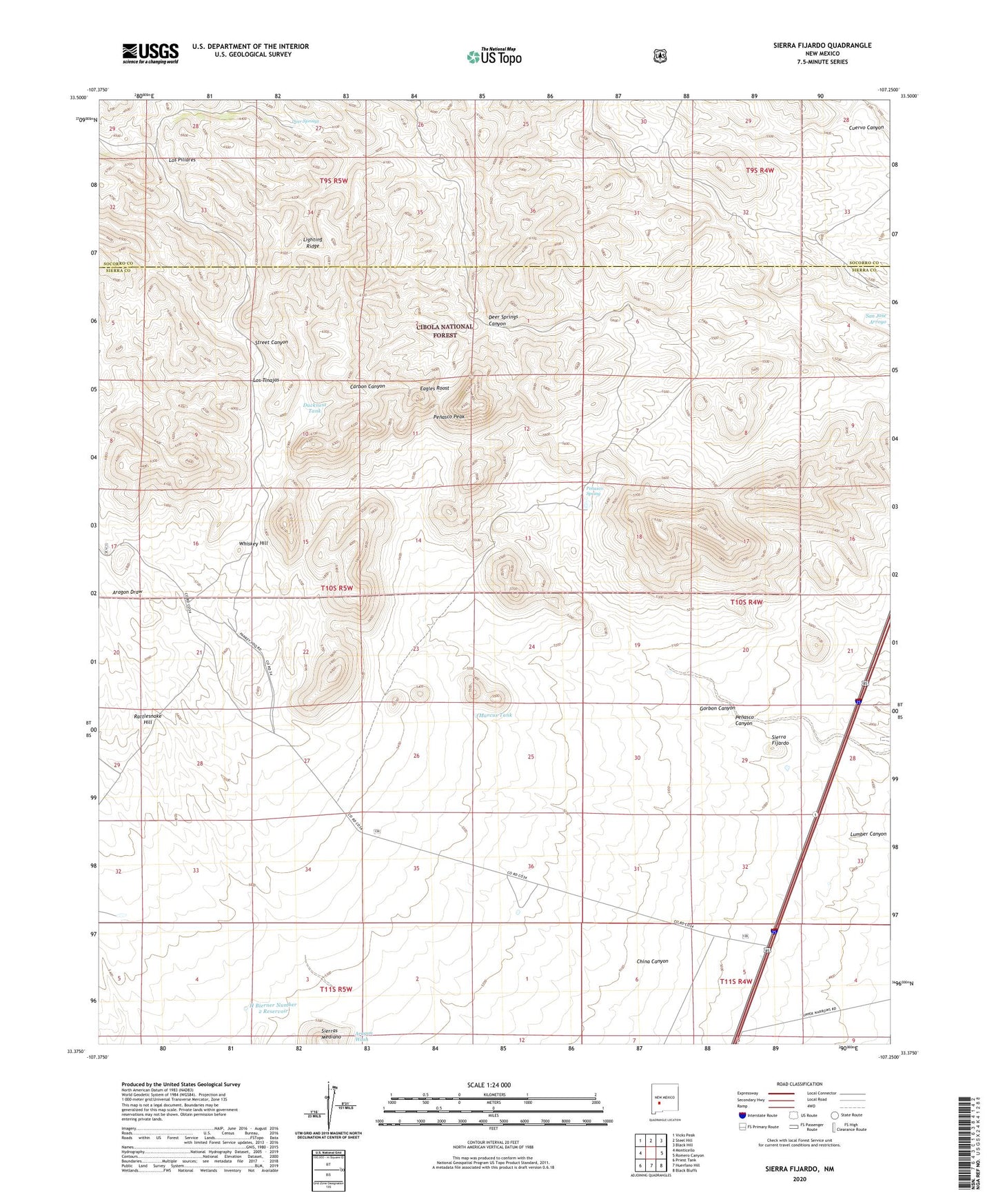
2023 topographic map quadrangle Sierra Fijardo in the state of New Mexico. Scale: 1:24000. Based on the newly updated USGS 7.5' US Topo map series, this map is in the following counties: Sierra, Socorro. The map contains contour data, water features, and other items you are used to seeing on USGS maps, but also has updated roads and other features. This is the next generation of topographic maps. Printed on high-quality waterproof paper with UV fade-resistant inks.
Quads adjacent to this one:
West: Monticello
Northwest: Vicks Peak
North: Steel Hill
Northeast: Black Hill
East: Romero Canyon
Southeast: Black Bluffs
South: Huerfano Hill
Southwest: Priest Tank
This map covers the same area as the classic USGS quad with code o33107d3.
Contains the following named places: Deer Springs, Deer Springs Canyon, Ducknest Tank, Eagles Roost, Flying X 2 Water Well, Flying X Ranch, Flying X Water Well, H Bierner Number 2 Reservoir, Lighting Ridge, Los Pillares, Los Pillares Well, Los Tinajas, Marcus Tank, Penasco Canyon, Penasco Peak, Penasco Spring, Rattlesnake Hill, Sierra Fijardo, Sierras Mediano, Street Canyon, Street Well, Whiskey Hill