MyTopo
Cow Springs New Mexico US Topo Map
Couldn't load pickup availability
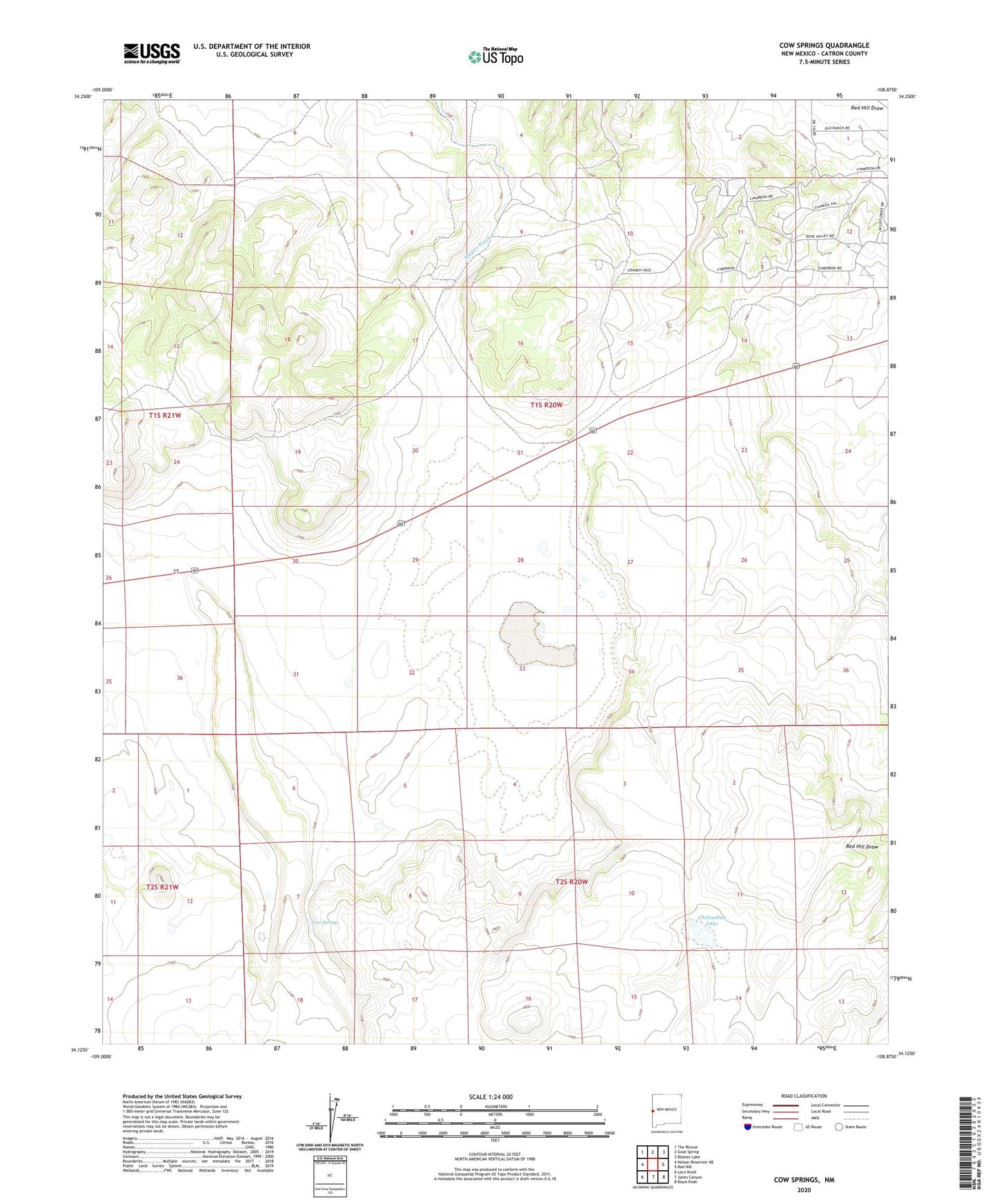
2023 topographic map quadrangle Cow Springs in the state of New Mexico. Scale: 1:24000. Based on the newly updated USGS 7.5' US Topo map series, this map is in the following counties: Catron. The map contains contour data, water features, and other items you are used to seeing on USGS maps, but also has updated roads and other features. This is the next generation of topographic maps. Printed on high-quality waterproof paper with UV fade-resistant inks.
Quads adjacent to this one:
West: Nelson Reservoir NE
Northwest: The Rincon
North: Goat Spring
Northeast: Blaines Lake
East: Red Hill
Southeast: Black Peak
South: Jones Canyon
Southwest: Loco Knoll
This map covers the same area as the classic USGS quad with code o34108b8.
Contains the following named places: Brockman Ranch, Chihuahua Lake, Cow Springs, Cow Springs Draw, Cow Springs Windmill, East Windmill, Goude Ranch, Vicente Baca Windmill