MyTopo
Ponderosa Tank New Mexico US Topo Map
Couldn't load pickup availability
Also explore the Ponderosa Tank Forest Service Topo of this same quad for updated USFS data
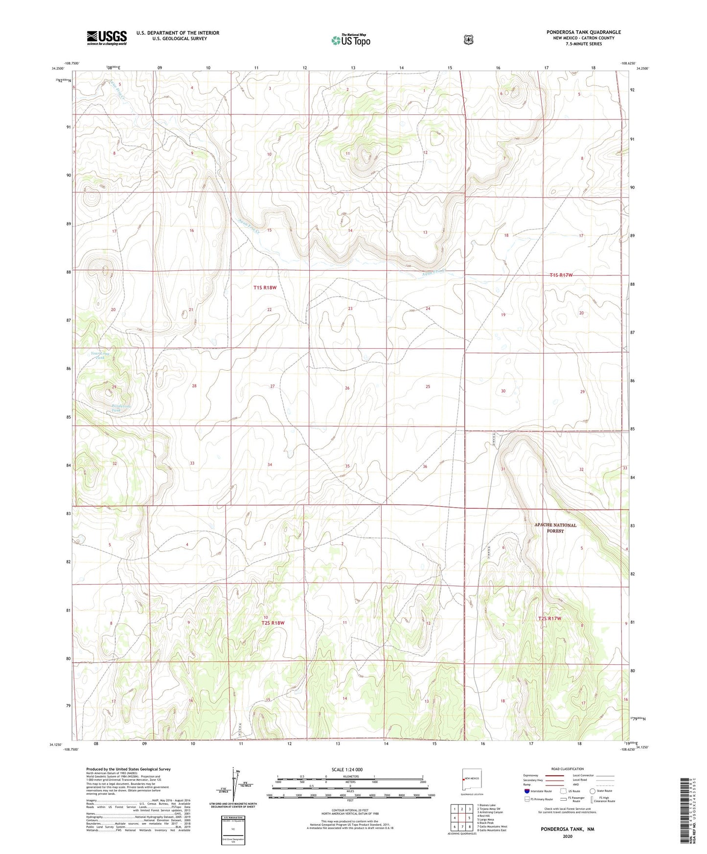
2023 topographic map quadrangle Ponderosa Tank in the state of New Mexico. Scale: 1:24000. Based on the newly updated USGS 7.5' US Topo map series, this map is in the following counties: Catron. The map contains contour data, water features, and other items you are used to seeing on USGS maps, but also has updated roads and other features. This is the next generation of topographic maps. Printed on high-quality waterproof paper with UV fade-resistant inks.
Quads adjacent to this one:
West: Red Hill
Northwest: Blaines Lake
North: Tejana Mesa SW
Northeast: Armstrong Canyon
East: Largo Mesa
Southeast: Gallo Mountains East
South: Gallo Mountains West
Southwest: Black Peak
Contains the following named places: Antelope Tank, North Windmill, Ponderosa Tank, South Well, Year Long Tank