MyTopo
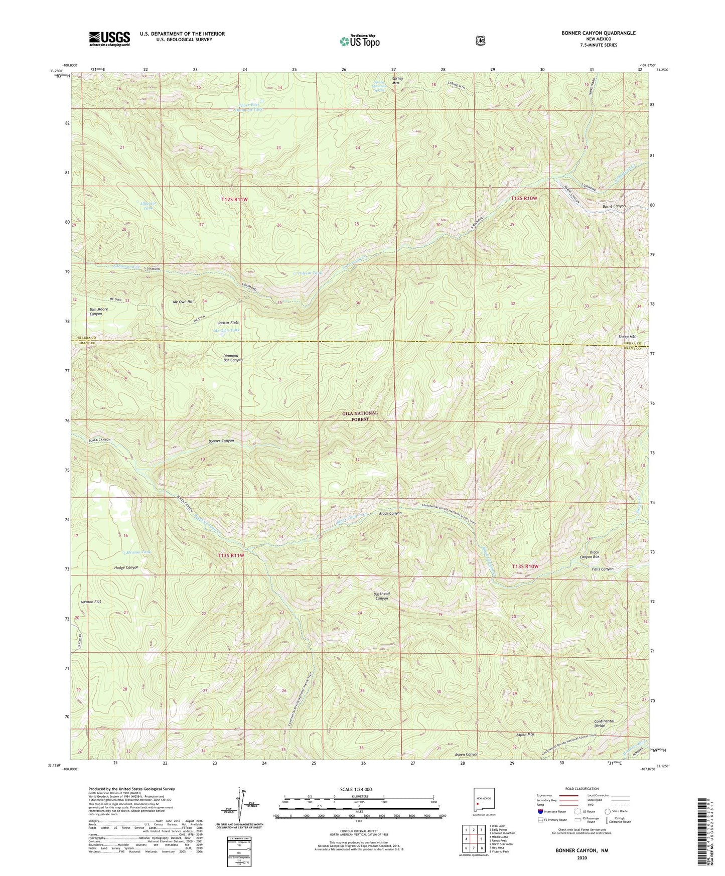
Bonner Canyon New Mexico US Topo Map
Couldn't load pickup availability
Also explore the Bonner Canyon Forest Service Topo of this same quad for updated USFS data
2023 topographic map quadrangle Bonner Canyon in the state of New Mexico. Scale: 1:24000. Based on the newly updated USGS 7.5' US Topo map series, this map is in the following counties: Grant, Sierra. The map contains contour data, water features, and other items you are used to seeing on USGS maps, but also has updated roads and other features. This is the next generation of topographic maps. Printed on high-quality waterproof paper with UV fade-resistant inks.
Quads adjacent to this one:
West: Middle Mesa
Northwest: Wall Lake
North: Baily Points
Northeast: Lookout Mountain
East: Reeds Peak
Southeast: Victorio Park
South: Hay Mesa
Southwest: North Star Mesa
This map covers the same area as the classic USGS quad with code o33107b8.
Contains the following named places: Aldo Leopold Wilderness, Alligator Tank, Aspen Canyon, Aspen Corral, Black Canyon Box, Bonner Canyon, Buckhead Canyon, Burnt Canyon, Falls Canyon, Me Own Hill, Me Own Tank, Meason Tank, Polecat Tank, Rastus Flats, Sheep Creek, Sheep Mountain, Spring Mountain, Spring Mountain Spring, Upper East Diamond Tank