MyTopo
Reeds Peak New Mexico US Topo Map
Couldn't load pickup availability
Also explore the Reeds Peak Forest Service Topo of this same quad for updated USFS data
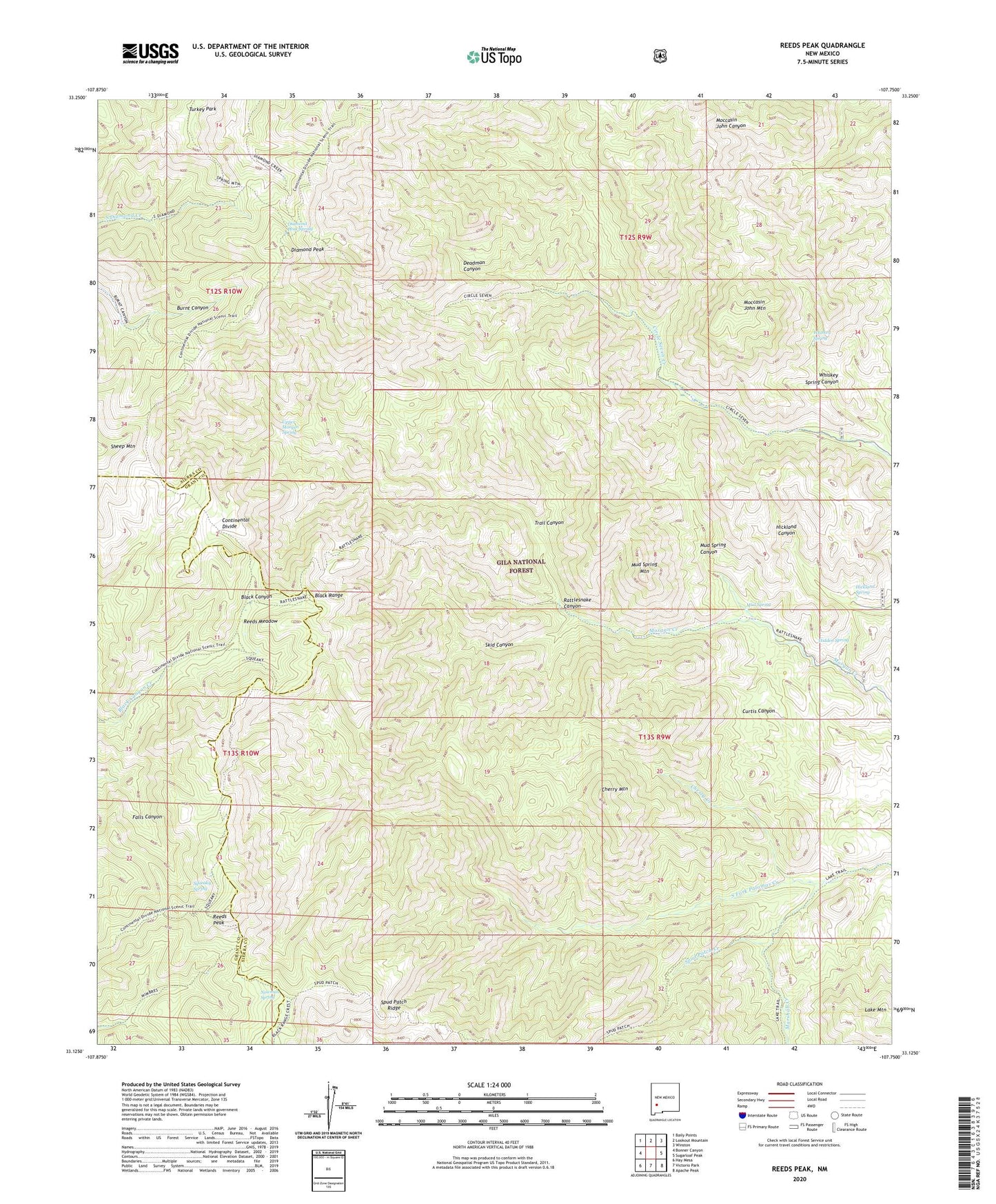
2023 topographic map quadrangle Reeds Peak in the state of New Mexico. Scale: 1:24000. Based on the newly updated USGS 7.5' US Topo map series, this map is in the following counties: Sierra, Grant. The map contains contour data, water features, and other items you are used to seeing on USGS maps, but also has updated roads and other features. This is the next generation of topographic maps. Printed on high-quality waterproof paper with UV fade-resistant inks.
Quads adjacent to this one:
West: Bonner Canyon
Northwest: Baily Points
North: Lookout Mountain
Northeast: Winston
East: Sugarloaf Peak
Southeast: Apache Peak
South: Victorio Park
Southwest: Hay Mesa
This map covers the same area as the classic USGS quad with code o33107b7.
Contains the following named places: Black Range, Cherry Creek, Cherry Mountain, Curtis Well, Deadman Canyon, Diamond Peak, Diamond Peak Spring, Hickland Spring, Hidden Spring, Lake Mountain, Marshall Creek, Moccasin John Mountain, Mud Spring, Mud Spring Canyon, Mud Spring Mountain, Newman Spring, North Prong Circle Seven Creek, Rattlesnake Canyon, Rattlesnake Corral, Reeds Meadow, Reeds Peak, Reeds Peak Lookout Tower, Reeds Ranch, Skid Canyon, Spud Patch Creek, Spud Patch Ridge, Squeaky Spring, Trail Canyon, Turkey Park, Upper Circle Seven Well, Upper Morgen Spring, Upper Palomas Corral, Whiskey Spring, Whiskey Spring Canyon, Whitmore Cabin