MyTopo
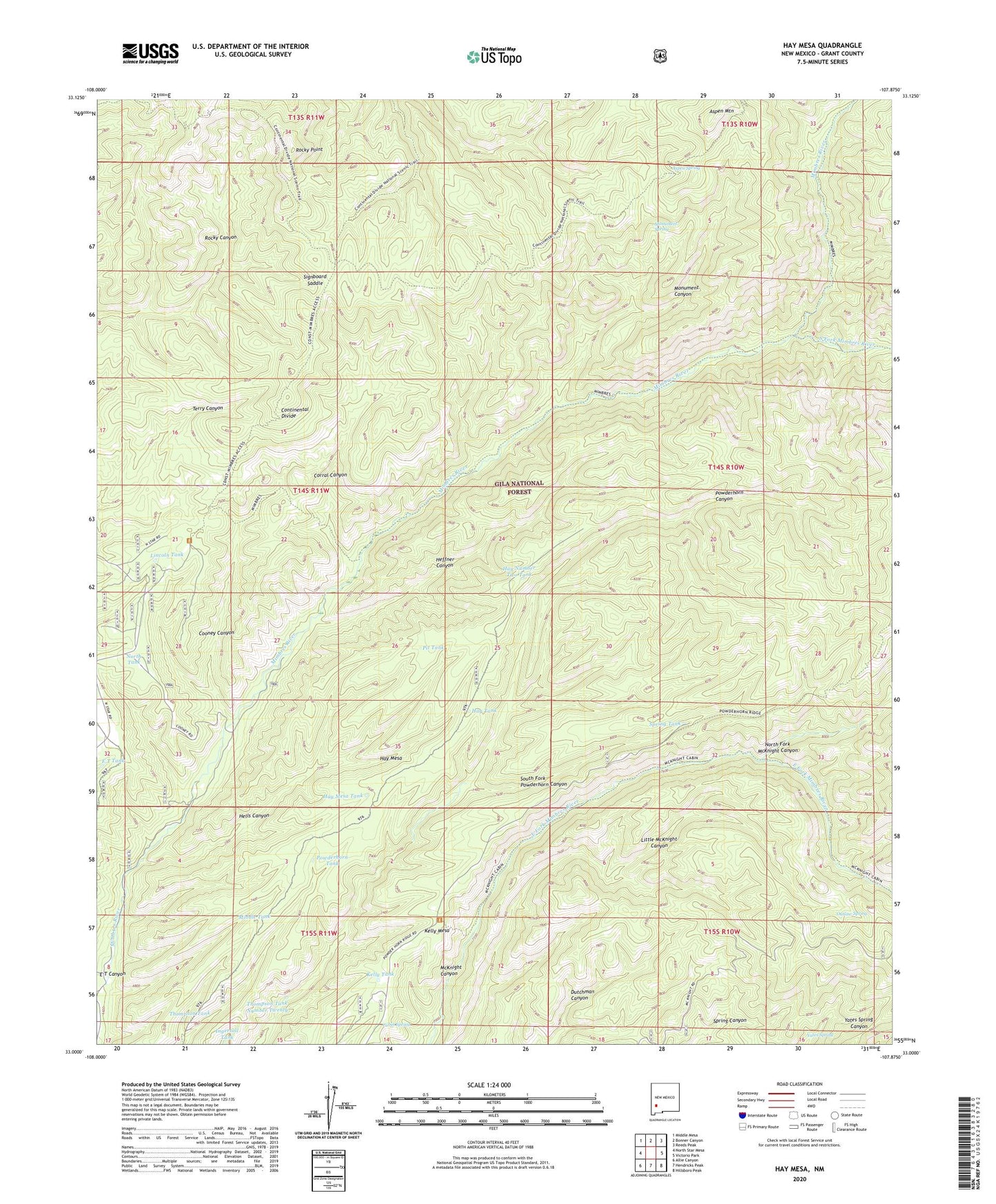
Hay Mesa New Mexico US Topo Map
Couldn't load pickup availability
Also explore the Hay Mesa Forest Service Topo of this same quad for updated USFS data
2023 topographic map quadrangle Hay Mesa in the state of New Mexico. Scale: 1:24000. Based on the newly updated USGS 7.5' US Topo map series, this map is in the following counties: Grant. The map contains contour data, water features, and other items you are used to seeing on USGS maps, but also has updated roads and other features. This is the next generation of topographic maps. Printed on high-quality waterproof paper with UV fade-resistant inks.
Quads adjacent to this one:
West: North Star Mesa
Northwest: Middle Mesa
North: Bonner Canyon
Northeast: Reeds Peak
East: Victorio Park
Southeast: Hillsboro Peak
South: Hendricks Peak
Southwest: Allie Canyon
This map covers the same area as the classic USGS quad with code o33107a8.
Contains the following named places: Aspen Mountain, Aspen Spring, Bloodgood Place, Cabin Spring, Cabin Well, Cooney Canyon, Cooney Place, Corral Canyon, Corral Number 9, E T Canyon, E T Tank, Hay Mesa, Hay Mesa Corral, Hay Mesa Tank, Hay Number Two Tank, Hay Tank, Heffner Canyon, Hells Canyon, Ingersoll Tank, Kelly Mesa, Kelly Tank, Lincoln Tank, Middle Tank, Mimbres Well, Monument Canyon, Monument Spring, North Fork McKnight Canyon, North Tank, Outlaw Spring, Pit Tank, Powderhorn Tank, Rocky Point, Signboard Saddle, South Fork Mimbres River, South Fork Powderhorn Canyon, Spring Tank, Thompson Tank, Thompson Tank Number Twenty, Yates Spring, ZIP Code: 88049