MyTopo
Dog Lake New Mexico US Topo Map
Couldn't load pickup availability
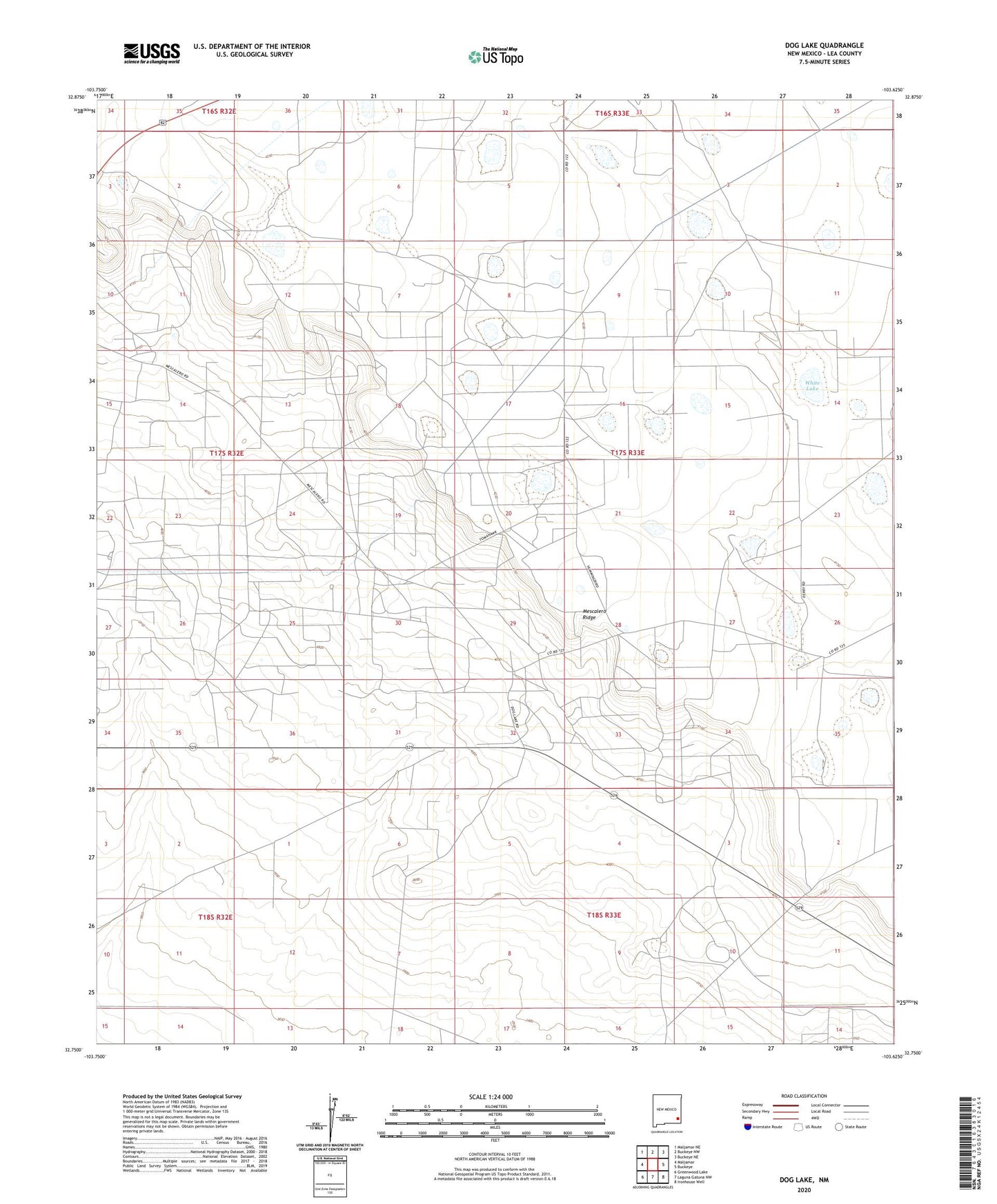
2023 topographic map quadrangle Dog Lake in the state of New Mexico. Scale: 1:24000. Based on the newly updated USGS 7.5' US Topo map series, this map is in the following counties: Lea. The map contains contour data, water features, and other items you are used to seeing on USGS maps, but also has updated roads and other features. This is the next generation of topographic maps. Printed on high-quality waterproof paper with UV fade-resistant inks.
Quads adjacent to this one:
West: Maljamar
Northwest: Maljamar NE
North: Buckeye NW
Northeast: Buckeye NE
East: Buckeye
Southeast: Ironhouse Well
South: Laguna Gatuna NW
Southwest: Greenwood Lake
This map covers the same area as the classic USGS quad with code o32103g6.
Contains the following named places: Caprock Sand and Gravel, Cogburn Windmill, Dog Lake Well, East Maljamar Oil Field, Emsay Windmill, Green Windmill, Lake Windmill, Leamex Oil Field, Little Windmill, Maljamar Oil Field, Pen Place Windmill, Roberts Oil Field, Sannel Oil Field, Steel Windmill, Taylor- Holeman Ranch, Taylor Ranch, Three Well Windmill, White Lake