MyTopo
La Cinta Canyon New Mexico US Topo Map
Couldn't load pickup availability
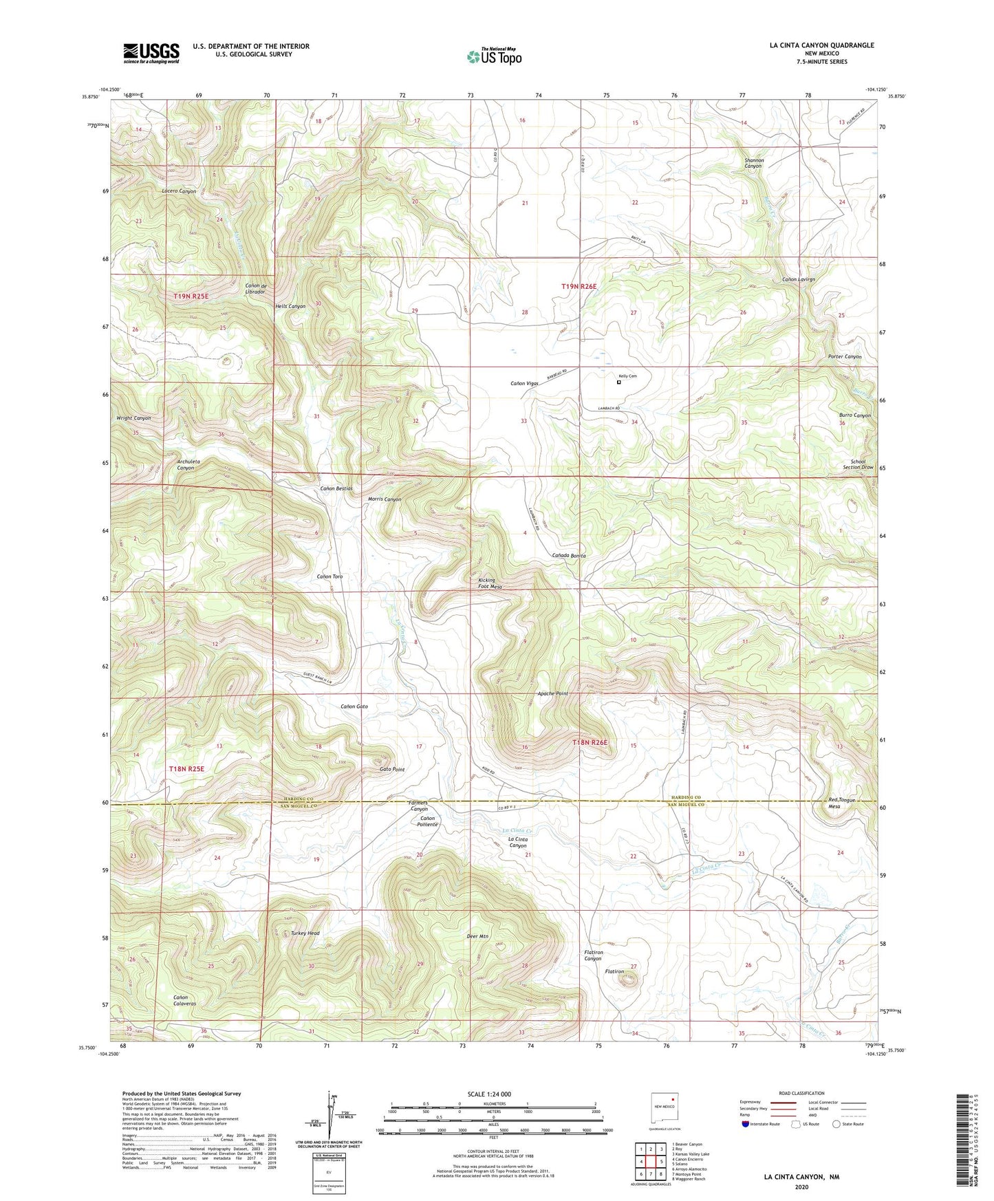
2023 topographic map quadrangle La Cinta Canyon in the state of New Mexico. Scale: 1:24000. Based on the newly updated USGS 7.5' US Topo map series, this map is in the following counties: Harding, San Miguel. The map contains contour data, water features, and other items you are used to seeing on USGS maps, but also has updated roads and other features. This is the next generation of topographic maps. Printed on high-quality waterproof paper with UV fade-resistant inks.
Quads adjacent to this one:
West: Canon Encierro
Northwest: Beaver Canyon
North: Roy
Northeast: Kansas Valley Lake
East: Solano
Southeast: Waggoner Ranch
South: Montoya Point
Southwest: Arroyo Alamocito
This map covers the same area as the classic USGS quad with code o35104g2.
Contains the following named places: Apache Point, Archuleta Canyon, Burro Creek, Campsey, Canon Bestias, Canon de Librador, Canon Gato, Canon Lavirgn, Canon Poniente, Canon Toro, Deer Mountain, Farmers Canyon, Flatiron, Flatiron Canyon, Gato Point, Hells Canyon, Kelly Cemetery, Kicking Foot Mesa, Kidd, La Cinta Canyon, Laumbach, Lucero Canyon, Martines, Morris Canyon, Porter Canyon, Prichard, Red Tongue Mesa, Riley, School Section Draw, Shannon Canyon, Turkey Head, Wright Canyon, Wright Springs Windmill